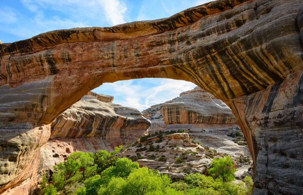
Sipapu Bridge
The second largest natural bridge in the USA.
Hiking Difficult
- Distance
- 1.9 km
- Ascent
- 162 m
- Descent
- 162 m
- Duration
- 0-1 hrs
- Low Point
- 1.8 km
- High Point
- 1.9 km
- Gradient
- 11˚

Sipapu Bridge is widely regarded as one of the most beautiful natural bridges in Utah's Natural Bridges National Monument. With a span of 268 feet and a height of 220 feet, Sipapu is the second largest natural bridge in the USA.
Description
The hike shown here visits the overlook, then drops down into the canyon bottom to visit the bottom of the bridge. Despite being just 1.2 miles long, the 531 feet of elevation gain makes this hike fairly stiff for the mileage. For an easier hike, you can just hike to the viewpoint instead of dropping all the way into the canyon bottom.
The hike descends slickrock slabs, aided by steps cut into the rock. You'll also encounter metal ladders, stairs, and railings along the way to help with the short, steep descent. While these manmade features help with the descent and climb, they also contribute to the adventurous feeling of this short hike.
Sources: https://www.dantreks.com/sipapu-bridge https://hikingwalking.com/index.php/destinations/ut/utse/blanding/sipapu http://www.naturalbornhikers.com/trails/sipapubridge.html
Difficulty
Difficult
Hiking trails where obstacles such as rocks or roots are prevalent. Some obstacles can require care to step over or around. At times, the trail can be worn and eroded. The grade of the trail is generally quite steep, and can often lead to strenuous hiking.
Medium Exposure

The trail contains some obstacles such as outcroppings and rock which could cause injury.
Remoteness
Away from help but easily accessed.
Best time to visit
Features
- Picturesque
- Family friendly