6.4 km away
The Subway (Bottom-Up)
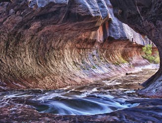
Hike and scramble into a hidden section of slot canyon made famous by photographers.
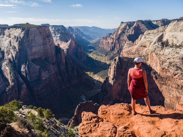
Severe Hiking
- Distance
- 11 km
- Ascent
- 493 m
- Descent
- 493 m
Canyoneering Route For the Subway
Hiking Severe

This is a popular hiking route which is generally considered to be severe. It's very remote, it features high exposure and is typically done between April and September. From a low point of 1.4 km to the maximum altitude of 2.1 km, the route covers 16 km, 504 vertical metres of ascent and 1082 vertical metres of descent.
Canyoneering Route For the Subway
Severe
Hiking challenging trails where simple scrambling, with the occasional use of the hands, is a distinct possibility. The trails are often filled with all manner of obstacles both small and large, and the hills are very steep. Obstacles and challenges are often unexpected and can be unpredictable.

Some trail sections have exposed ledges or steep ascents/descents where falling could cause serious injury.
Little chance of being seen or helped in case of an accident.
6.4 km away
Hike and scramble into a hidden section of slot canyon made famous by photographers.
Severe Hiking
11 routes · Hiking