9.1 km away
Spectra Point - Ramparts Trail
Stunning hike in Cedar Breaks National Monument.
Moderate Hiking
- Distance
- 5.4 km
- Ascent
- 257 m
- Descent
- 257 m
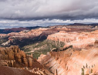
Ancient Bristlecone Pines and views of Cedar Breaks National Monument.
Hiking Moderate
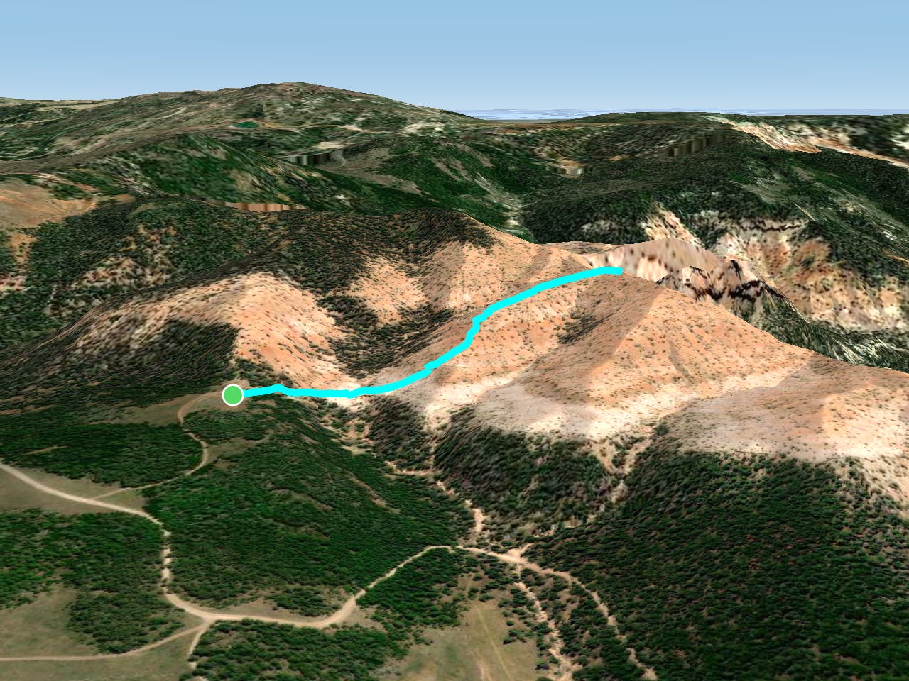
At only a mile-long, the Twisted Forest Trail is a wonderful hike for nearly anyone. Starting at an elevation of 9,750' and climbing to 10,000' over half a mile, it is strenuous only due to the ascent.
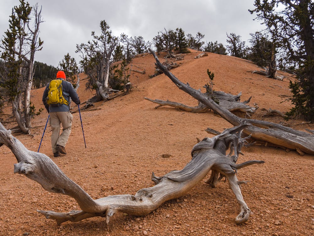
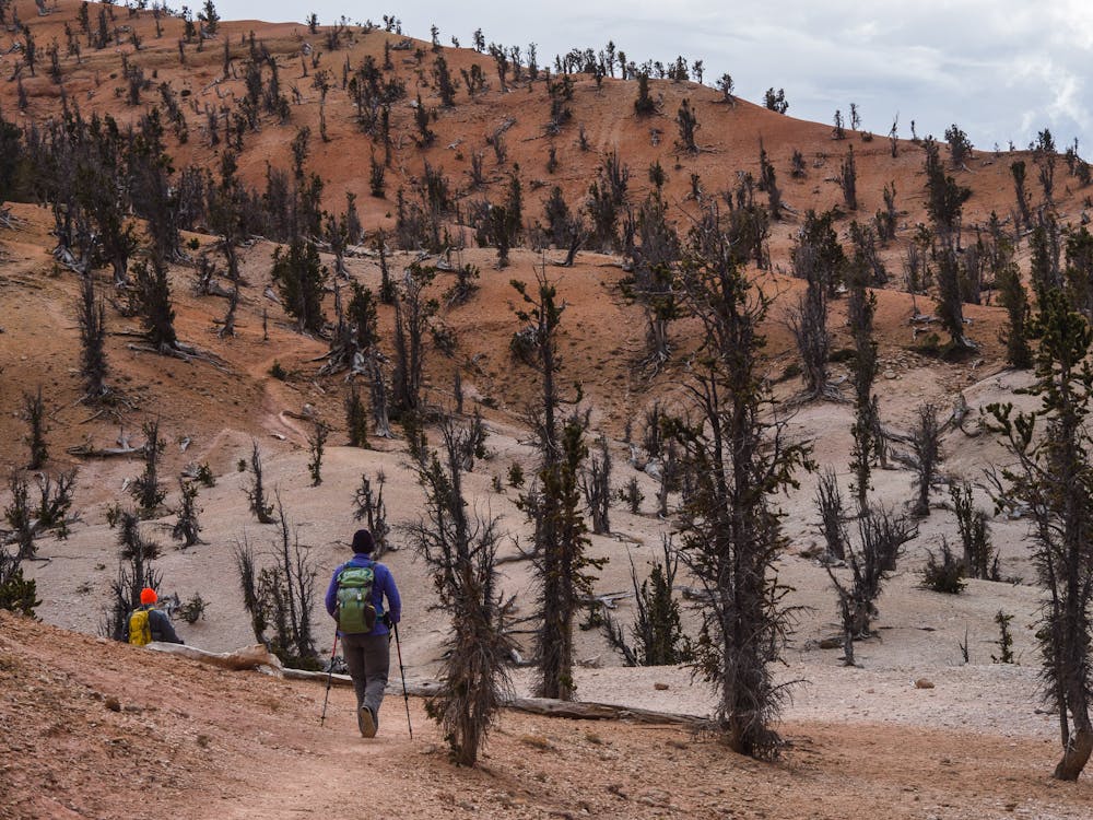
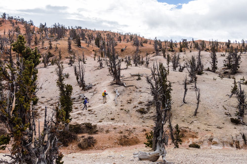
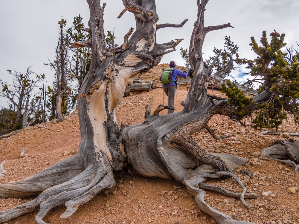
This area has a fantastic Bristlecone Pine stand, which makes everything look a bit Dr. Suess-ian and accounts for the name, “Twisted Forest” trail. The Bristlecones in the Twisted Forest are protected, which is a really good thing since they are so incredibly old. In fact, “ancient” better describes Bristlecone Pines; they are often thousands of years old! The oldest living Bristlecone, named “Methuselah” is over 4,700 years old. That tree's location in California is kept a secret to better protect such a national treasure.
Located at high elevation, this hike can be quite cool and often breezy, so be sure to carry extra layers. It would be a shame to be too cold to spend ample time wandering among the fascinating ancient, gnarly trees.
The route initially drops about 50 feet, but from then on gains elevation steadily as it travels up a ridge. The surface is comprised of rough pellet-like dirt that can be extremely loose-footing on the descent. Trekking poles make it far easier to stay upright!
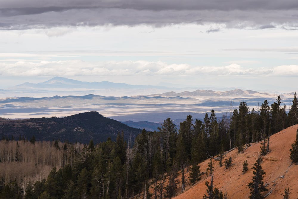
Once at the top of the ridge, there are absolutely amazing views to be had. Since the total mileage is so short, there is plenty of time to explore the rim and the expansive vistas. Be sure to peer over the edge at lovely canyon views and Cedar Breaks National Monument sprawled out below.
To access the Twisted Forest trailhead, turn onto Summit Canyon Road from Hwy 143, 10 miles east of Parowan. Continue for six miles until you reach the Twisted Forest Road. The trail is located in the Dixie National Forest, on Cedar Mountain, and travels into the Ashdown Gorge National Wilderness Area.
Moderate
Hiking along trails with some uneven terrain and small hills. Small rocks and roots may be present.

The path is on completely flat land and potential injury is limited to falling over.

Away from help but easily accessed.
9.1 km away
Stunning hike in Cedar Breaks National Monument.
Moderate Hiking