24 m away
Riggs Spring Loop
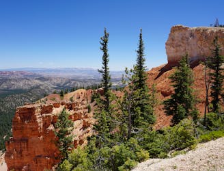
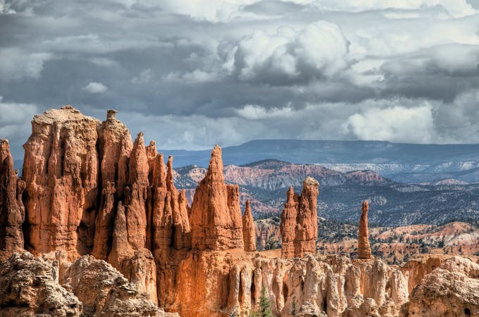
A peaceful day or overnight loop in the lesser-traveled reaches of Bryce Canyon National Park.
Difficult Hiking
- Distance
- 14 km
- Ascent
- 567 m
- Descent
- 565 m
A stunning hike through Bryce Canyon National Park
Hiking Difficult

This is a popular hiking route which is generally considered to be difficult. It's very remote, it features high exposure and is typically done between May and July. From a low point of 2.1 km to the maximum altitude of 2.8 km, the route covers 50 km, 2026 vertical metres of ascent and 2270 vertical metres of descent.
Beautiful canyon views and desert colors
Difficult
Hiking trails where obstacles such as rocks or roots are prevalent. Some obstacles can require care to step over or around. At times, the trail can be worn and eroded. The grade of the trail is generally quite steep, and can often lead to strenuous hiking.

Some trail sections have exposed ledges or steep ascents/descents where falling could cause serious injury.
Little chance of being seen or helped in case of an accident.
24 m away
A peaceful day or overnight loop in the lesser-traveled reaches of Bryce Canyon National Park.
Difficult Hiking
6 routes · Hiking