
25 routes · Mountain Biking
Flat Pass is an outstanding, genuine Moab mountain biking experience without Moab crowds.
Mountain Biking Severe

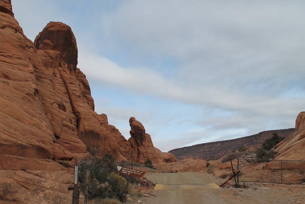
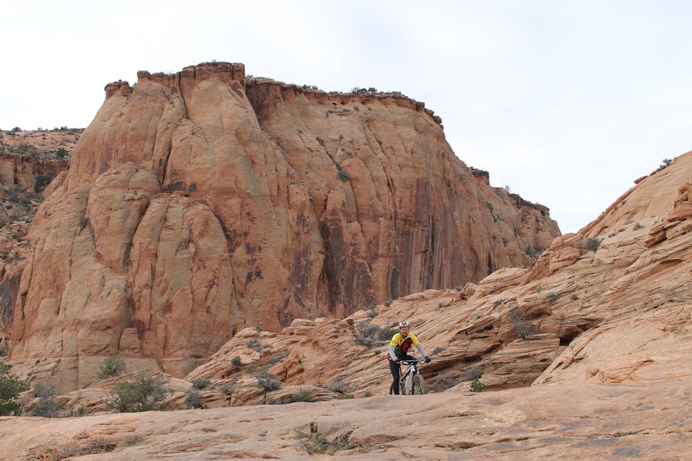
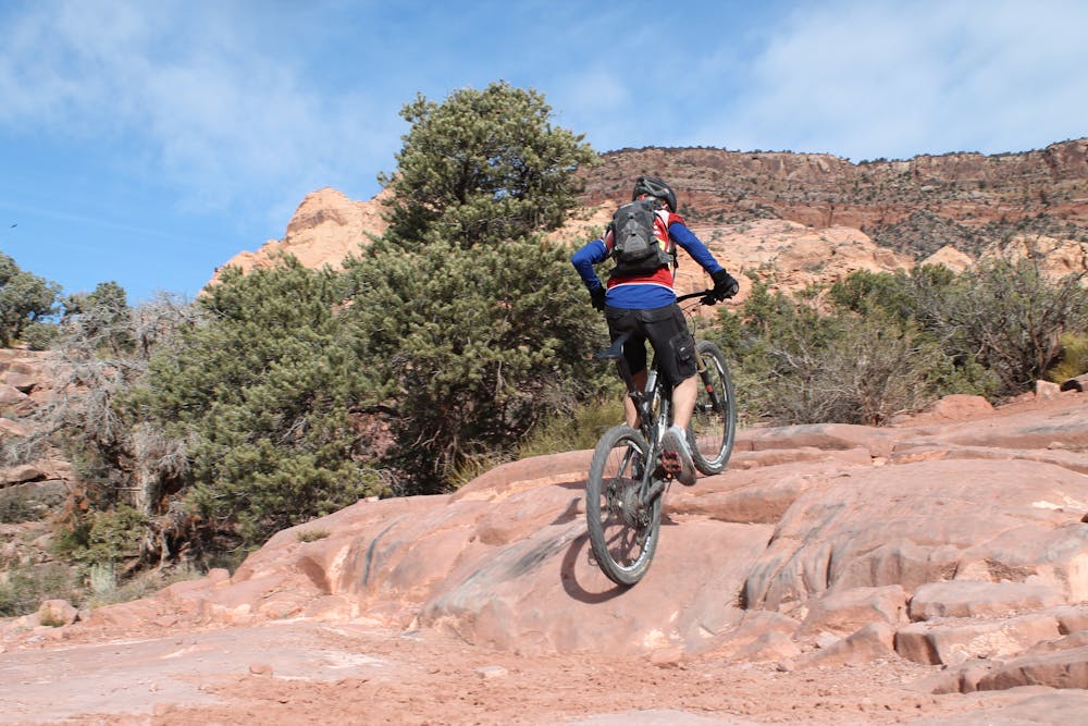
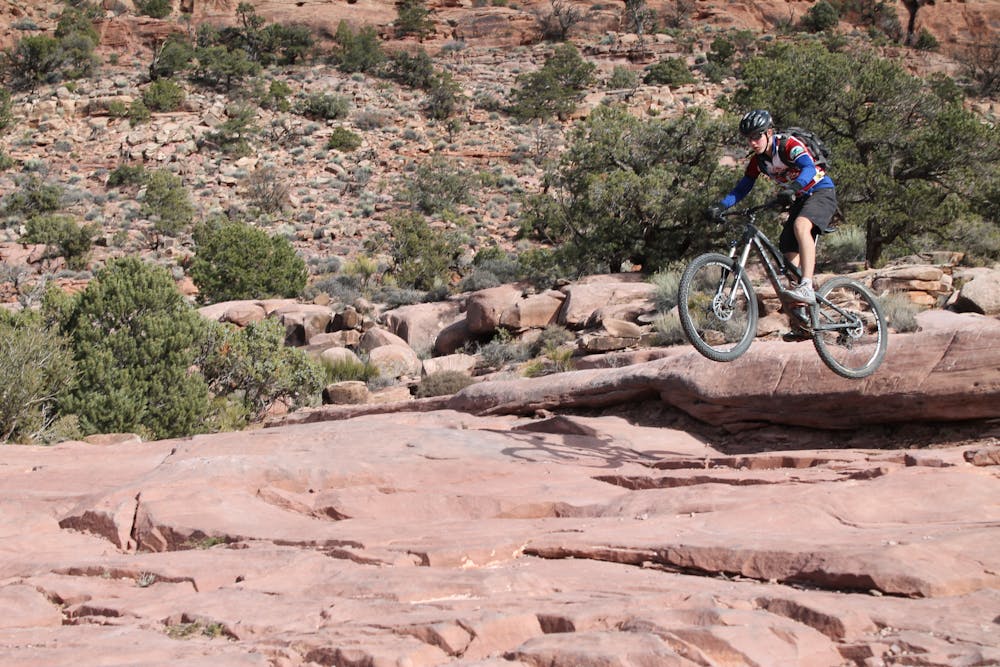
Like most of Moab's old school rides, this started off as a jeeper's route, originally known as the Steelbender Safari. But don't let its origins undersell its excellence as a mountain bike route. All those step ups and rock slabs make for a superb mountain bike outing, even if it is double-wide. The wide sections actually allow for a variety of line choices where you can choose a ride-around, a roller, or a huck. And even on the uphill part of the journey, all those ledges are a technical climber's dream.
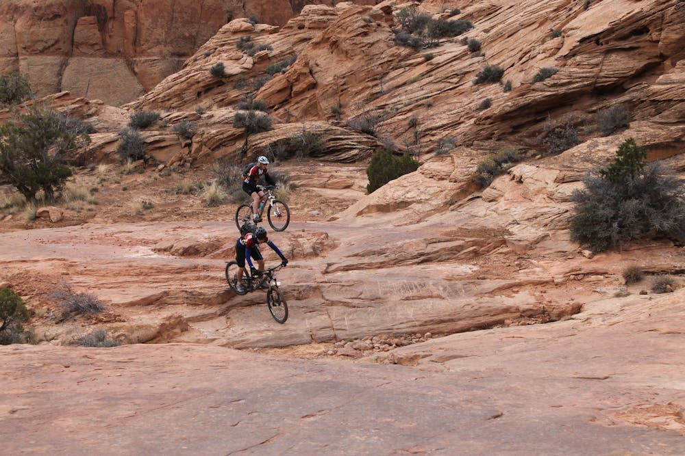
Two other things make this a delightful route. First, riders who venture here will likely have the route all to themselves, even on weekends or in high season. It's amazing that such a great route in mountain biking's #1 Mecca remains under the radar for most riders. As Moab's riding opportunities grow, and more and more bike-specific, new school routes are added, this one continues to fall even further from the public eye, which is even better for the rider in search of the trail less ridden.
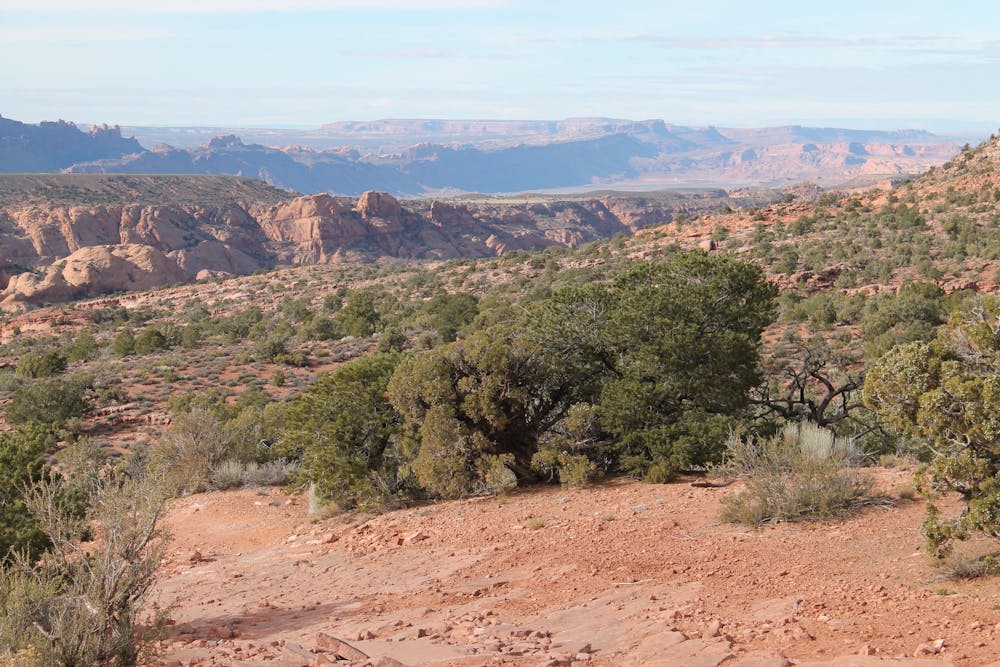
Second, the scenery along this route is nothing short of spectacular, even by Moab standards. The most amazing red rock formations are the visitor's constant companion, presenting new and unique looks around every corner. Whether gawking at the short distance views of the rock walls sitting nearby or the long distance view of the Hanging Valley on the other side of town, there's always something to look at and no shortage of photo opportunities.
The basic, all-dirt point to point is roughly 10 miles and best done as a shuttle. If there's no shuttle available, it's fairly easy to close the loop with an additional eight miles of pavement, mostly flat and easy, but most of it is also on a busy highway, which is the main reason to try to set up a shuttle.
-Written by John Fisch
Severe
Widely variable, narrow trail tread with steeper grades and unavoidable obstacles of 15in/38cm tall or less. Obstacles may include unavoidable bridges 24in/61cm wide or less, large rocks, gravel, difficult root sections, and more. Ideal for advanced-level riders.

Some trail sections are extremely exposed where falling will almost certainly result in serious injury or death.

Little chance of being seen or helped in case of an accident.
25 routes · Mountain Biking