Spinal Tap: The Full Epidural
An epic Utah shuttle run that's severely underrated!
Mountain Biking Severe
- Distance
- 30 km
- Ascent
- 136 m
- Descent
- 1.4 km
- Duration
- 1-2 hrs
- Low Point
- 1.6 km
- High Point
- 2.9 km
- Gradient
- 6˚

The top-to-bottom Spinal Tap Trail, known as "The Full Epidural," is one of Utah's premier mountain bike shuttle runs. Yet, somehow, it is still massively underrated! This 18.6-mile rip climbs a mere ~446 vertical feet along its length while dropping a massive ~4,715 feet from the top of the mountain range all the way down to Richfield below. With a variety of trail types and climate zones along its length, this is a truly fantastic mountain bike ride that ranks among the best in Utah.
- •
- •
- •
- •
- •
- •
- •
- •
Description
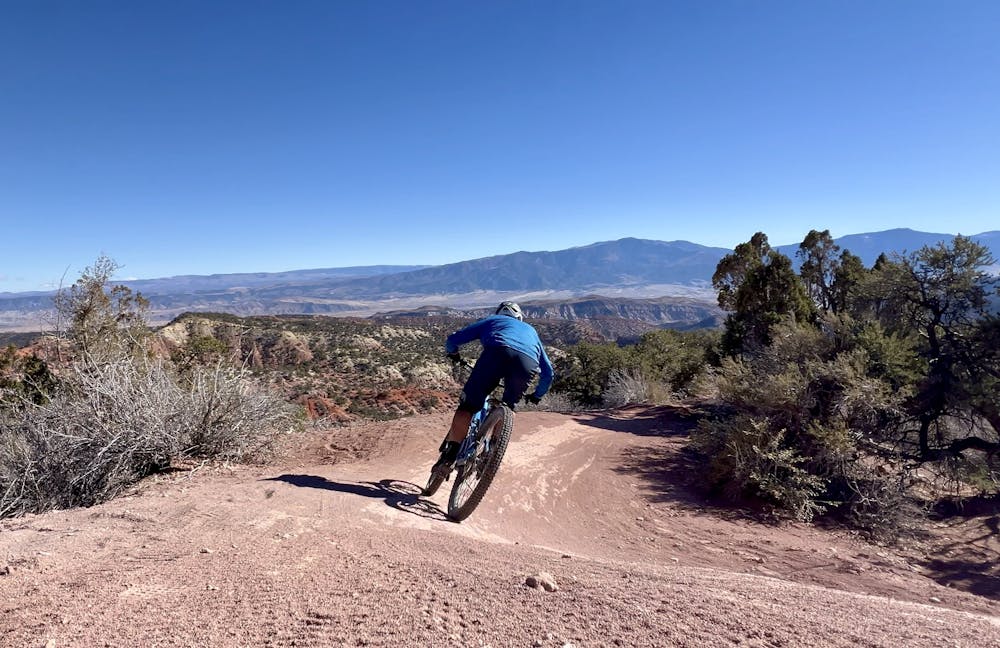
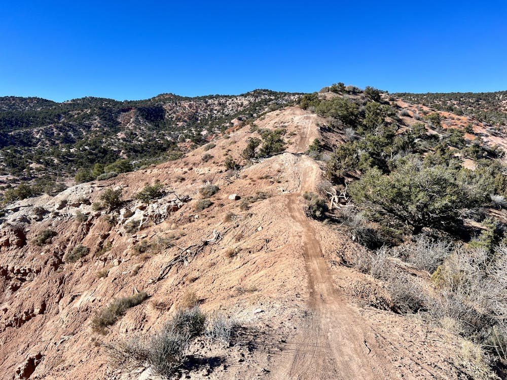
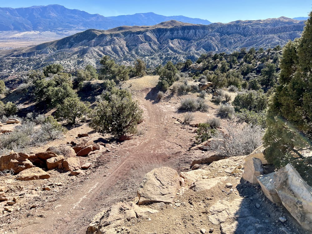
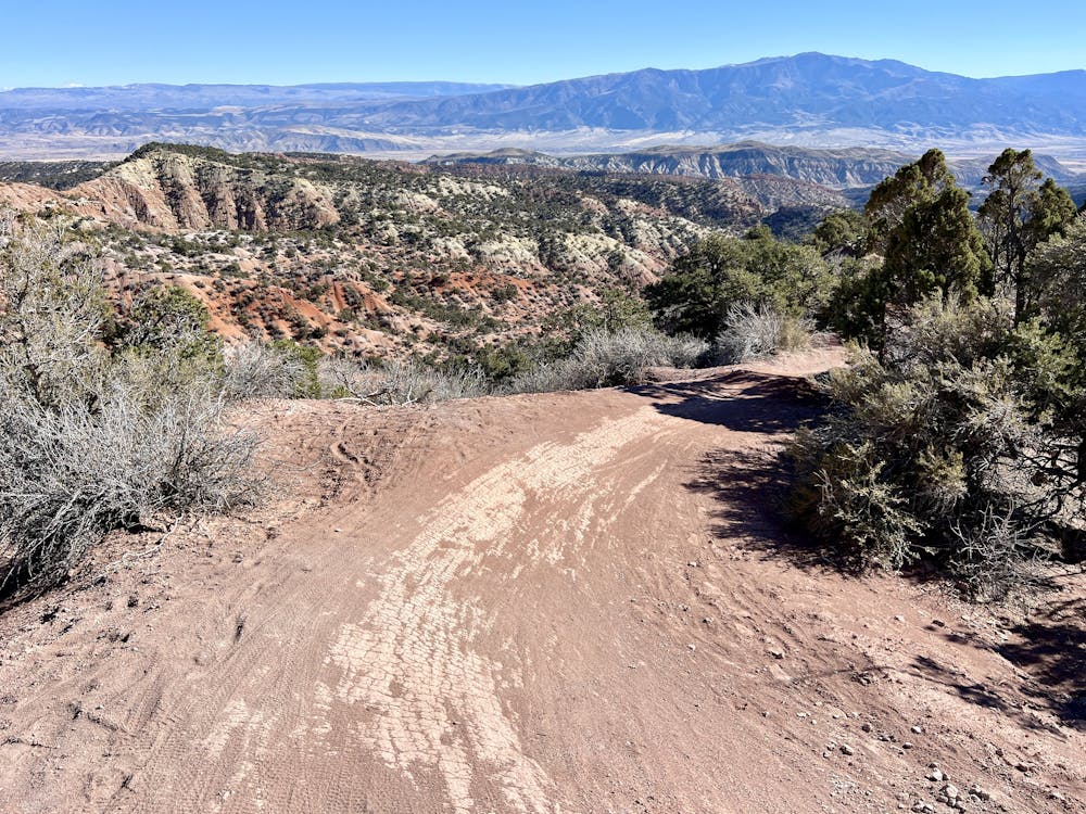
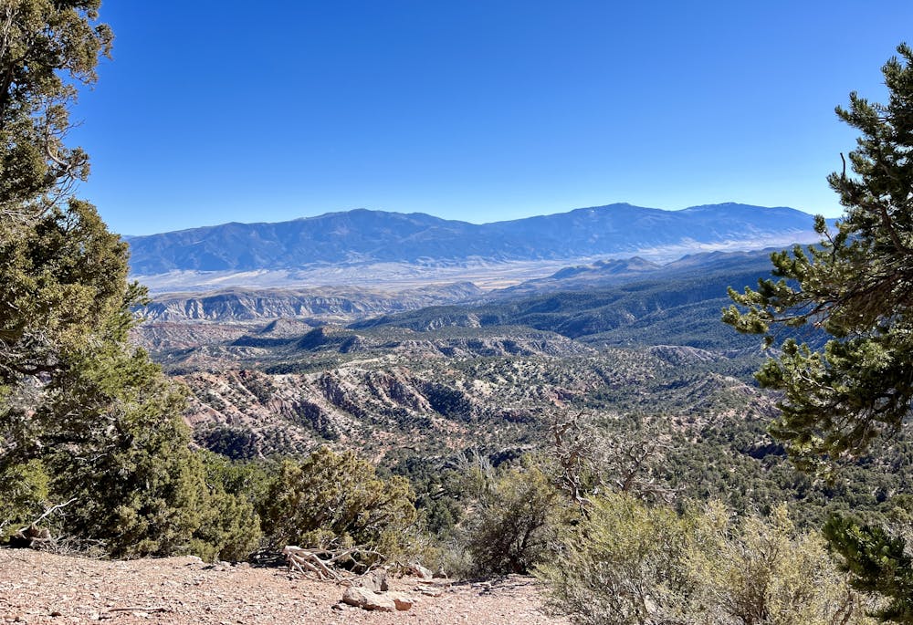
The upper section is one of the most newly built sections of Spinal Tap, running for about 9 miles and dropping over 2,000 vertical feet. While there are a few mellow uphill grades, the trail consists mainly of flowy, intermediate downhill singletrack rolling through the aspens and scrubby trees. The singletrack in this section features plenty of fun berms and optional double jumps, which advanced riders will enjoy gapping. As you can imagine, these upper sections of trail offer superb views of the surrounding landscape, and you'll realize just how high you are above the valley floor! As the upper section descends, it gets a bit more difficult, with a few optional drops along the way.
As the ride transitions into Middle Spinal Tap, the flow kicks up with superb berms and constant jumps. Advanced riders will absolutely love sending a slew of substantial step-down drops and doubling even more rollers and small jumps. The singletrack also runs along a few beautiful natural spines, with drop offs on both sides. Ripping through such fantastic berms and jumps for miles and miles on a remote trail high in the mountains is a rare treat that you can't find in many places!
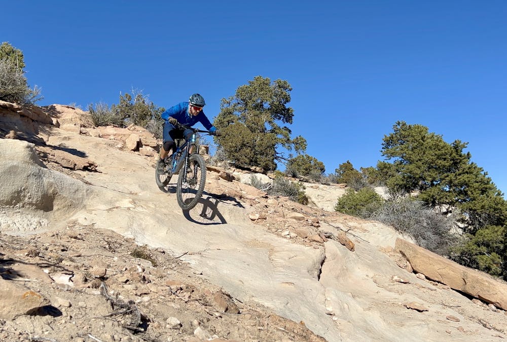
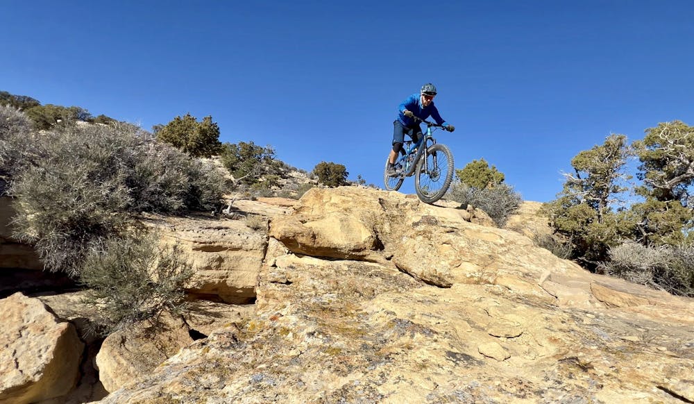
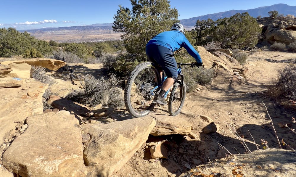
Spinal Tap gets progressively more difficult as you descend, and the final section is the oldest and gnarliest! Here, you'll rip through some fantastic rock slab rolls, chunky rock gardens, and substantial drops. All of the mandatory drops have ride-around options, but advanced riders will enjoy the huckortunities—some of which are 5+ feet tall! Even if you don't want to huck your meat, you'll undoubtedly enjoy the beautiful rock formations—including overhangs that you'll ride under—in this final stretch. Before you know it, you'll drop out at the bottom and pedal through a maze of trails to connect back to the parking lot just under the interstate.
Logistics: Be sure to check out Richfield Bike Shuttle for a commercial shuttle option. Unless you have a large private group, they only run shuttles on the weekends. That said, most vehicles can make it up the shuttle road without too much difficulty, but it's a long, slow drive to the top that's made all the more arduous by having to do it three times if self-shuttling with two cars.
Difficulty
Severe
Widely variable, narrow trail tread with steeper grades and unavoidable obstacles of 15in/38cm tall or less. Obstacles may include unavoidable bridges 24in/61cm wide or less, large rocks, gravel, difficult root sections, and more. Ideal for advanced-level riders.
High Exposure

Some trail sections have exposed ledges or steep ascents/descents where falling could cause serious injury.
Remoteness
Little chance of being seen or helped in case of an accident.
Best time to visit
Features
- Flow
- Technical
- Picturesque
- Shuttle-run
- Singletrack
- Drops
- Jumps
- Gap Jumps
- Rock Rolls
- Rock Slabs
- Rock Gardens