4 routes · Mountain Biking
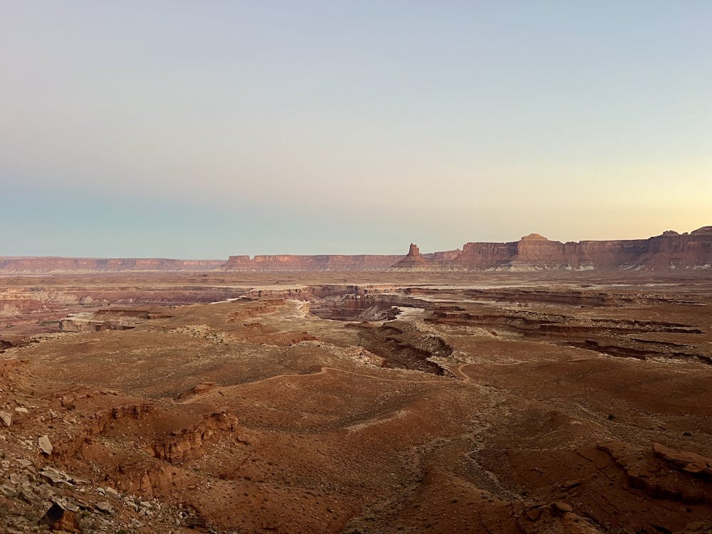
Day 3 passes several intriguing side trips and offers up spectacular views of the Green River.
Mountain Biking Moderate

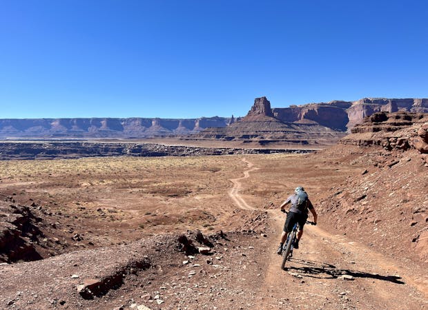
After the stiff climb to end Day 2, you can imagine what fun the downhill to begin Day 3 will be! The descent off of Murphy Hogback is one of the fastest and steepest of the trip, and there are even a few rocks mixed into the roadbed. Unfortunately, diving into one of the steepest downhills without any warm-up can be a recipe for disaster. Be sure to ride conservatively—you're in the heart of the Canyonlands and at the furthest point from the pavement. An injury here could be catastrophic.
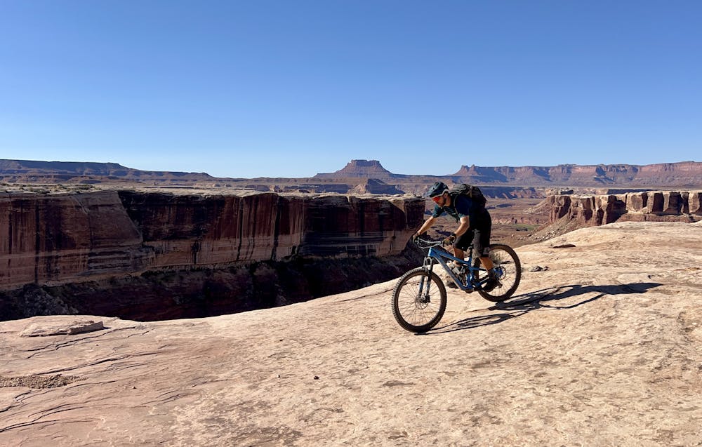
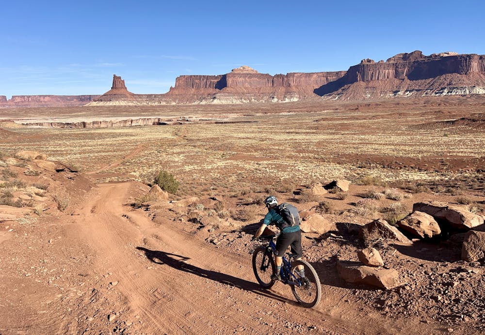
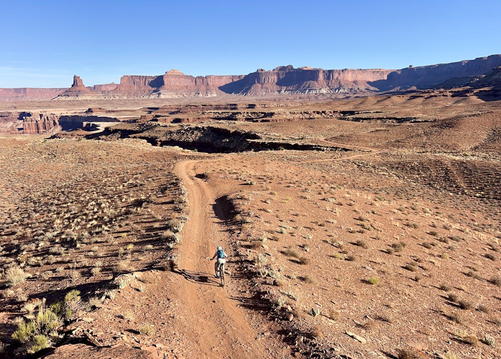
If you're able to enjoy the descent after that warning, the high-speed ripping will be an absolute pleasure! But all too soon, you'll quickly hit some small riser climbs on cold legs. After a few short climbs, the descending picks back up again until you finally return to the White Rim layer.
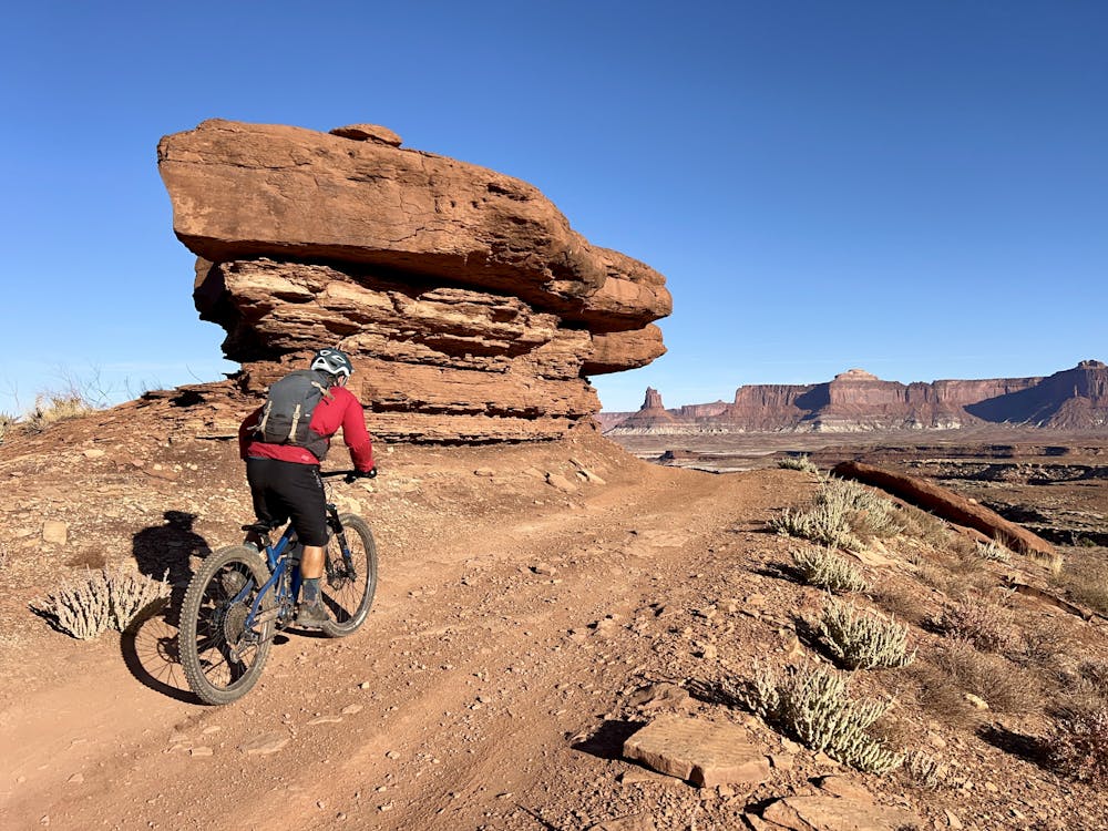
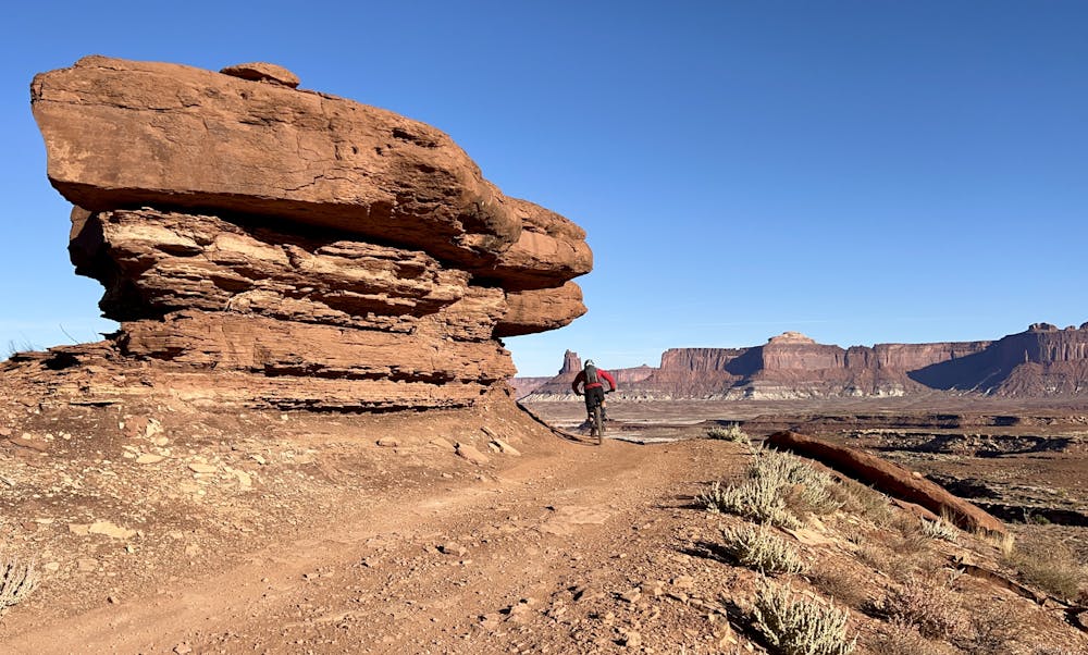
The pedaling on Day 3 is very manageable. With just 643 feet of climbing, this is the least climbing of any day in this itinerary. But to make the most of the time on the White Rim, this section offers two of the best side trips of the itinerary.
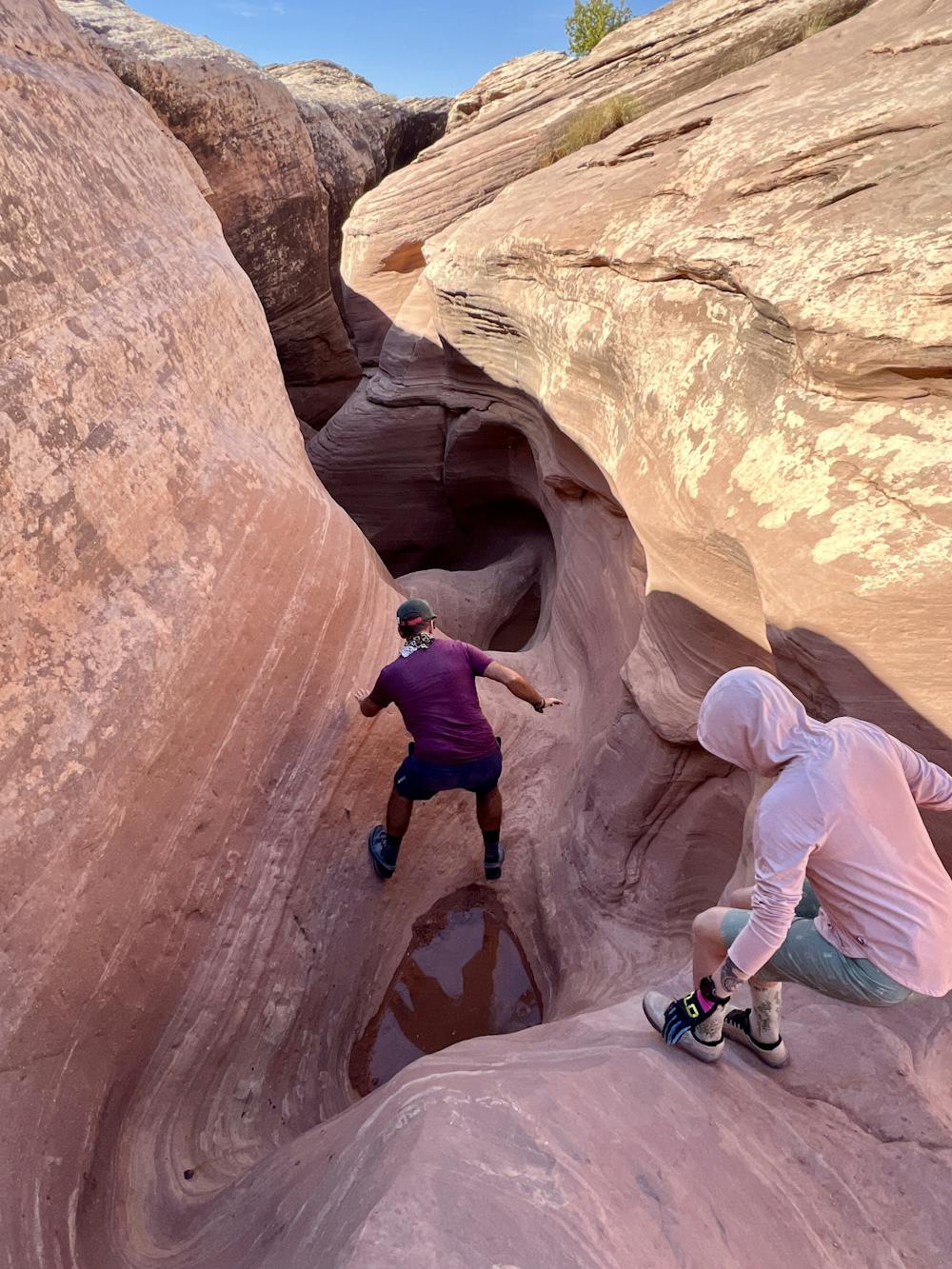
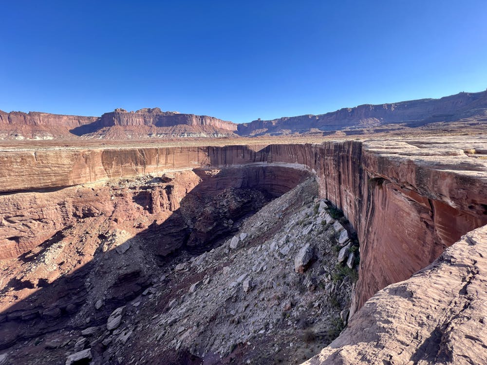
At about mile 12.45, where the Wilhite Trail begins, there's a small but beautiful slot canyon descending into the White Rim rock layer. This is a truly spectacular side trip that's well worth experiencing!
Just a few miles later, an Ancient Puebloan granary can be seen from the roadway. Located high on a nearby hill, there's no trail to the granary, so view it from a distance.
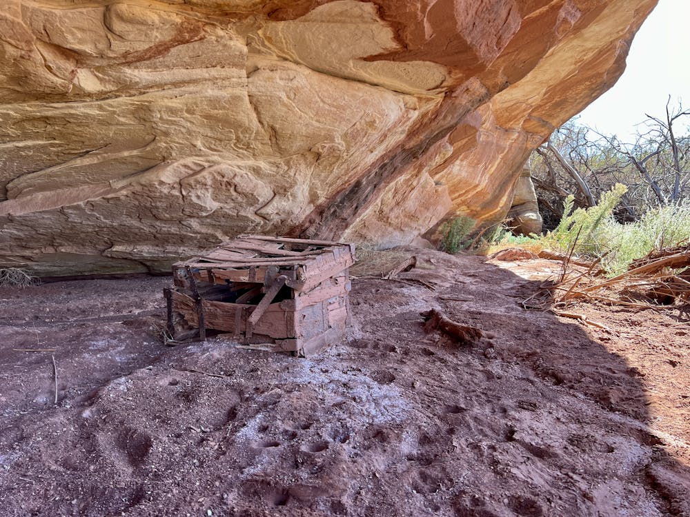
Finally, there's the option to hike to a hidden treasure chest from the cattle rustling days that was abandoned deep in Canyonlands. If you find it, you just might find some treasure hidden there, too! (The location isn't provided here to protect this unique artifact—yet another reason to hire a guide.)
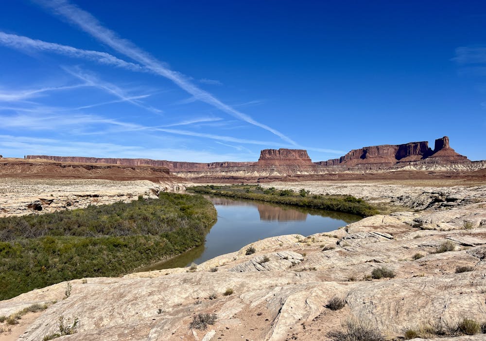
The Potato Bottom campground on the banks of the Green River is sadly the final campsite of the trip, but it's a true gem. You'll enjoy some shade in this campground, thanks to towering cottonwood trees. After pedaling through such an arid landscape, these trees might seem surprising, but they reach such staggering heights thanks to the year-round water source of the nearby river. That means you can chuck your dust-covered body into the refreshing water! Reaching the bank might require a bit of a bushwhack through thick undergrowth, but the frigid water is so refreshing after the past three days of hot, dry riding.
At 20.5 miles, Day 3 would be the shortest day in this itinerary if you opt for the self-service option. If you've opted for the guided option, it would likely be the second-longest day. That said, if you're going self-served, you do have the option to continue past the Potato Bottom campground to Hardscrabble instead (as long as you book the permits that way). If you continue to Hardscrabble campground instead, you'll have one final climb and descent to finish the day. That would turn Day 3 into a 24.7-mile pedal with 1,200 feet of climbing.
Moderate
Mostly stable trail tread with some variability, with unavoidable obstacles 8in/20cm tall or less. Other obstacles such as rock gullies and steep sections may exist. Ideal for lower intermediate riders.

The path is on completely flat land and potential injury is limited to falling over.

Little chance of being seen or helped in case of an accident.
4 routes · Mountain Biking