9 routes · Hiking
The northernmost portion of Vermont's 273-mile Long Trail.
Hiking Difficult

This portion of the 273-mile Long Trail begins at a trailhead along VT-15. To the east, the town of Johnson serves as an excellent opportunity for resupply before heading back into northern Vermont's rugged terrain.
After crossing the Lamoille River, the trail climbs to Prospect Rock. Just a mile from the trailhead, the views from the top make it an excellent destination for a short out-and-back day hike. A shelter and overlook lie ahead near the summit of Roundtop.
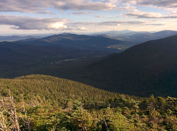
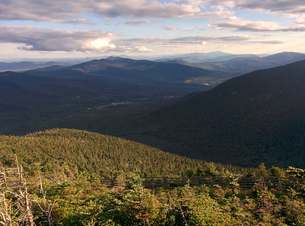
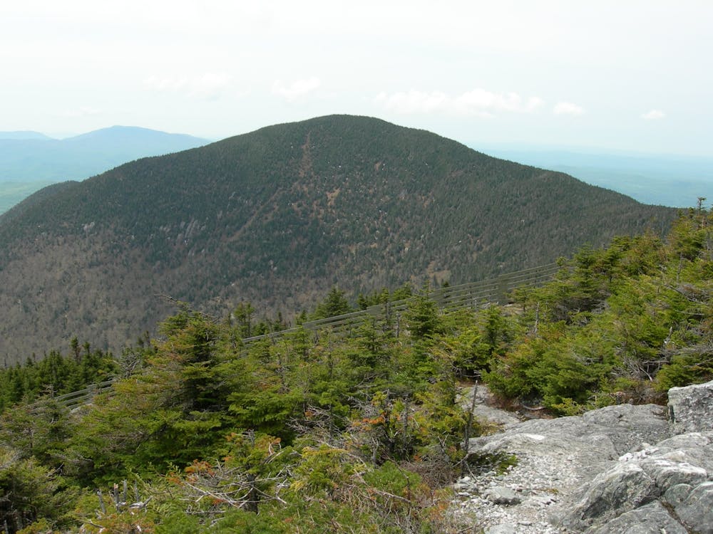
A long, yet steady, climb awaits as the trail makes its way to Laraway Mountain at 2,700 feet. Though not as tall as other mountain peaks, the summit provides some commanding views of Mount Mansfield to the south.
Ahead, the Long Trail traverses the ridge of Bowen Mountain before quickly descending into an area known as Devil's Gulch. Passing through a large field of boulders, the trail runs between two ponds before reaching VT-118. A small parking area lies on the north side of the road, bringing the picturesque formations and ponds within reach of a day hike.
Heading north, the trail welcomes hikers with an intense climb to the summit of Belvidere Mountain. Atop its perch, you're rewarded with some phenomenal views from a rocky outcropping. A shelter to the north marks a rough halfway point to this segment.
Continue north with a relentless trek across several mountain peaks beginning with Tillotson Peak and Haystack Mountain. Soon after crossing VT-58, you will be welcomed with some excellent views from the top of Sugarloaf Mountain. Buchanan Mountain lies ahead and offers sweeping views in every direction.
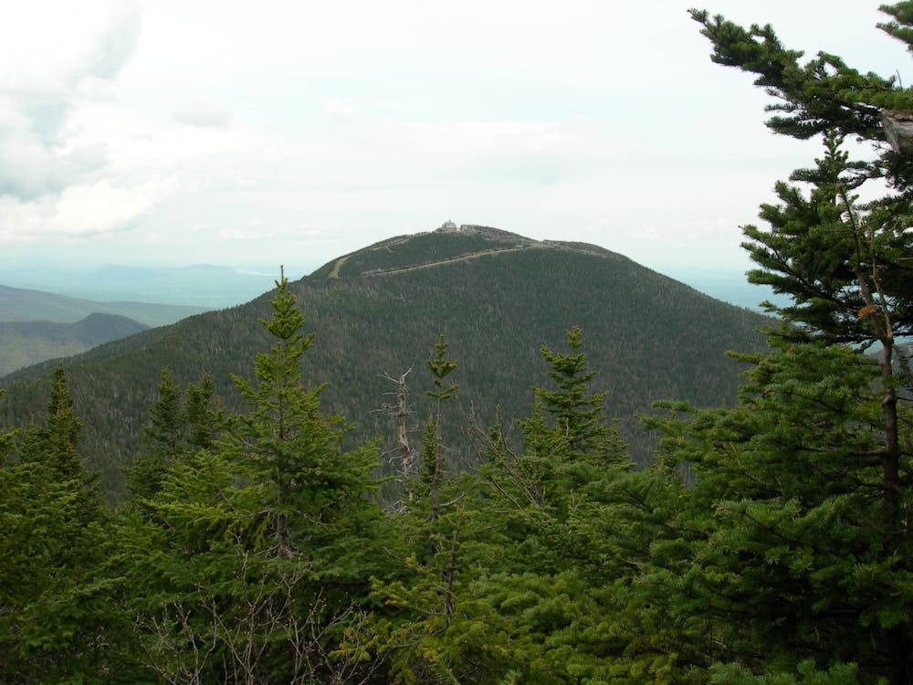
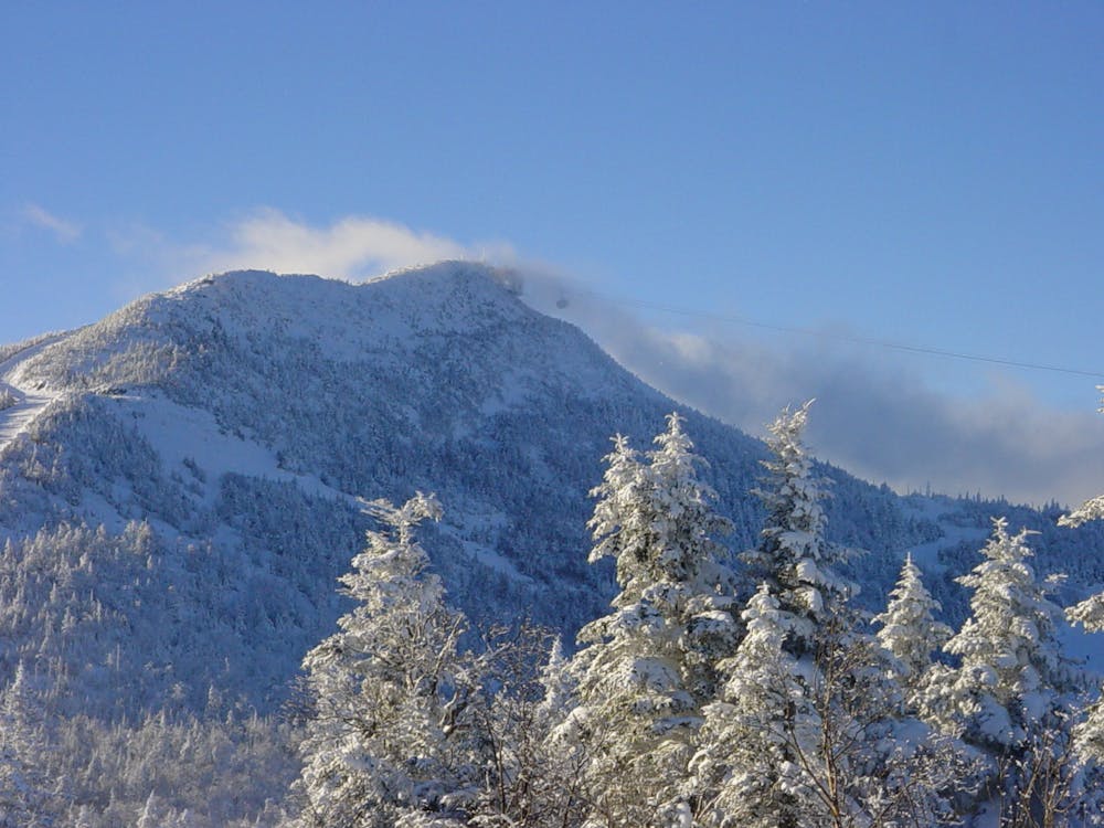
The final high peak of the trail lies ahead. Renowned for its skiing, Jay Peak provides some incredible views from its summit. The views to the south are particularly noteworthy, as you have an expansive view of the terrain you've just traversed.
North of the summit, a brief descent leads to a shelter before continuing onto the three final mountains on the trail. Skirting around North Jay Peak, the trail undulates onto Burnt Mountain, Carleton Mountain, and ultimately the Canadian border.
Sources: https://www.backpacker.com/trips/long-trail-section-11-vt-15-to-tillotson-camp https://www.backpacker.com/trips/long-trail-section-12-tillotson-camp-to-journeys-end
Difficult
Hiking trails where obstacles such as rocks or roots are prevalent. Some obstacles can require care to step over or around. At times, the trail can be worn and eroded. The grade of the trail is generally quite steep, and can often lead to strenuous hiking.

Some trail sections have exposed ledges or steep ascents/descents where falling could cause serious injury.
Little chance of being seen or helped in case of an accident.
9 routes · Hiking