Mount Pisgah Hike - Vermont VT
Mount Pisgah Hike - Vermont VT
Hiking Moderate
- Distance
- 5.2 km
- Ascent
- 291 m
- Descent
- 119 m
- Duration
- 1-2 hrs
- Low Point
- 384 m
- High Point
- 652 m
- Gradient
- 12˚

One of the most memorable views in Vermont is the reward for this moderately stiff climb with a vertical rise of about 460m/1,500 feet. You can take either of three trails.
- •
- •
- •
Description
START: Valid to all of them: From Barton, drive east on VT-16 N for 6.9 miles
North Trail: After VT-16, turn right onto VT-5A South and continue for 3.5 miles. Turn into the parking area on the left-hand side of the road. The trailhead is off of the parking lot.
East (Long Pond) Trail: After VT-16, turn right onto VT-5A South and continue for 1.5 miles. Turn left onto Long Pond Road and continue for 1.7 miles and turn right into the parking lot. The trailhead is off of the parking lot.
South Trail: After VT-16, turn right onto VT-5A South and continue for 5.7 miles. Turn into the parking area on the left hand side of the road. The trailhead is off of the parking lot.
WEATHER AND CONDITIONS:
Normally the weather is good, but in case there are heavy clouds on the horizon, it is recommended that you stay down. This hike can be slippery, always bring good shoes.
You can expect a few climbs, always followed by flat sections to relax a bit walking and seeing nature. Close to the summit you will once again find a few sections with exposed granite.
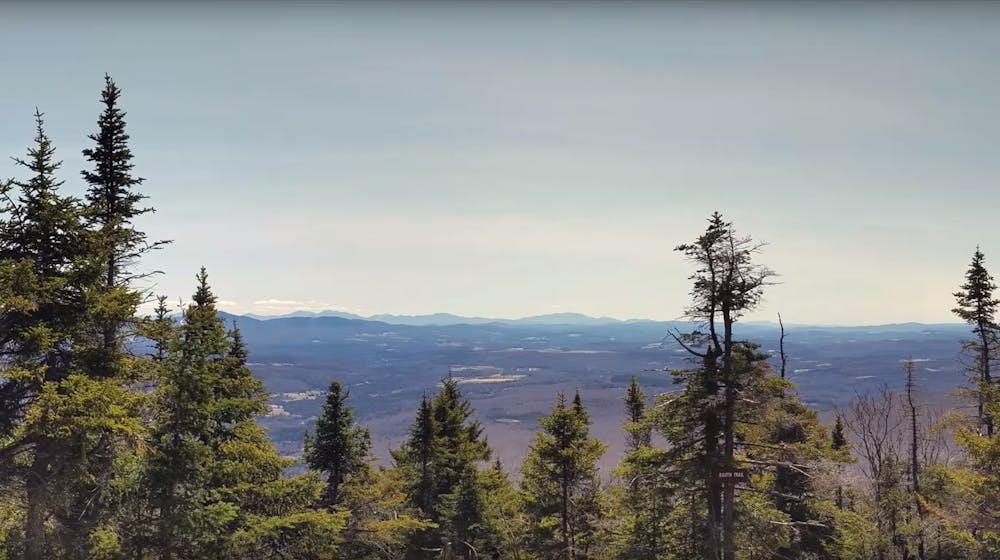
On a clear day, you should be able to see the south of Burke Mountain and New Hampshire.
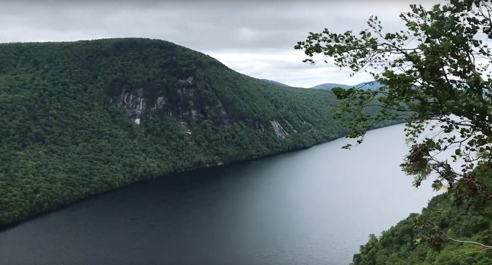
Be warned: Do not expect a view from the summit (it is marked by a small sign). There is a gentle descend, where you should walk a couple hundred yards along North Trail until you reach a sign indicating a western overlook. If you want to have some great views of the lake, proceed down a steep, gullied path to a cliff-top where you can take a look at the landscape.
About the different trails, you can expect:
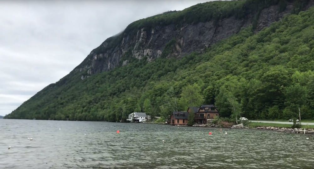
North Trail: The most scenic way to reach the summit You start from halfway up Lake Willoughby. The trail climbs for 1.5 miles then comes to an intersection with the East Trail on the left, continue on straight to the summit. After another 0.4 miles, the trail reaches a number of scenic lookouts of Lake Willoughby and the surrounding mountains. From there it is another 0.3 miles to the summit, where there are more cliff top views of Willoughby and the mountains.
East (Long Pond) Trail: beautiful lookouts over Willoughby Start from the northeast side of the mountain and is a mild, winding climb until with converges with the North Trail. Much of this section of trail (1.6 miles) follows open or existing logging roads and is located on private lands. At the intersection with the North Trail turn left for the summit, from there it is a moderate climb for another 0.7 miles to the summit. Along the way to the summit there are a number of beautiful lookouts over Willoughby and the surrounding mountains.
South Trail: Good for families and children. Start from the parking area south of the lake on VT-5A and climbs the southern side of Mount Pisgah. This is the shortest, most gradual way to the top of the mountain. About a mile up the trail is Pulpit Rock which offers birds-eye views of Lake Willoughby. Before the summit, there is an open ledge area that stands above the cliffs and has fantastic views of the lake. At the summit, the South Trail connects to the North Trail, so hikers can continue on or turn around and head back.
Difficulty
Moderate
Hiking along trails with some uneven terrain and small hills. Small rocks and roots may be present.
Medium Exposure

The trail contains some obstacles such as outcroppings and rock which could cause injury.
Remoteness

Close to help in case of emergency.
Best time to visit
Features
- Picturesque
- Dog friendly
- Family friendly