Cascade Pass and Sahale Arm
The best trail in North Cascades for a day hike into the alpine, making a determined ascent to stand eye-level glaciers.
Difficult Hiking
- Distance
- 18 km
- Ascent
- 1.2 km
- Descent
- 1.2 km
The full Cascade Pass Trail in all its glory!
Hiking Difficult

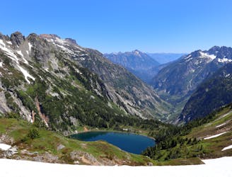
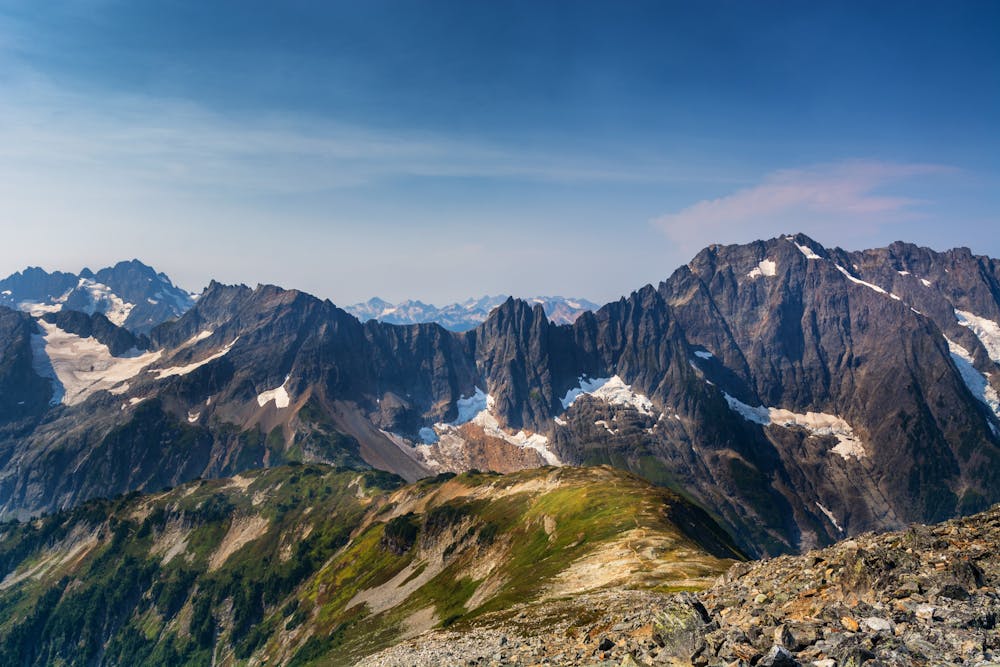
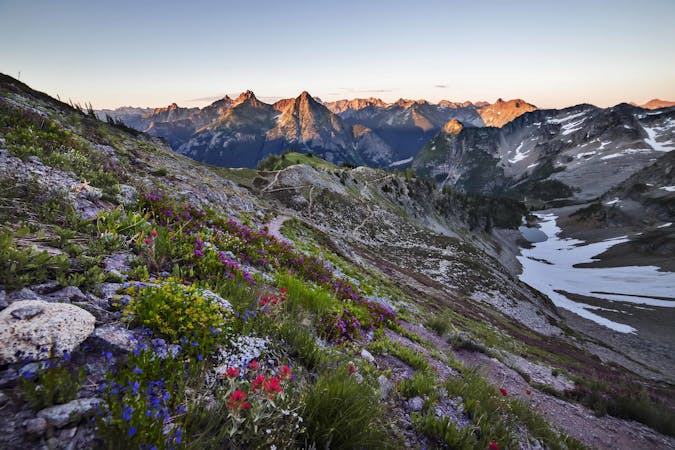
The Cascade Pass Trail offers up some of the most incredible views in the entire state of Washington! From the top of the pass, you'll get to soak in views of "the high peaks on either side of the pass, verdant meadows curve down to a saddle that offers sweeping views of nearby valleys, glaciers, mountains, and passing wildlife," according to Paul Kriloff on WTA.org.

The hike begins by climbing 30+ switchbacks in the first 2.7 miles to reach the top of the pass. After a couple of miles of climbing, you'll break out of the trees and enjoy stupendous views as you hike through the alpine!
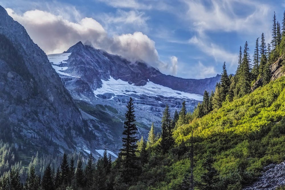
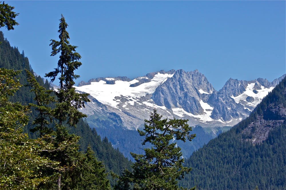
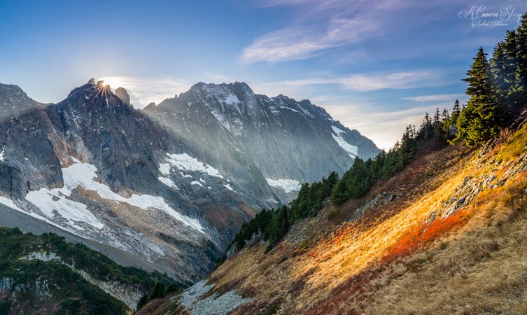
"Cascade Pass offers views of several impressive peaks and glaciers," according to Kriloff. "The ridge from Johannesburg Mountain connects to Mixup Peak and Magic Mountain, in between which lies the Cache Glacier. Back the way you came, the horizon is comprised largely of the glacier-dotted lower slopes and snowy summit arête of El Dorado Peak."
For an easy hike, you can simply turn around at the top of the pass and return the way you came. For a medium-length version, you can continue down the opposite side of the pass and then take a left on the Sahale Arm trail for a gorgeous out-and-back hike to the base of a glacier.
But the route mapped here details the entire Cascade Pass Trail, an epic 15.2-mile point-to-point trail that continues to descend this stunning mountain valley. The trail follows a stream down from the pass and provides endless views of the soaring mountain peaks above you as you slowly hike along their bases.
The hike ends at Stehekin Valley Road, and will require you to arrange a car shuttle in advance… unless you decide to turn this into an epic backpacking trip. That decision is up to you!
Sources: https://www.wta.org/go-hiking/hikes/cascade-pass https://www.nps.gov/noca/planyourvisit/cascade-pass-trail.htm
Difficult
Hiking trails where obstacles such as rocks or roots are prevalent. Some obstacles can require care to step over or around. At times, the trail can be worn and eroded. The grade of the trail is generally quite steep, and can often lead to strenuous hiking.

The trail contains some obstacles such as outcroppings and rock which could cause injury.

In the high mountains or remote conditions, all individuals must be completely autonomous in every situation.
The best trail in North Cascades for a day hike into the alpine, making a determined ascent to stand eye-level glaciers.
Difficult Hiking
5 routes · Hiking
7 routes · Hiking

63 routes · Alpine Climbing · Hiking