9.2 km away
Chain Lakes Loop
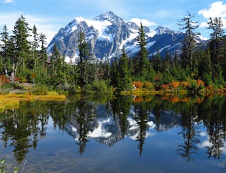
A popular hike with amazing views every step of the way, around alpine lakes reflecting soaring cliffs and snow-capped summits.
Moderate Hiking
- Distance
- 9.9 km
- Ascent
- 550 m
- Descent
- 546 m
A one or two-night trek, through a deep river valley and along a soaring ridge, with views stretching across peaks of the North Cascades.
Hiking Difficult

This is one of the best backpacking loops in North Cascades National Park, so it’s advisable to reserve your permits in advance, during the application period in March. If you don’t reserve then, you might still score a walk-up permit just before you intend to start your trip. See the park’s wilderness trip planner for more information. Though the permits can be hard to get, the reward is an utterly remote trek on which you’ll see few other people.
The trail begins outside the national park boundary, at Hannegan Pass Trail in the national forest. A valid Recreation Pass is required to park here, separate from the national park’s wilderness permit. The trail climbs gently through a valley streaked with avalanche paths, where low-growing flora allows for abundant mountain views. A steep but brief ascent then leads to the pass, where a side trail goes up Hannegan Peak, in case you wish to bag a summit. Otherwise, continue over the pass to enter the national park and reach Boundary Camp.
This camp marks the beginning of the loop portion, so the direction you proceed will depend on which campsites you’ve reserved. The route is mapped here counterclockwise, going first along the Chilliwack River where there are a handful of campsites. These miles through the valley are generally easy, but buried in thick forest which is not particularly exciting. One highlight is the cable car crossing over the river. You’ll load yourself and your gear in the box, then pull yourself across the gap on a fixed rope. This is crucial when the river flows high in early summer. Otherwise it’s quicker to simply ford where the trail crosses, but the cable might still be preferable for the novelty.
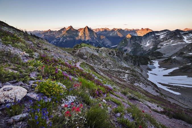
Continuing on, another trail branches off at Brush Creek, ascending an adjacent valley to Whatcom Pass. This makes another possible side trip from the main loop. Beyond that junction, the Chilliwack River Trail continues through forest and occasional avalanche meadows. After fording the river again, the trail tips dramatically upward to begin the climb to Copper Ridge. Nearly three miles of uphill through the forest finally gets you on top of the ridge. The remaining miles roll among flowery meadows and rocky slopes, with constant views to glaciers and peaks all around
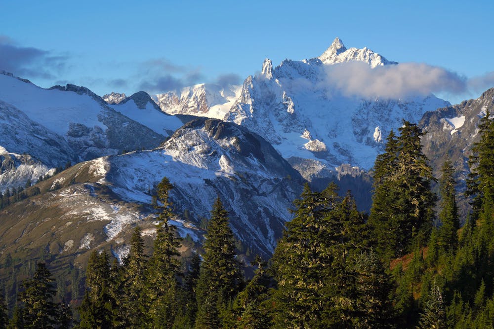
In good weather this section is truly spectacular. Poor weather can be especially bad up here though, so you should be prepared for any conditions. In July and early August you may contend with lingering snow on the ridge. Once it’s melted, water sources become far between. The only reliable fill-ups are Copper Lake and Egg Lake, both of which have campsites at them. The third camp on the ridge is Silesia, which has the most dramatic setting but no water. The highpoint of the ridge is Copper Mountain Lookout, and from there you’ll find a great view to Mount Baker if the weather is clear. To complete the loop, the trail follows the descending ridgeline and eventually returns to Boundary Camp. Backtracking over Hannegan Pass and down Ruth Creek puts you finally back at the trailhead.
Sources: https://www.nps.gov/noca/planyourvisit/copper-ridge-trail.htm https://www.wta.org/go-hiking/hikes/copper-ridge-loop https://www.fs.usda.gov/recarea/mbs/recarea/?recid=17556
Difficult
Hiking trails where obstacles such as rocks or roots are prevalent. Some obstacles can require care to step over or around. At times, the trail can be worn and eroded. The grade of the trail is generally quite steep, and can often lead to strenuous hiking.

The trail contains some obstacles such as outcroppings and rock which could cause injury.

Little chance of being seen or helped in case of an accident.
9.2 km away
A popular hike with amazing views every step of the way, around alpine lakes reflecting soaring cliffs and snow-capped summits.
Moderate Hiking
7 routes · Hiking

19 routes · Hiking