148 m away
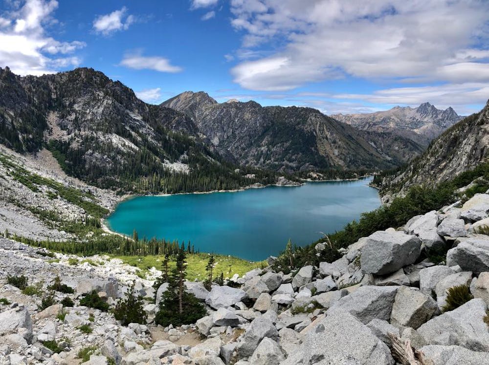
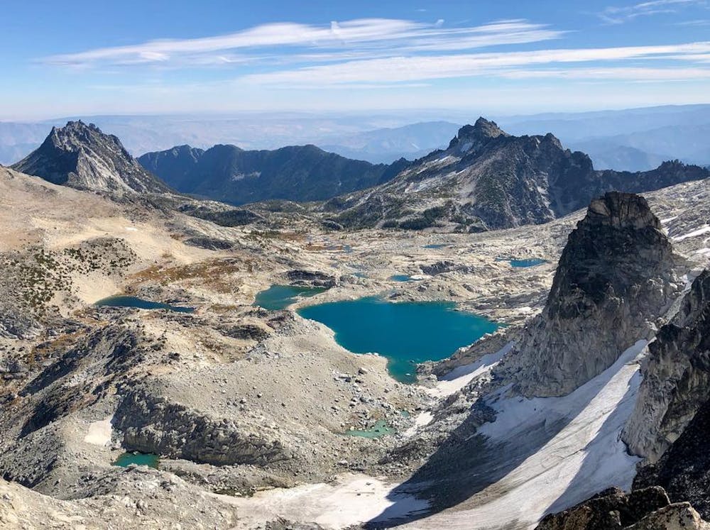
The Enchantments Traverse
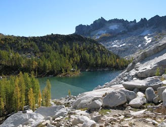
A stunning hike through the Enchantments outside of Leavenworth.
Severe Hiking
- Distance
- 29 km
- Ascent
- 1.5 km
- Descent
- 2.2 km
The first ever same day ascent of Dragontail and 2 Double-Doubles at In-n-Out.
Hiking Extreme

I’d like to think I made history with this one.
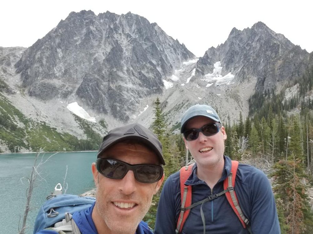
After a huge Italian dinner and beers, we casually decided at the midnight hour, “let’s do Dragontail tomorrow”. The prior 2 big days had started to take their toll, but the beer was talking now. Only thing: I had a catch a flight back to SF the next evening. If we went for Dragontail, we’d have to book it. I was skeptical. But Josh just said, “Let’s do it.”
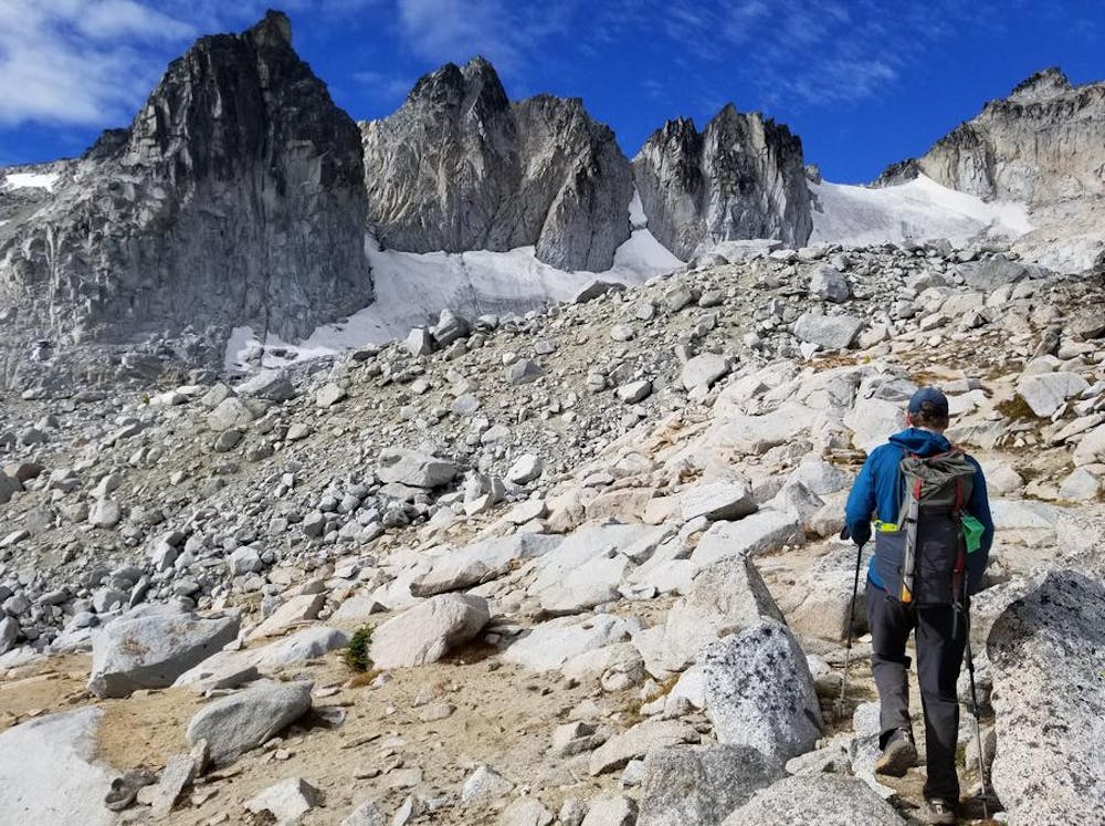
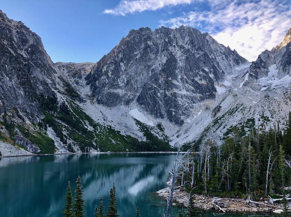
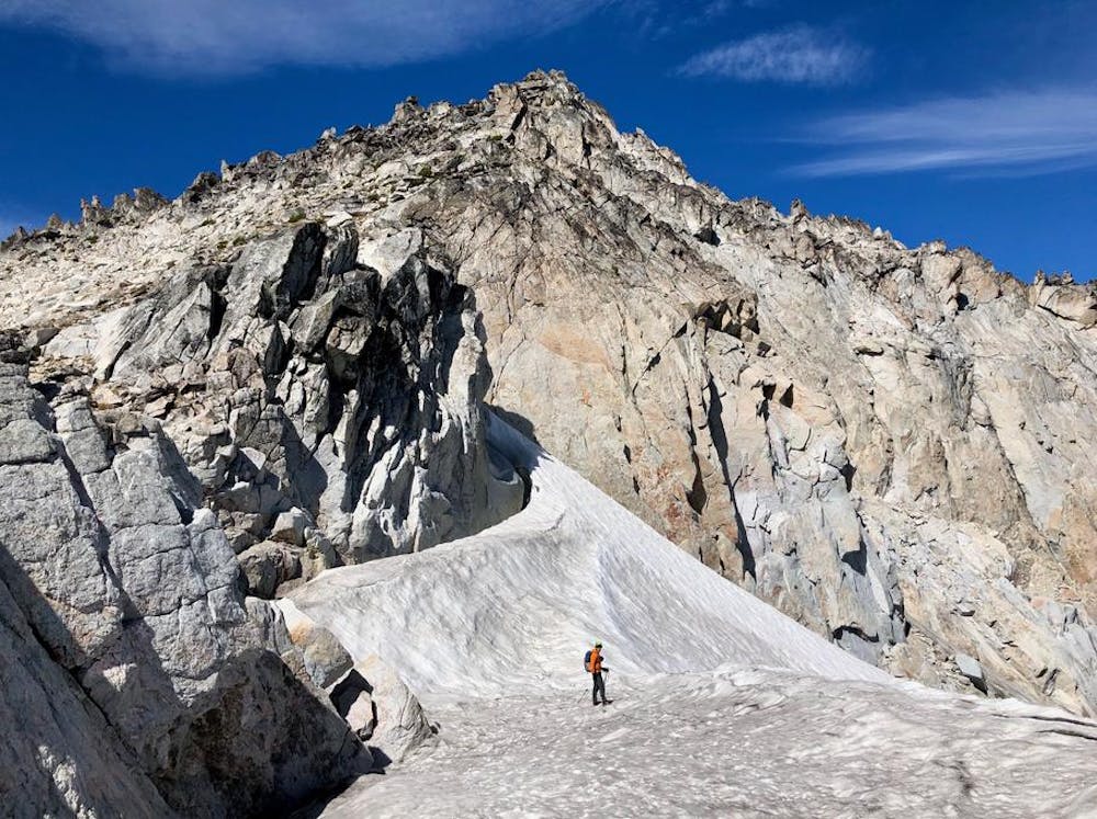
On the trail to Colchuck Lake at 6:30am. We flew up, under 1 1/2 hrs to the lake. I ran out of steam a bit on Aasgard while Josh surged ahead and flashed the whole pass climb in 40 min.
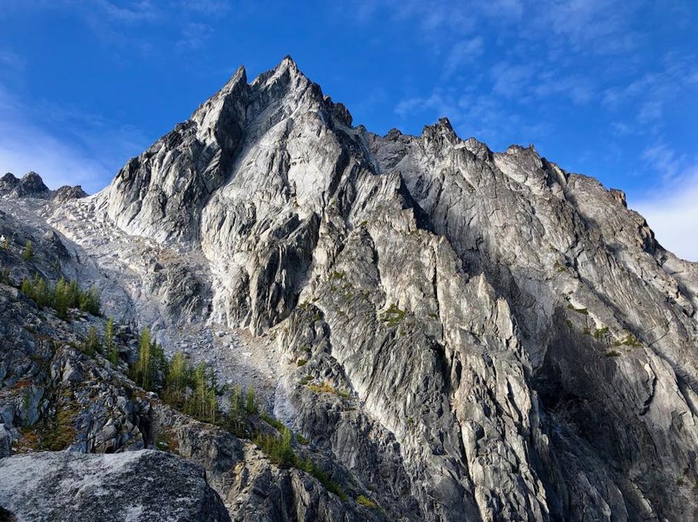
From here, we made some routefinding mistakes that cost us precious time and eventually led us into walls of smooth boulders in a glacier headwall. Getting out of that mess proved to be our crux; we were also dangerously close to our turnaround time.
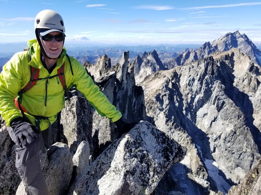
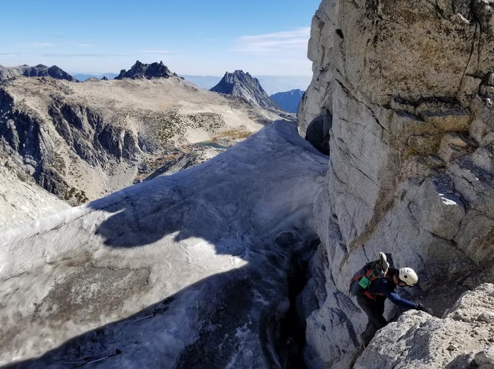
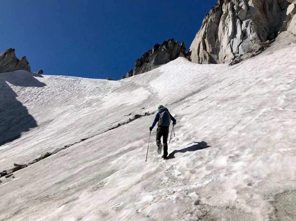
Luckily, once above the rock bands it was smooth sailing. Crampons across to the top of the glacier and then a couple class 3/4 moves over a late-season moat to gain the Class 2 south ridge.
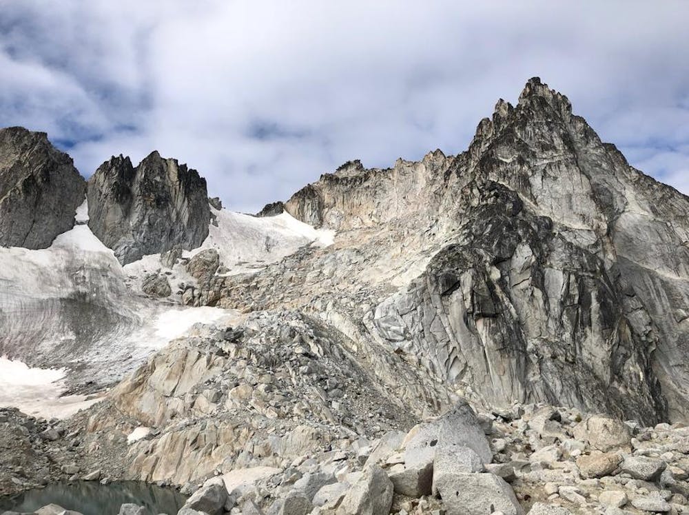
Going down we skirted left and avoided all of the mess in the headwall. A climber’s route is well cairned and only moderately tedious talus and rocky footing.
We stopped rarely and motored down to the trailhead, getting to the car 3 minutes before our drop-dead departure time (that also factored in a required stop to get these huge milkshakes again at a place we’d hit 2 days ago). Stats for our 3 day trip: 4 peaks, almost 50 miles, and 20,000 ft vert.
Threw on new clothes in the parking lot, made my flight, and then hit In-n-Out before midnight (2 Double-Doubles Animal Style). Thus history may have been made — the first ever same day ascent of Dragontail and 2 Double-Doubles at In-n-Out.
Also --- my 500th peak on peakery.
Extreme
Scrambling up mountains and along technical trails with moderate fall exposure. Handholds are necessary to navigate the trail in its entirety, although they are not necessary at all times. Some obstacles can be very large and difficult to navigate, and the grades can often be near-vertical. The challenge of the trail and the steepness of the grade results in very strenuous hiking. Hikes of this difficulty blur the lines between "hiking" and "climbing".

Some trail sections have exposed ledges or steep ascents/descents where falling could cause serious injury.

In the high mountains or remote conditions, all individuals must be completely autonomous in every situation.
148 m away
A stunning hike through the Enchantments outside of Leavenworth.
Severe Hiking
5 routes · Hiking

19 routes · Hiking