1 m away
West Oval Lake to Eagle Creek Trailhead
A long, scenic and varied stroll back to the trailhead
Difficult Hiking
- Distance
- 21 km
- Ascent
- 675 m
- Descent
- 1.8 km
A day trip from West Oval Lake to 2 wild peaks
Hiking Severe

Plenty of hikers do the 2-day circular route to the Oval Lakes, but factoring in an extra day and climbing these 2 peaks is highly recommended. Carrying camping gear up to and then out from the lakes is hard work, so rewarding yourself with a day of peak bagging whilst carrying a light pack is a great way to extend the trip and improve the (already favourable) effort:reward equation.
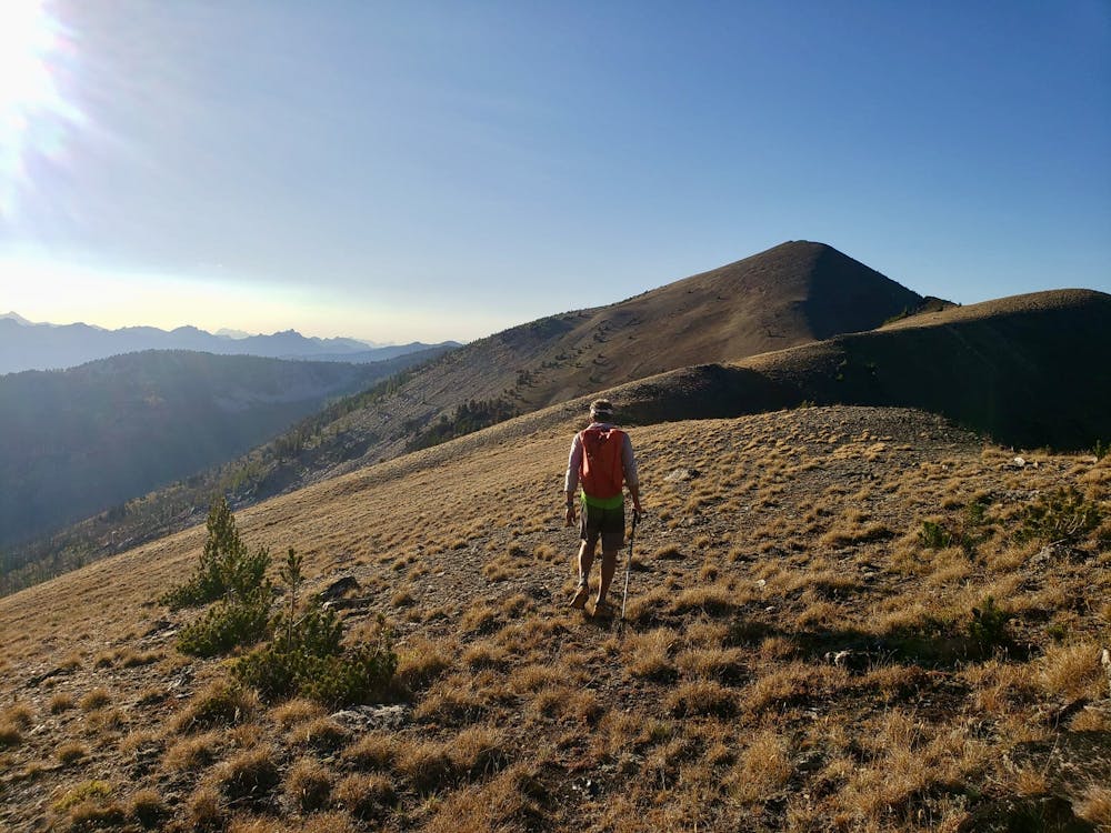
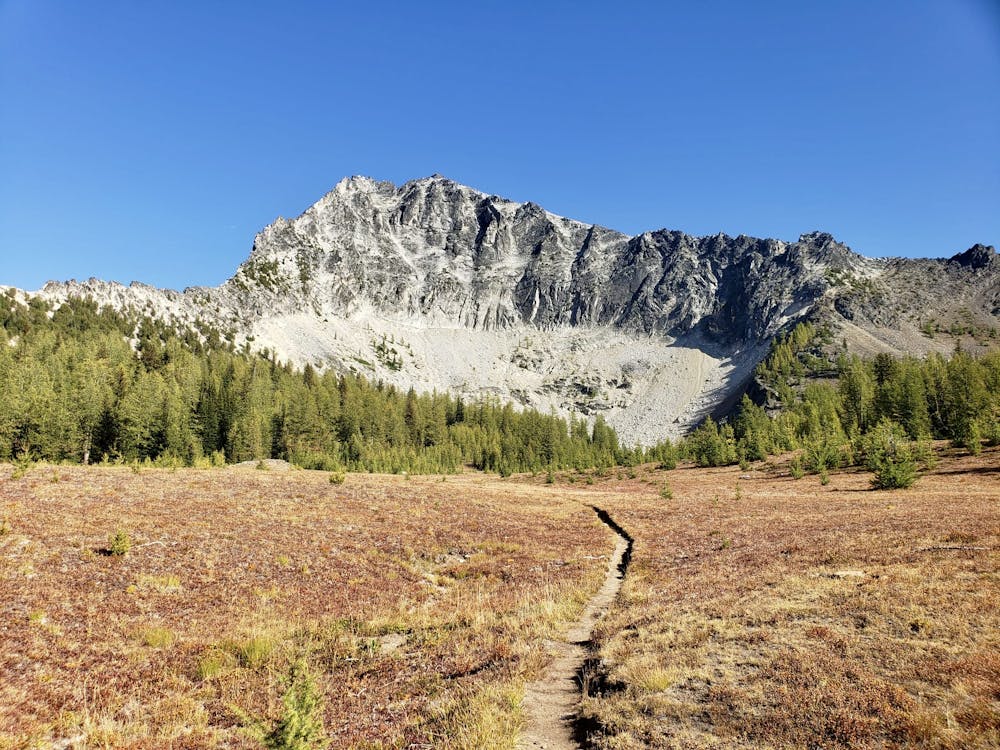
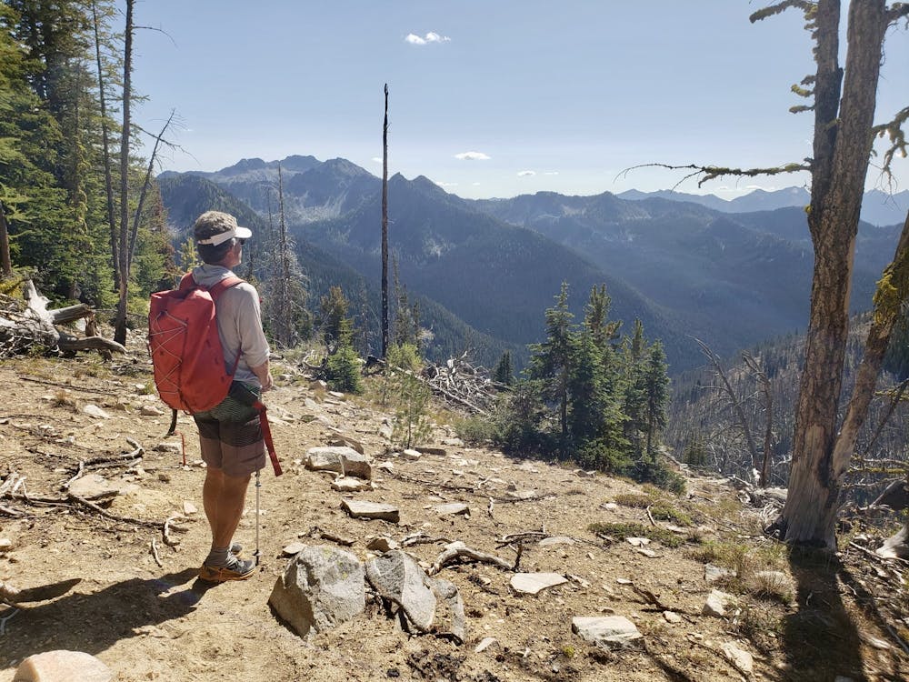

The first job of the day is climb up to Oval Pass and then descend past the stunning Tuckaway Lake, and the forest camp just below it, before swinging around on a good path which leads beneath both Gray and Courtney Peaks. The trail is gorgeous and hangs high above a remote valley, giving it a wonderful ambience to match the fabulous views across the North Cascades. The big glaciated peak you can see from the path (on a clear day) is Glacier Peak - one of the more remote Washington volcanoes.
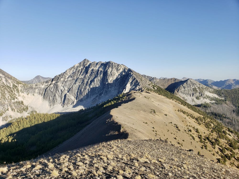
As you get closer to Fish Creek Pass (between Courtney and Star Peaks), Star Peak's imposing north-west ridge dominates the view, and it's an intimidating sight! Star Peak can be climbed relatively easily via its south ridge, but the north-west ridge is the mountain's most impressive feature.
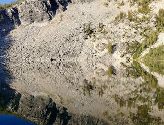
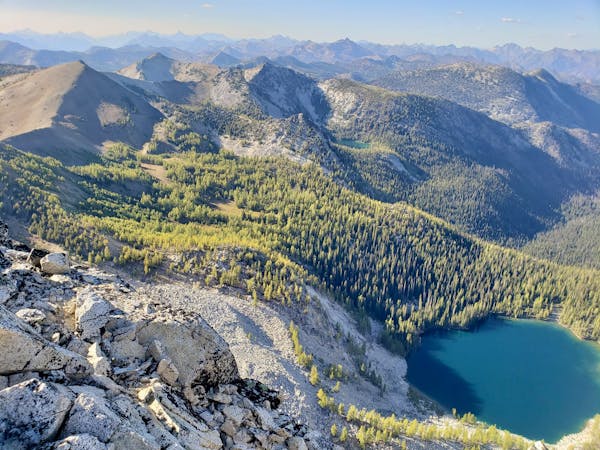
Upon reaching Fish Creek Pass, hang a left and scramble easily to the summit of Courtney Peak. Be extremely careful on the summit - the mountain's huge north-west face is vertical and begins less than 10 feet from the top of the peak! The view from the summit is staggering, and you'll be able to see today's hike almost in its entirety, as well as Middle and East Oval Lakes (which aren't visible from West Oval).
The route from the summit down to the broad col beneath Gray Peak is not well-travelled but it's simple enough for confident hikers who can move over boulder and scree fields in occasionally exposed positions. Take your time, pick a line carefully and you'll soon find yourself hitting the vague trail which leads onto the summit of Gray Peak. As on Courtney Peak, the views are fabulous, so soak them in and then head down to West Oval Lake for another blissful camp in the forest.
Severe
Hiking challenging trails where simple scrambling, with the occasional use of the hands, is a distinct possibility. The trails are often filled with all manner of obstacles both small and large, and the hills are very steep. Obstacles and challenges are often unexpected and can be unpredictable.

Some trail sections have exposed ledges or steep ascents/descents where falling could cause serious injury.

In the high mountains or remote conditions, all individuals must be completely autonomous in every situation.
1 m away
A long, scenic and varied stroll back to the trailhead
Difficult Hiking
9.2 km away
A long forest hike leads to a gorgeous lake
Difficult Hiking
3 routes · Hiking