McAlester Lake to Stehekin
Long Descent from McAlester Lake to Stehekin
Hiking Difficult
- Distance
- 23 km
- Ascent
- 350 m
- Descent
- 1.7 km
- Duration
- 5-6 hrs
- Low Point
- 336 m
- High Point
- 1.8 km
- Gradient
- 22˚

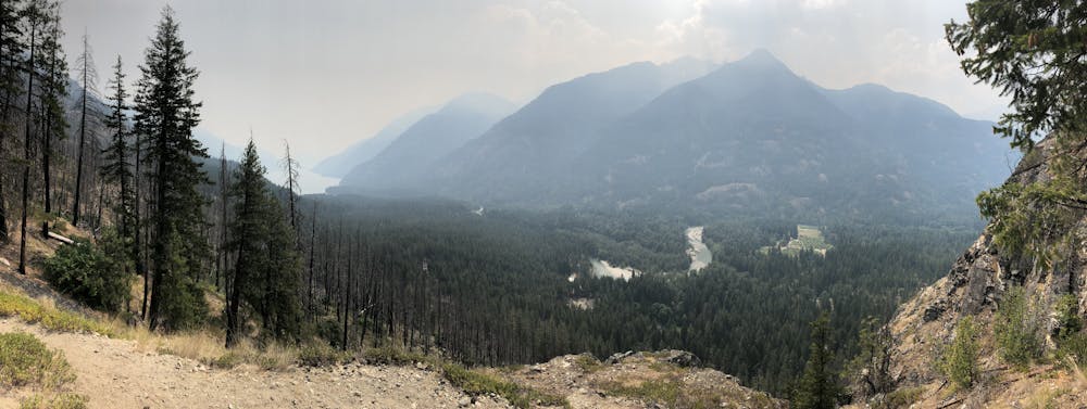
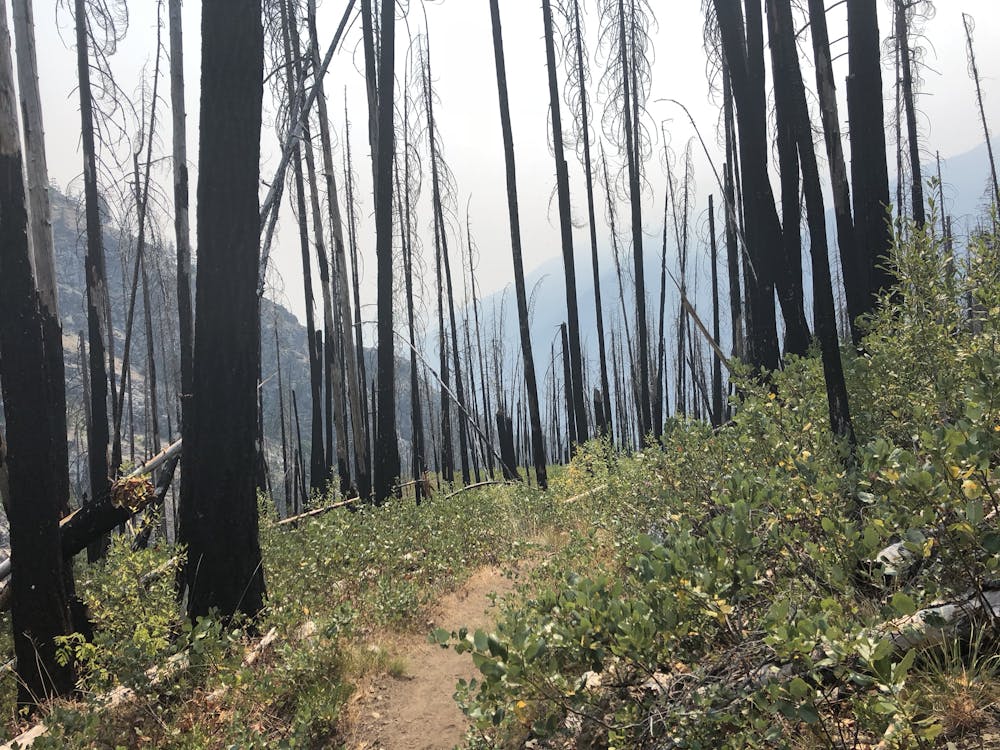
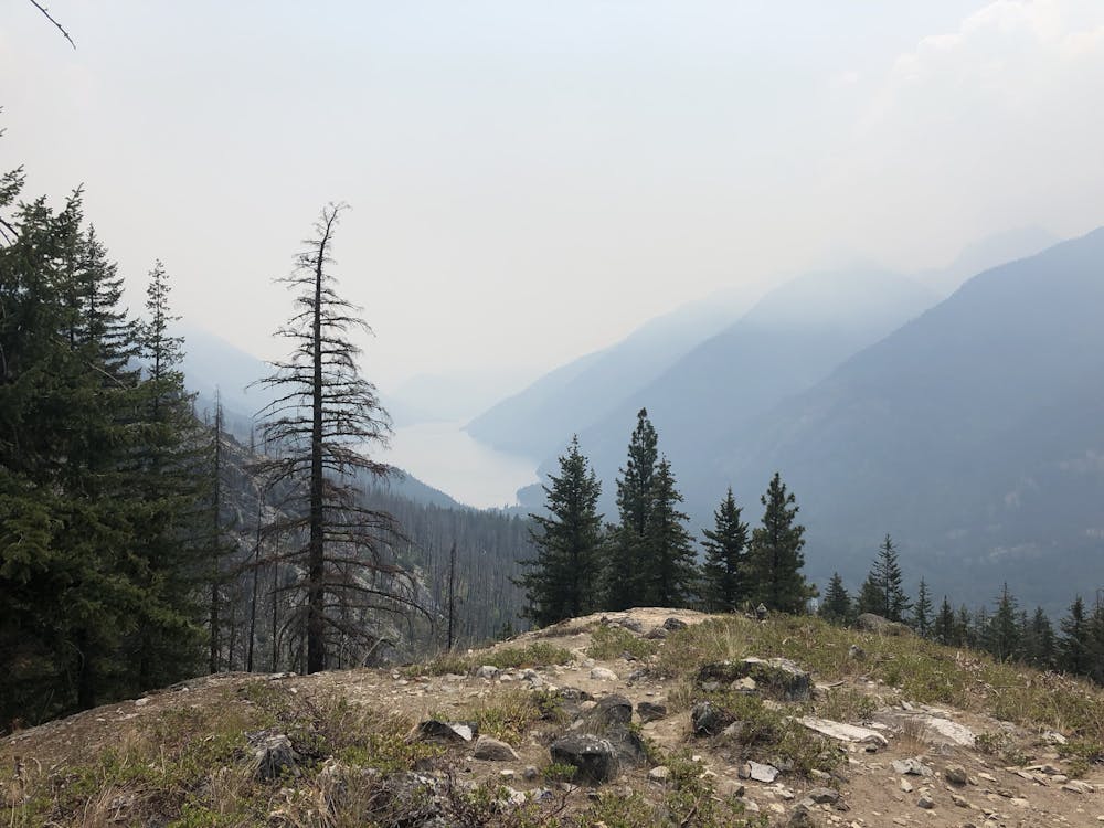
A long hike from McAlester Lake, to McAlester Pass and 13 miles of downhill! Prepare your knees and hips for some torture, this trail is gorgeous as it descends from an old growth forest down to barren mountainside and along through a valley. The area is susceptible to wildfires in the summer, but if you are lucky, you will be rewarded with a view! There are multiple campsites along this trail, reservable through the NPS.
- •
- •
- •
Difficulty
Difficult
Hiking trails where obstacles such as rocks or roots are prevalent. Some obstacles can require care to step over or around. At times, the trail can be worn and eroded. The grade of the trail is generally quite steep, and can often lead to strenuous hiking.
Medium Exposure

The trail contains some obstacles such as outcroppings and rock which could cause injury.
Remoteness
Away from help but easily accessed.
Best time to visit
Features
- Alpine
- Wildlife
- Picturesque
- Wild flowers
- Water features
- Forestry or heavy vegetation