8.8 km away
Kendall Katwalk
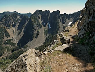
Hike to the stunning Kendall Katwalk section of the PCT.
Difficult Hiking
- Distance
- 18 km
- Ascent
- 935 m
- Descent
- 935 m
Mt Price Climb from Hester Lake
Hiking Moderate

This is a popular hiking route which is generally considered to be moderate. It's extremely remote, it features high exposure and is typically done between July and October. From a low point of 1.2 km to the maximum altitude of 1.7 km, the route covers 3.5 km, 460 vertical metres of ascent and 565 vertical metres of descent.
Mt Price Climb
Moderate
Hiking along trails with some uneven terrain and small hills. Small rocks and roots may be present.

Some trail sections have exposed ledges or steep ascents/descents where falling could cause serious injury.

In the high mountains or remote conditions, all individuals must be completely autonomous in every situation.
8.8 km away
Hike to the stunning Kendall Katwalk section of the PCT.
Difficult Hiking
9 km away
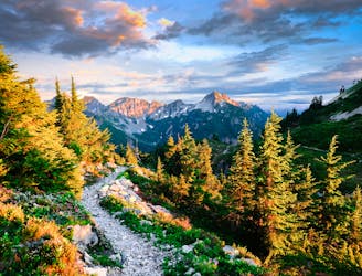
Miles 2393.2-2464.1 of the northbound PCT: Stunning views along a series of big ups and downs, between high mountain lakes and lush valley forest in the Alpine Lakes Wilderness.
Difficult Hiking

10 routes · Hiking

72 routes · Hiking