2.9 km away
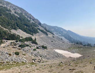
Glacier Basin Day Hike
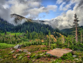
Day hike to and from the Glacier Basin Campground—not the full mountaineering ascent to the summit of Rainier.
Difficult Hiking
- Distance
- 11 km
- Ascent
- 524 m
- Descent
- 524 m
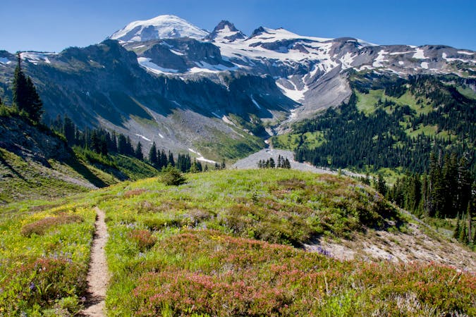
One of the most stunning day hikes in the state of Washington!
Hiking Difficult

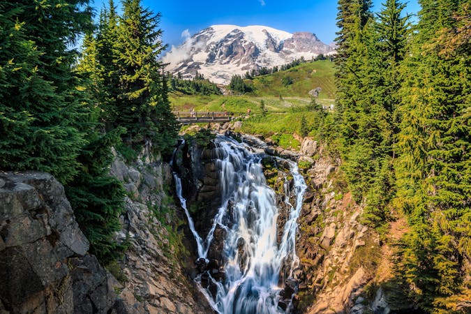
"If you can only do one summer full-day hike in Washington, the hike to Summerland in Mount Rainier National Park is your best bet,” writes SwitchbackTravel.com. “Summerland,” the destination of your hike, is a beautiful alpine meadow filled with stunning wildflowers. Named by famous climber and explorer E. S. Ingraham, Summerland serves as a basecamp for climbers ascending Mount Rainier via its southern slopes. A backcountry camping area of the same name has been established near the meadow to serve both climbers and backpackers.
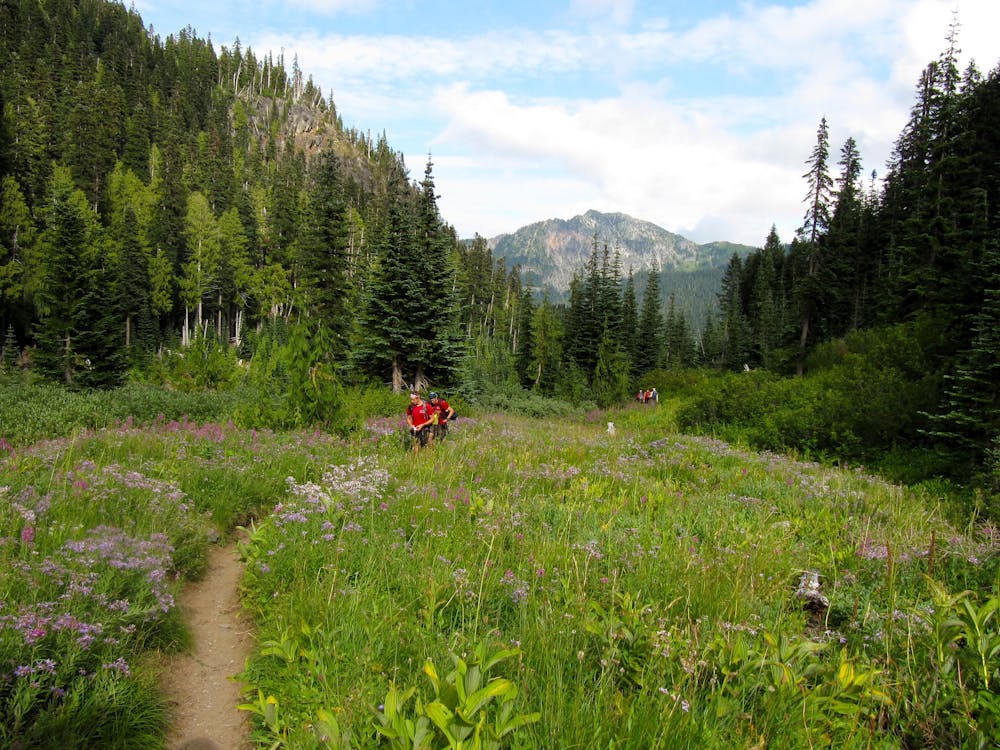
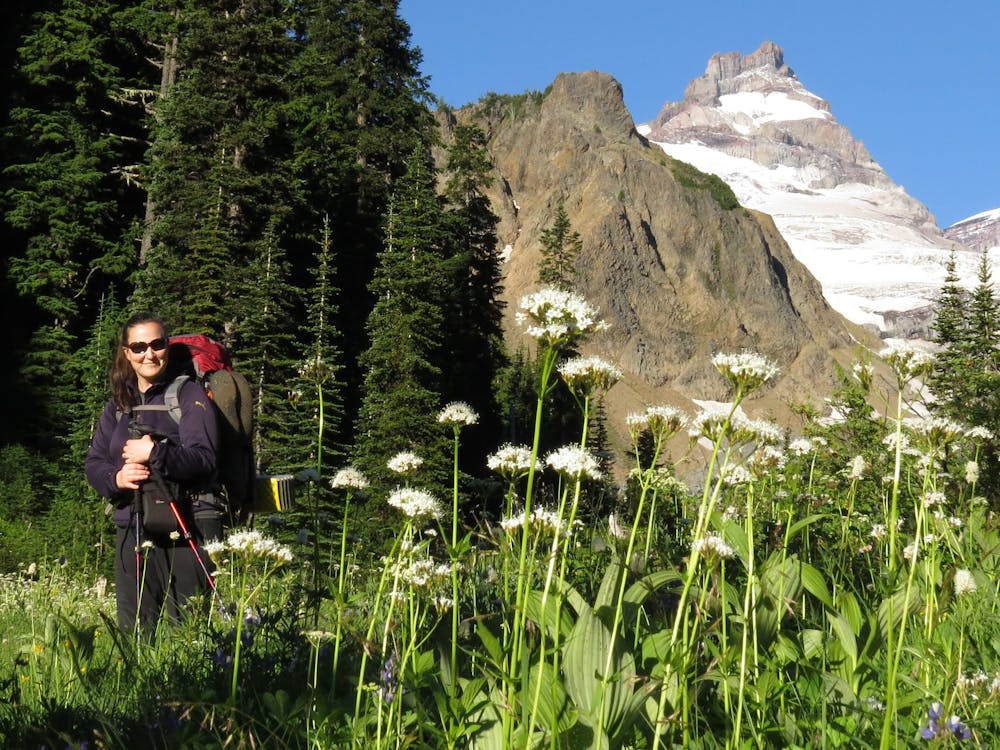
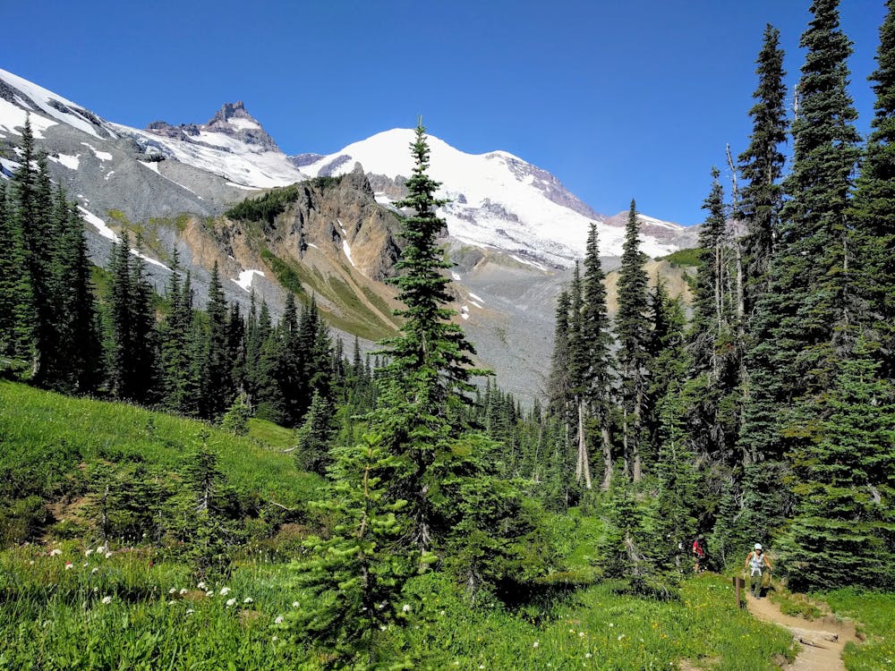
You’ll begin your hike to Summerland from a trailhead along Sunrise Park Road. After a short section of flat trail, the route joins with the Wonderland Trail—a long-distance hiking trail that circumnavigates Mount Rainier. Essentially, the rest of your ascent up the valley to Summerland meadow is a segment of the Wonderland Trail. So in addition to sharing the trail with other day hikers, trail runners, and alpinists attempting the summit of Mount Rainier, you’re also likely to encounter backpackers and fastpackers seeking to complete the entire circumnavigation of the mountain.
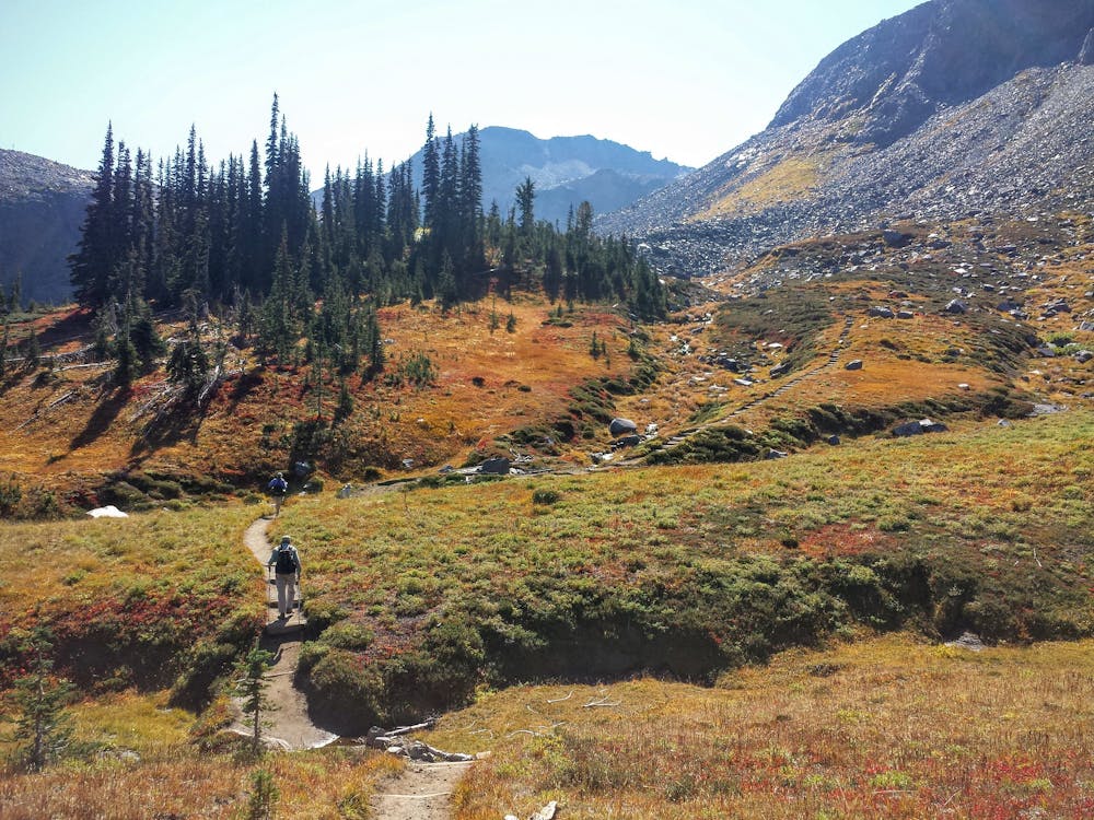
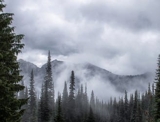
The trail slowly ascends a narrow mountain valley. In addition to the steep mountainsides blocking the sun during certain times of the day, the forest here is deep and dark. “Not much sun reaches the forest floor along the first part of your trail, but a few shade-tolerant wildflowers do manage to thrive here, writes Alan Gibbs on WTA.org.
Soon, the trail steepens, climbing a series of rocky switchbacks. As you gain more and more elevation, the trees get smaller, and the forest begins to open up. "Soon you are out on more open slopes, with small alpine firs and a lot of white rhododendron shrubs. . .that often display their small white blooms in June,” writes Gibbs.
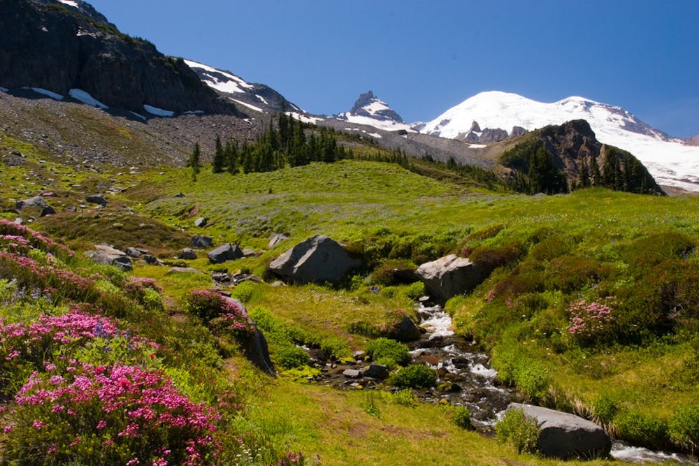
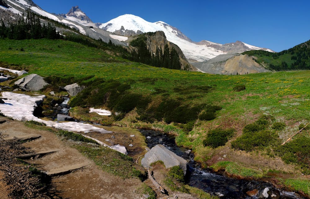
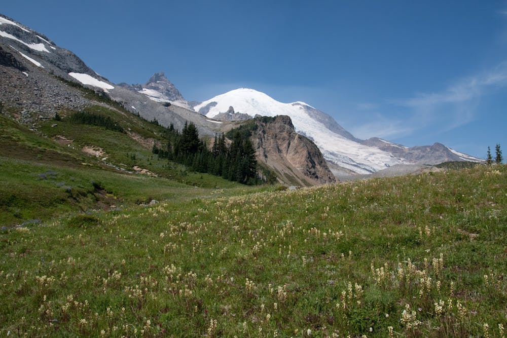
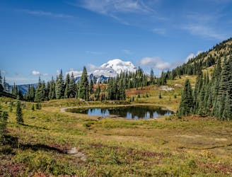
As you approach Panhandle Gap and Summerland, the views begin to come in earnest! Enjoy the vistas of the alpine meadows, rushing glacial melt in the mountain streams, and the towering glaciated peaks above you. Before you know it, you’ll reach Summerland meadow.
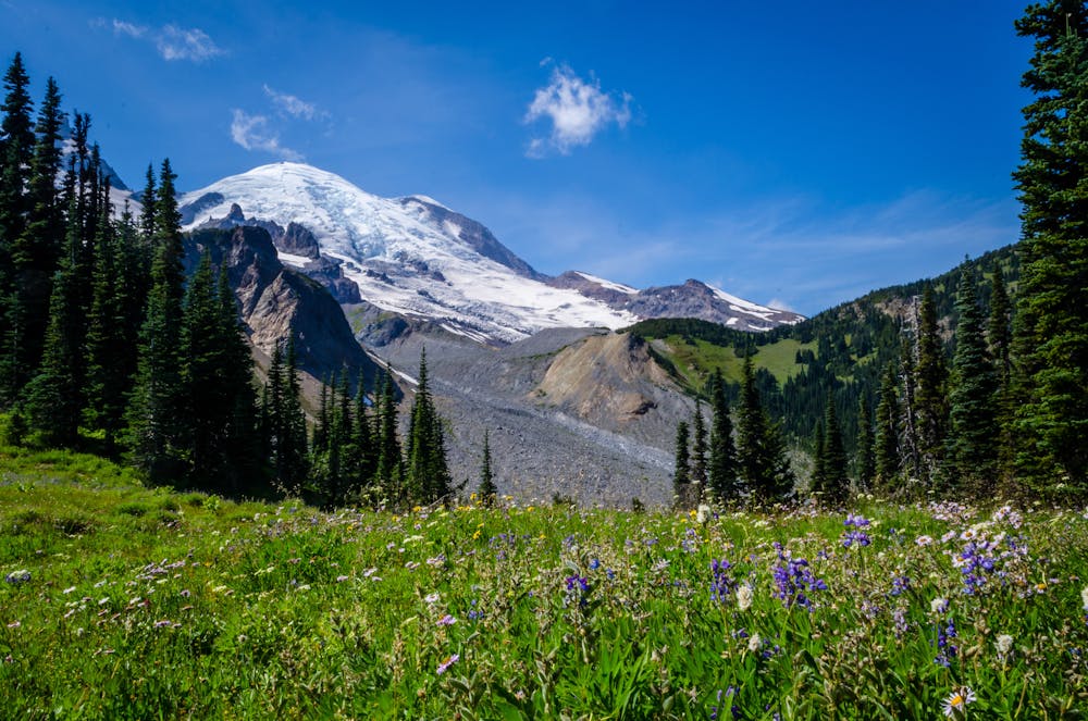
Early in the year, the meadow is filled with colorful wildflowers! If your goal is to see wildflowers, try to time your hike to Summerland early in the season, soon after the snow melts. "When the snow first melts, avalanche lilies appear here, to be followed later by lupine, Indian paintbrush, white pedicularis, and many others,” writes Gibbs. Over the course of the summer, the intensity of the flowers will fade dramatically.
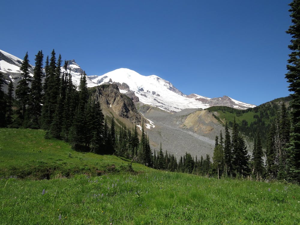
From the meadow, you’ll also enjoy views of Little Tahoma and the summit dome of Mount Rainier itself. Be sure to spend some time sitting and soaking in the view here. This is the perfect spot for a picnic lunch.
While the hike to and from Summerland is easily achievable in a day, you can also choose to turn this into a short backpacking trip by staying at the wilderness camp for the night. Or, if you yearn for more, consider backpacking a longer section of the Wonderland Trail—or even the entire thing!
Sources: https://www.switchbacktravel.com/great-day-hikes-near-seattle https://www.nps.gov/mora/planyourvisit/summerland.htm https://www.wta.org/go-hiking/hikes/summerland-panhandle-gap
Difficult
Hiking trails where obstacles such as rocks or roots are prevalent. Some obstacles can require care to step over or around. At times, the trail can be worn and eroded. The grade of the trail is generally quite steep, and can often lead to strenuous hiking.

The trail contains some obstacles such as outcroppings and rock which could cause injury.
Away from help but easily accessed.
2.9 km away
Day hike to and from the Glacier Basin Campground—not the full mountaineering ascent to the summit of Rainier.
Difficult Hiking
3.8 km away
A stunning alpine loop hike up Burroughs Mountain.
Moderate Hiking
3.8 km away
An easy but incredibly scenic hike from the Sunrise Visitor Center.
Easy Hiking
3.8 km away
Hike to beautiful views from a historic fire tower in Mount Rainier National Park
Moderate Hiking
7.4 km away
Enjoy stunning views of Mount Rainier National Park while circumnavigating Naches Peak.
Moderate Hiking
7.5 km away
Leaving Mount Rainier on a lofty mountain crest, then traveling miles of forest mosaic on a long series of hills to reach Snoqualmie Pass.
Moderate Hiking
10 routes · Hiking

10 routes · Hiking

25 routes · Alpine Climbing · Hiking

72 routes · Hiking

10 routes · Hiking
8 routes · Hiking

63 routes · Alpine Climbing · Hiking

19 routes · Hiking