4.7 km away
Predator Loop

A gnarly double black diamond downhill line on Tiger Mountain.
Extreme Mountain Biking
- Distance
- 7.7 km
- Ascent
- 422 m
- Descent
- 422 m
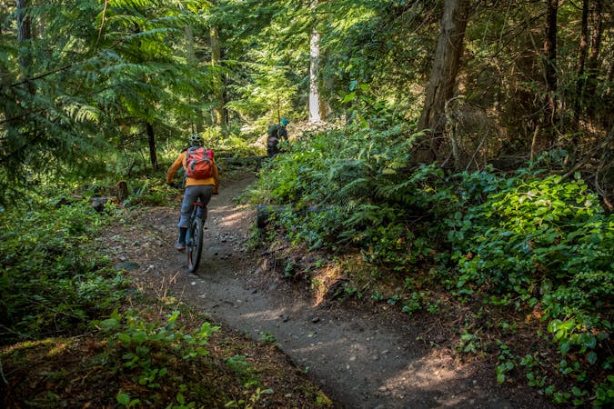
A mellow lollipop route through a multi-use trail system close to Seattle.
Mountain Biking Moderate

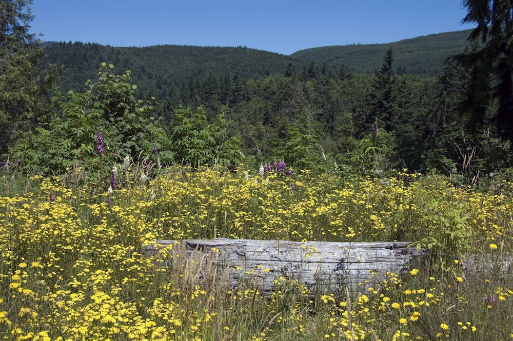
"Connecting the Cedar River Watershed to the Tiger Mountain State Forest, the 1,924 acre Taylor Mountain Forest treats visitors with views of Mount Rainier, forested wetlands, and meadows of wildflowers,” according to King County Parks. This state forest is also a working forest, meaning that it’s supposed to demonstrate "how environmentally sound forest management protects and restores ecological systems while still allowing for recreational opportunities,” according to King County Parks.
The lollipop ride mapped here seeks to maximize your time on singletrack and minimize your time on dirt roads. However, if you’re fine with grinding some gravel, you can easily create longer loops and more intricate ride options in the Taylor Mountain Trail System.
Overall, this ride is pretty mellow and non-technical. All of the trails in this system are rated either intermediate or beginner.
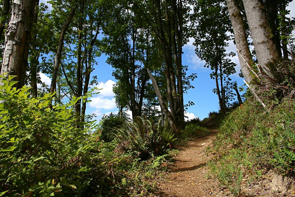
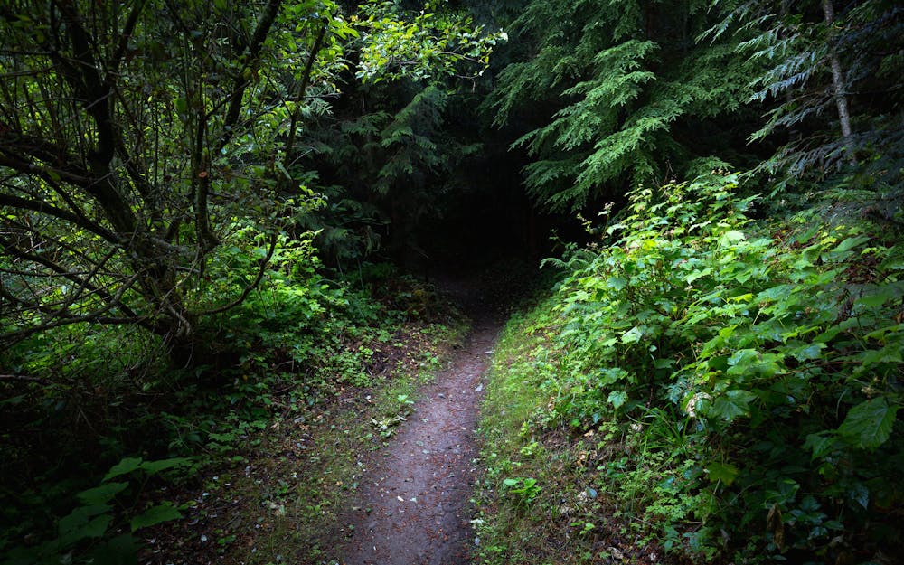
Over the course of your ride, you’ll likely see open areas and evidence of logging in this working forest. In other areas, you’ll find yourself in a deep, dark PNW rain forest that feels dramatically removed from the city, even though you’re just a few miles from downtown Seattle.
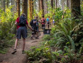
The trail system at Taylor Mountain is a multi-use trail network, meaning that you can expect to encounter hikers, trail runners, and equestrians in addition to other mountain bikers. Since Taylor Mountain is so close to Seattle, the trails can get crowded, especially on the weekends. Be sure to practice proper trail yielding—mountain bikers are supposed to yield to all other trail users.
Sources: https://www.kingcounty.gov/services/parks-recreation/parks/trails/backcountry-trails/taylor-mtn.aspx https://www.evo.com/travel-guides/bike/washington/seattle-north-puget-sound/taylor-mountain
Moderate
Mostly stable trail tread with some variability, with unavoidable obstacles 8in/20cm tall or less. Other obstacles such as rock gullies and steep sections may exist. Ideal for lower intermediate riders.

The trail contains some obstacles such as outcroppings and rock which could cause injury.
Away from help but easily accessed.
4.7 km away
A gnarly double black diamond downhill line on Tiger Mountain.
Extreme Mountain Biking
4.7 km away
The gnarliest trail system near Seattle.
Severe Mountain Biking
9.4 km away
An expansive cross country-oriented trail system.
Difficult Mountain Biking
8 routes · Mountain Biking

16 routes · Mountain Biking
5 routes · Mountain Biking