132 m away
Alpine Lakes Traverse
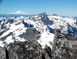
A stunning traverse through Alpine Lakes Wilderness
Severe Ski Touring
- Distance
- 54 km
- Ascent
- 5.5 km
- Descent
- 5.8 km
A 4 days scenic route passing by 14 Lakes in Alpine Lakes Wilderness
Ski Touring Difficult

The Hyas Lake to Stevens Pass ski traverse came together after looking at maps for months and trying to figure out a unique traverse encompassing numerous ski descents along the way. This trip brings you to some of the more isolated area within the Alpine lakes Wilderness during the winter. Jason Hummel and I did this traverse in early April over 4 days with the help of a snowmobile but can also be done if you went in the moment the snow melted out in the valley. The two most important things to consider when attempting this is have a 4 day window of clear skies and to be completely self sufficient. When Jason Hummel and I did this ski traverse we called it the 14 Lake Traverse.


Starting at the Hyas Lake Trailhead make your way North up the valley staying on the East side of Hyas Lake. Once near the northern shores start heading lookers right into the forest climbing up the Western Slopes of Granite Mountain. The trick to this climb is to stay south of the main gully on a nice ramp and once in the alpine make your way over the Robin Lakes area. That night we decided to camp there making our way to the sub summit of Granite Peak before sunset before riding back down to camp.
Waking up at upper Robin Lake start making your way northwest gaining the ridge and heading for Trico Mountain. On the way up you will notice a small notch which allows for riding down to Lake Phoebe via the northeast slopes. Putting your skins back on start heading north to a low col which allows you to drop into the north facing slopes of a West facing bowl riding down to Talus Lake. Start ascending west slowly gaining elevation until making your way up the ridge with trees all the way to the top. Now follow the ridge East all the way to the summit of Mac Peak, this is the second spot we decided to camp for the night.
Waking up to a beautiful sunrise it is time to get moving by riding down the Northeast bowl of Mac Peak until arriving on the shores of Square Lake. With the lake still frozen head northeast before climbing up to Lake Wolverine. From here start climbing north until arriving at a low col and start descending but instead of heading down the main gully make a hard skier left to stay on an upper bench. Before long the terrain will drop off to the north which you can ride down to Trapper Lake. Now it is time for a brutal traverse sticking on the Pacific Crest Trail passing numerous avalanche prone slopes. After a nasty sidehill we decided to climb the last main peak within this area to set up camp for the night.
We started the last day of the traverse by riding down a south facing gully and getting back to the Pacific Crest Trail passing Mig Lake. Once getting to the high col keep following the Pacific Crest trail wrapping above Josephine Lake before it is time to descend down to Steven Passes Backside. Once on the groomers it is time for the final climb of the trip making it to near the top of the Tye Mill Chairlift with a nice descent down to the ski resort base.
To see my trip in the area and more photos check out this link https://www.whereiskylemiller.com/snoqualmie-pass/14-lakes-traverse/
Difficult
Serious gradient of 30-38 degrees where a real risk of slipping exists.

As well as the slope itself, there are some obstacles (such as rock outcrops) which could aggravate injury.

In the high mountains or remote conditions, all individuals must be completely autonomous in every situation.
132 m away
A stunning traverse through Alpine Lakes Wilderness
Severe Ski Touring

11 routes · Ski Touring