Mount Pilchuck
A relatively short run yields a rewarding mountain summit!
Trail Running Moderate
- Distance
- 8.4 km
- Ascent
- 649 m
- Descent
- 648 m
- Duration
- 1-2 hrs
- Low Point
- 960 m
- High Point
- 1.6 km
- Gradient
- 13˚

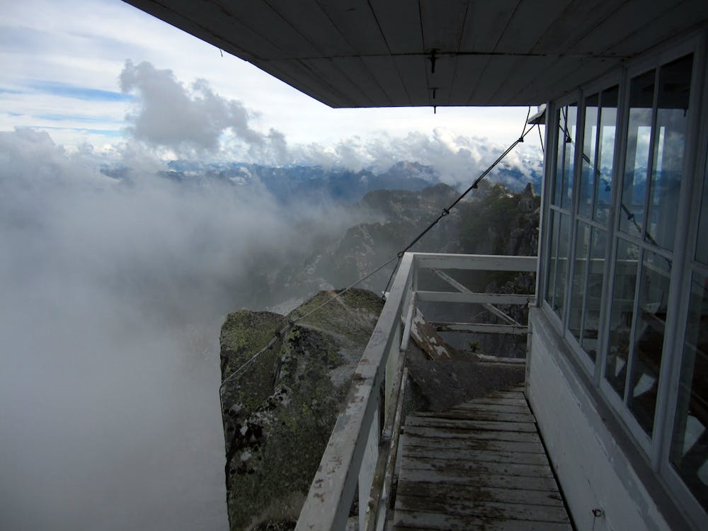
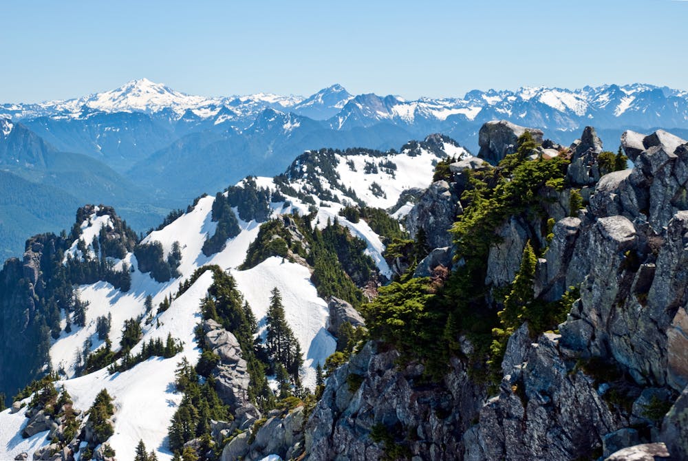
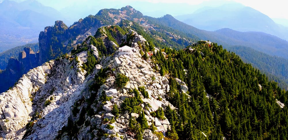
"Easily one of the most rewarding hikes in the area, Mount Pilchuck’s relatively short 2.7 mile, 2,300 feet ascent gifts you 360-degree views of Mount Baker, Mount Rainier and the Olympics from its shelter lookout, which sits nestled on a summit that tops out around 5,300 feet,” writes Conor Dempsey on WTA.org.
- •
- •
- •
- •
- •
Description
Adding to Mount Pilchuck’s popularity is the ease of access: the trailhead is less than two hours from Seattle. While the trailhead requires driving up a rough gravel road to reach it, that rough drive saves about 3,300 feet of climbing that you no longer have to ascend. Score!
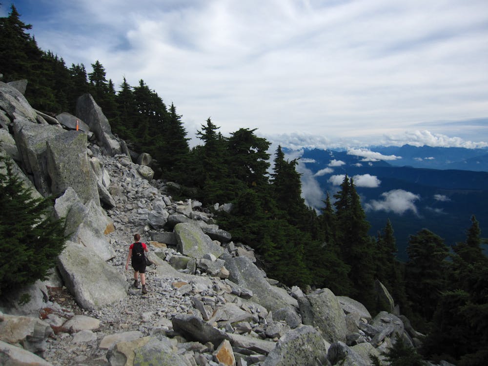
The trail to the summit isn’t very well marked, but if you follow the route as mapped here, you should reach the summit easily. At one point about a mile in, you’ll reach a scree field. “Do not attempt to scramble upward,” says Dempsey. Instead, follow the orange markers to traverse through the boulder field and return to the trail.
While the run may be moderate by some standards, the upper sections of the route are very rocky and can be a little exposed. If the weather turns sour, this run can get a little sketchy. During the winter, people often wander off trail and get lost, and subsequently need to be rescued. While this may be a popular hike or run, route finding skills and awareness of your surroundings are still highly recommended.
Sources: https://www.wta.org/go-hiking/hikes/mount-pilchuck https://www.outsideonline.com/2404959/6-great-hikes-do-seattle
Difficulty
Moderate
Medium Exposure

The trail contains some obstacles such as outcroppings and rock which could cause injury.
Remoteness
Away from help but easily accessed.