Kettle Moraine Southern Unit Big Loop
The premier trail system in the Southern Wisconsin / Northern Illinois region.
Moderate Mountain Biking
- Distance
- 46 km
- Ascent
- 577 m
- Descent
- 577 m
The best trail loop in the Southern Kettle Moraine unit.
Mountain Biking Moderate

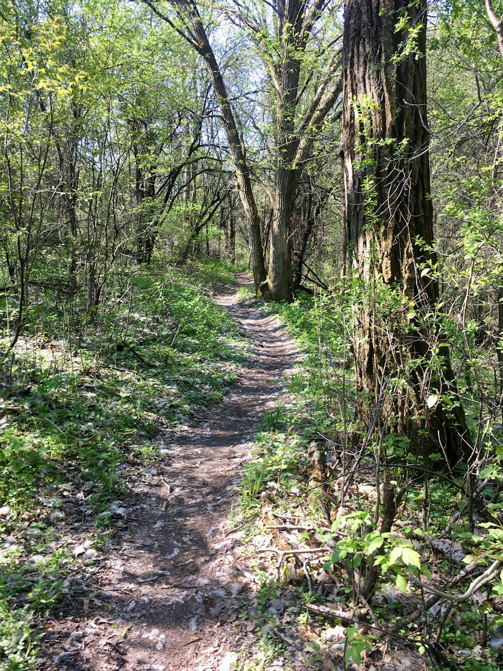
The Southern Unit of Wisconsin's Kettle Moraine State Forest is home to an extensive mountain bike trail system known alternatively as the "John Muir Trails" or "Emma Carlin." The two names come from the respective trailheads and trail loops at either end of the trail network. Despite having distinct names, singletrack runs between the two networks, effectively creating a lengthy mountain bike ride that is quite rare in this region of the Midwest.
In fact, many riders agree that the John Muir and Emma Carlin trails collectively comprise one of the premier mountain bike trail systems in the Southern Wisconsin / Northern Illinois region. Easily accessible from three major metropolitan areas (Chicago, Milwaukee, and Madison), the high-quality singletrack attracts thousands of riders every year.
To help keep up with the demand on the facilities and trail maintenance, out of state riders will have to pay $11 for a day parking sticker and $5 for a day riding pass. However, if you're an in-state local and plan to ride here often, an annual parking pass is just $28, and an annual trail pass is $25.
So, are the trails worth the cost to ride? Compared to most other mountain bike trails in the region, the short answer is "yes!"
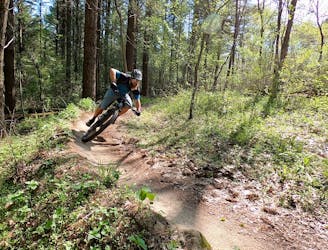
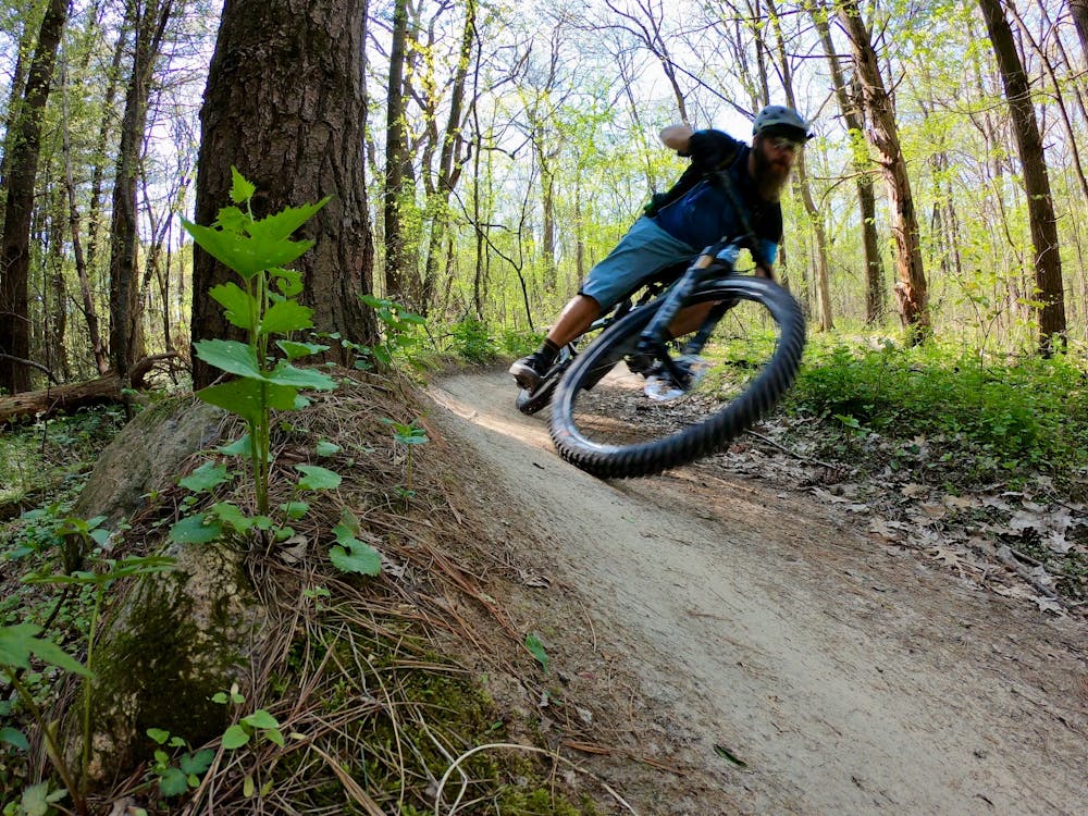
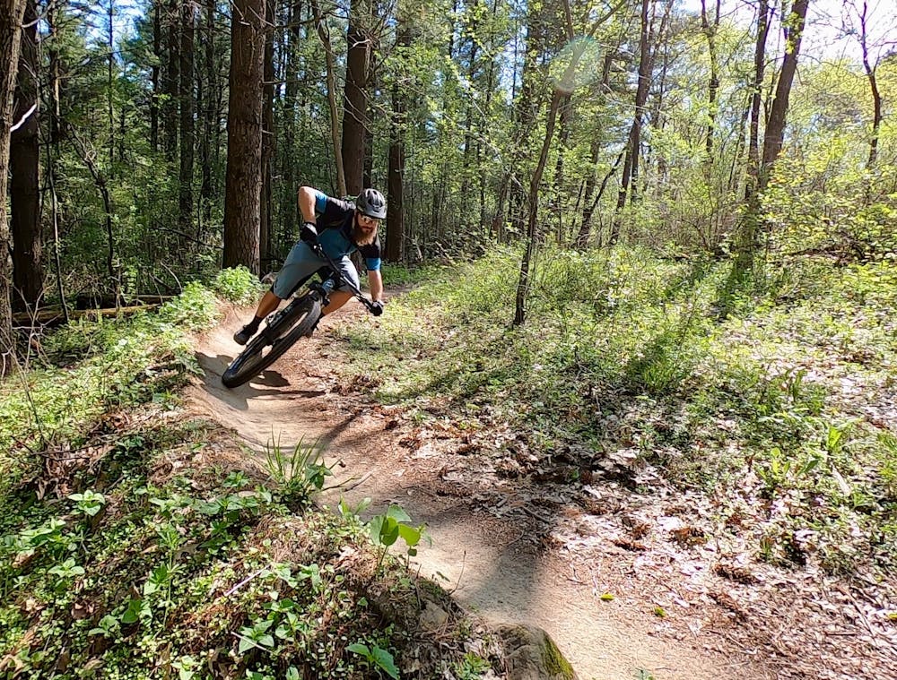
If you can only ride one half of this trail system, the John Muir trails are hands-down the best choice, with flowier and better-designed singletrack than what you’ll find at Emma Carlin.
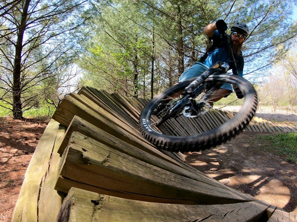
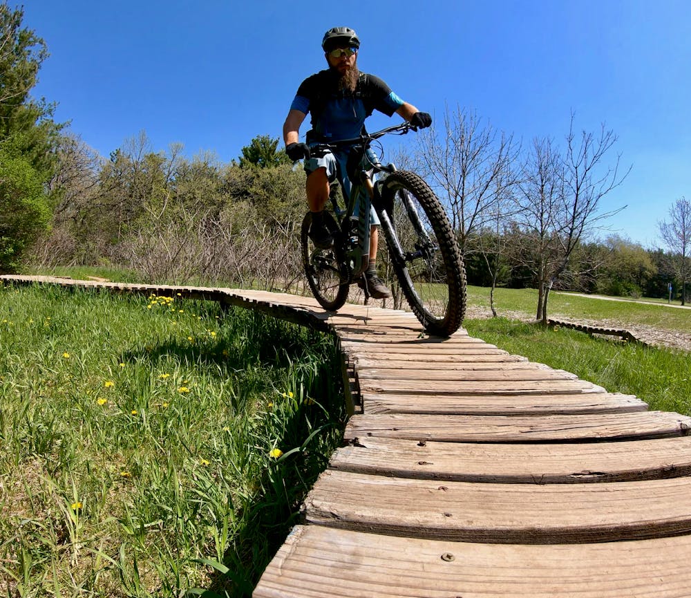
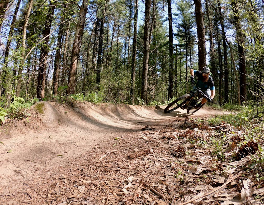
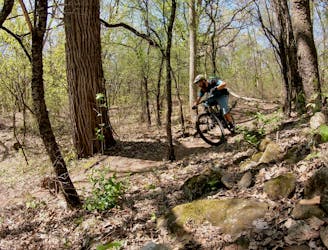
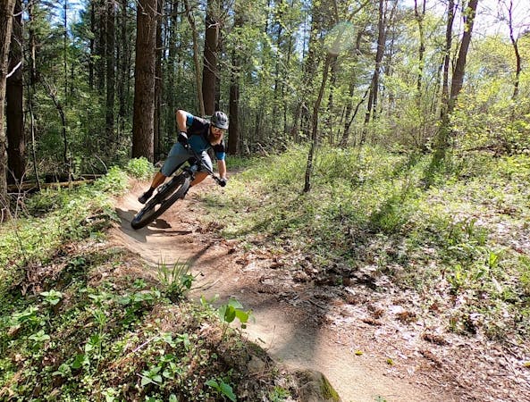
The trails at John Muir are bike-optimized to the max, despite having been built in relatively flat Southern Wisconsin terrain. The singletrack swoops and flows through the tight trees, and almost every downhill features small-but-entertaining berms to provide a playful ride experience. Deeper into the network, the trails get a little steeper and offer a bit more climbing to keep you honest. At the trailhead, you'll find an entertaining skills course with well-built wooden berms, skinnies, and jumps.
Moderate
Mostly stable trail tread with some variability, with unavoidable obstacles 8in/20cm tall or less. Other obstacles such as rock gullies and steep sections may exist. Ideal for lower intermediate riders.

The path is on completely flat land and potential injury is limited to falling over.

Away from help but easily accessed.
The premier trail system in the Southern Wisconsin / Northern Illinois region.
Moderate Mountain Biking
7.4 km away
Tight, twisty, steep Wisconsin singletrack.
Moderate Mountain Biking
3 routes · Mountain Biking