4.8 km away
Rock Lake Loop
A classic rocky loop in the Northwoods.
Difficult Mountain Biking
- Distance
- 19 km
- Ascent
- 290 m
- Descent
- 290 m
A flowier alternative to the Rock Lake Loop.
Mountain Biking Moderate

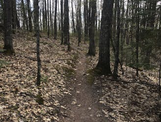
The Namakagon Loop offers a slightly easier alternative to the nearby Rock Lake trail. This singletrack loop is much less rocky and instead offers fast, flowy singletrack hidden deep beneath the canopy of the northwoods. Sections of wide-open singletrack beg you to get up on the pedals and hammer, but you need to be ready to lean into the impending corner to keep your speed up!
CAMBA has been reworking some of the corners on the Namakagon Trail to make them flow better and for the trail to be much more bike-friendly overall. Despite the trail work, you'll still be reminded that this is a mountain bike ride! Roots and rocks can be found throughout the trail, and while this is definitely a cross-country ride, be prepared to negotiate a few technical challenges.
For an even longer ride that incorporates the Namakagon Loop, be sure to check out the Rock Lake IMBA Epic.
Moderate
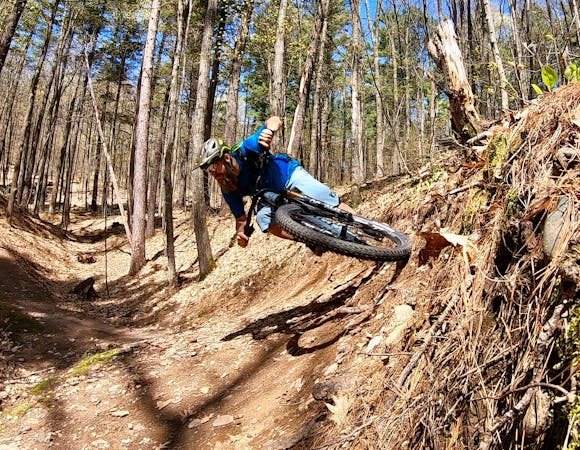
Mostly stable trail tread with some variability, with unavoidable obstacles 8in/20cm tall or less. Other obstacles such as rock gullies and steep sections may exist. Ideal for lower intermediate riders.

The trail contains some obstacles such as outcroppings and rock which could cause injury.
Away from help but easily accessed.
4.8 km away
A classic rocky loop in the Northwoods.
Difficult Mountain Biking
4.8 km away

Northern Wisconsin's classic IMBA Epic ride.
Difficult Mountain Biking
8 routes · Mountain Biking