
4 routes · Mountain Biking · Hiking · Trail Running
A ripping descent off the backside of Grand Targhee resort.
Mountain Biking Difficult

The Mill Creek Trail has become famous as one of the fastest and funnest enduro descents in the Wydaho region.
While most often done as a shuttle ride, there’s still a significant amount of climbing required to actually reach the top of Mill Creek. Most riders begin at the base of Grand Targhee ski resort and pedal up to the top of the resort via a combination of various singletrack trails. A popular route is mapped here: Andy’s -> Action Jackson -> Buffalo Soldier -> Peaked -> Colter’s Escape -> Mill Creek. Once on Colter’s Escape, the descending begins in earnest, flowing straight into the Mill Creek trail.
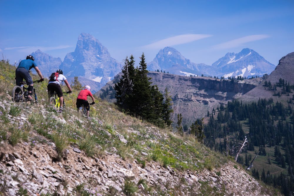
Don’t count out the climbing as boring riding, however! The singletrack at Grand Targhee is of superb quality and once on the Buffalo Soldier trail, expansive views of the Tetons greet you, providing the perfect place to stop for a photo, a snack, or maybe even a beer.
Once onto Colter’s Escape, the main descent begins, flowing down smooth singletrack through alpine meadows and whispering aspen trees.
Once into Mill Creek proper, the trail tread gets progressively rougher with roots, rocks, and the optional kicker or two. Mill Creek is an old school legacy trail, and the age shows with a deeper trail tread groove.
Still, this classic trail is a classic for a reason, as it sheds elevation quickly while screaming down a narrow one-track through a deep forested valley. Lower down, the trail gets curvier and curvier, with natural berms allowing riders to flow at top speed. Just be aware of oncoming traffic!
The descent is over all too quickly at the dirt road, with either an easy spin back to town or a shuttle vehicle to pick you up. The only thing left to do is to ride back up to the resort and begin again!
Difficult
Mostly stable trail tread with some variability featuring larger and more unavoidable obstacles that may include, but not be limited to: bigger stones, roots, steps, and narrow curves. Compared to lower intermediate, technical difficulty is more advanced and grades of slopes are steeper. Ideal for upper intermediate riders.

The trail contains some obstacles such as outcroppings and rock which could cause injury.
Away from help but easily accessed.
4 routes · Mountain Biking · Hiking · Trail Running