7.6 km away
AAA Chute

A highly technical optional route into A chute.
Severe Ski Touring
- Distance
- 537 m
- Ascent
- 0 m
- Descent
- 288 m
Classic Teton couloir with rappel entry and two chokes
Ski Touring Severe

Start at the end of Moose-Wilson Road (either north from Moose or south from Wilson works). Skin along the groomed road until reaching the Phelps Lake summer trail. (Should see a skin / XC ski track.)
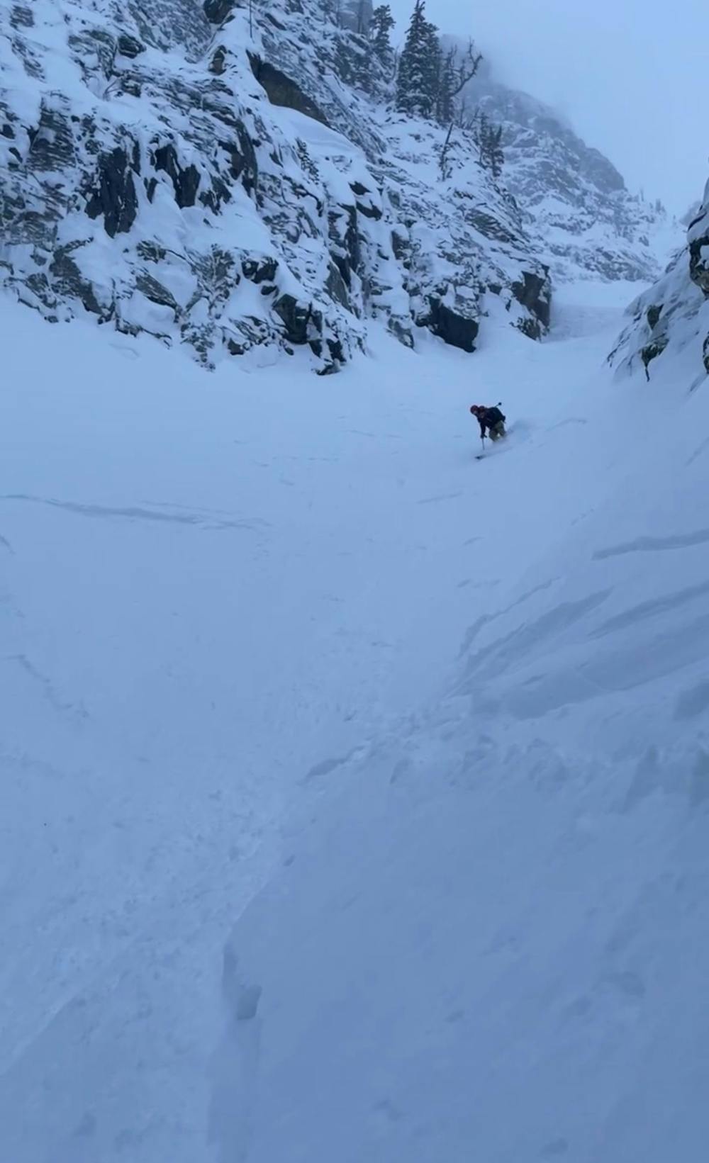
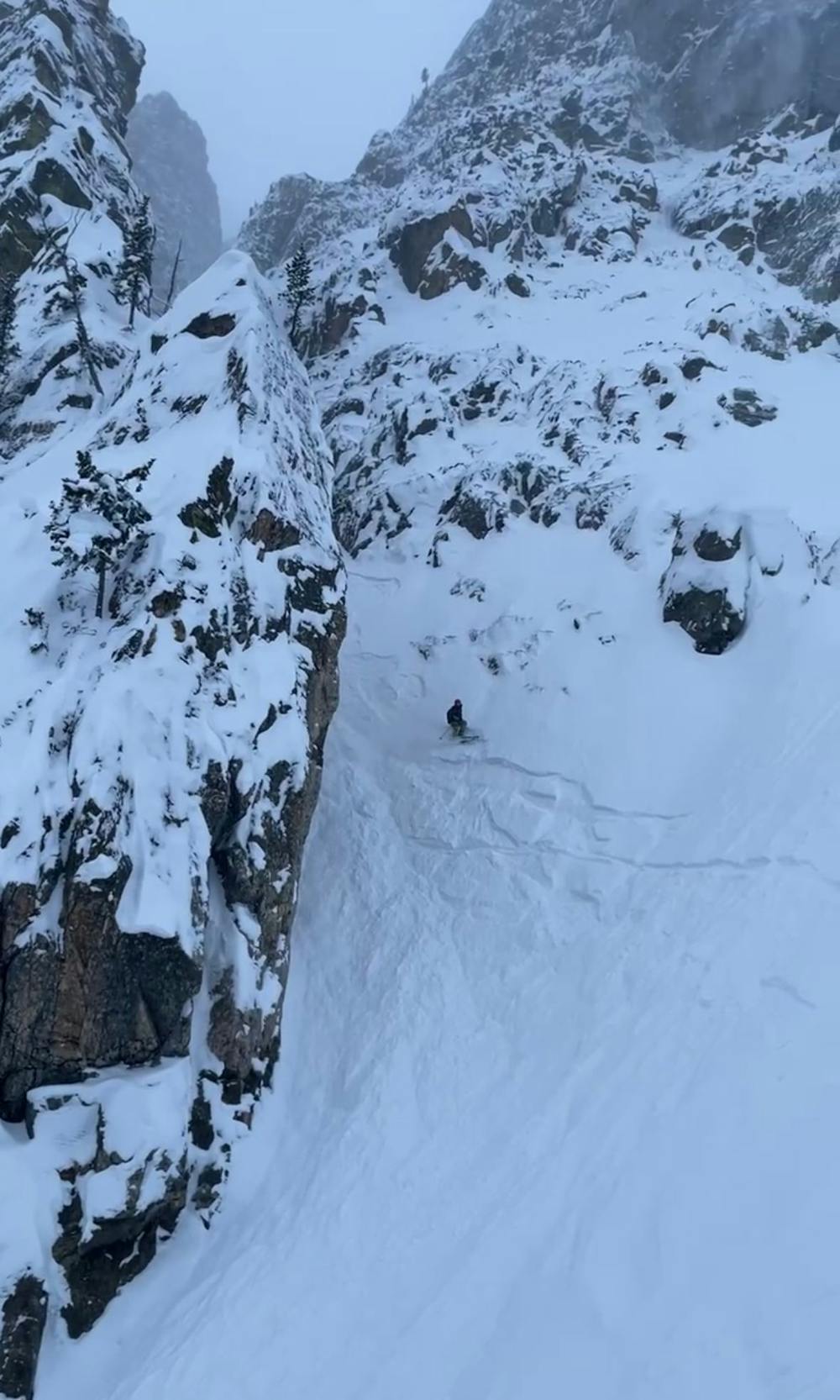
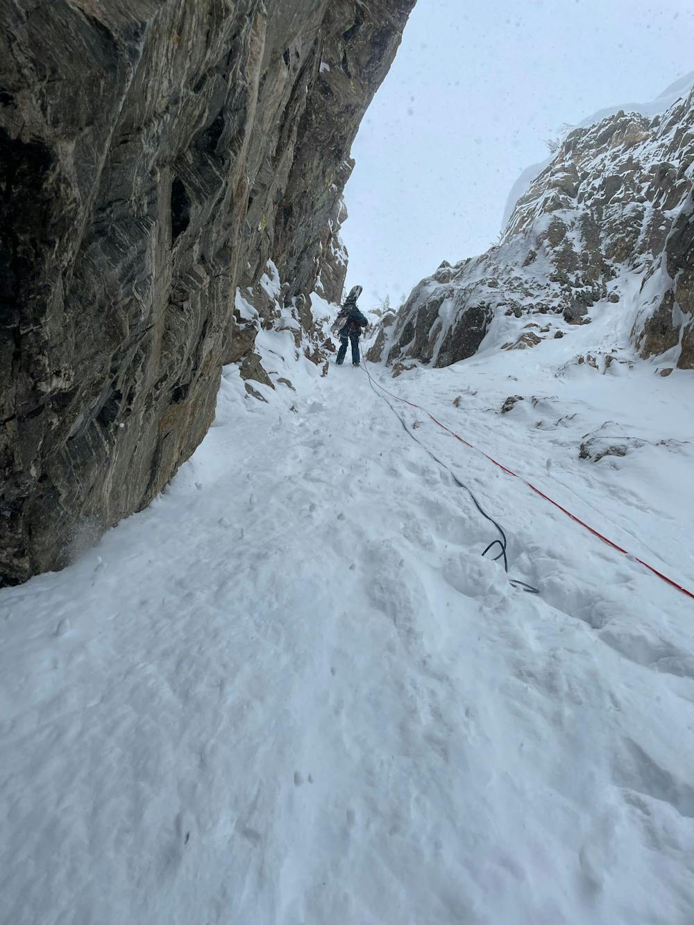
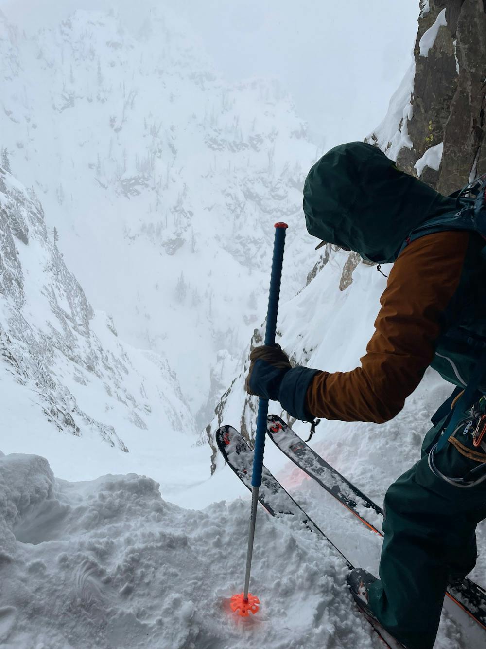
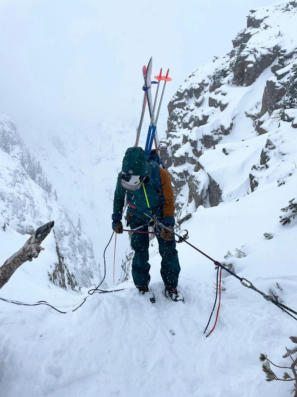
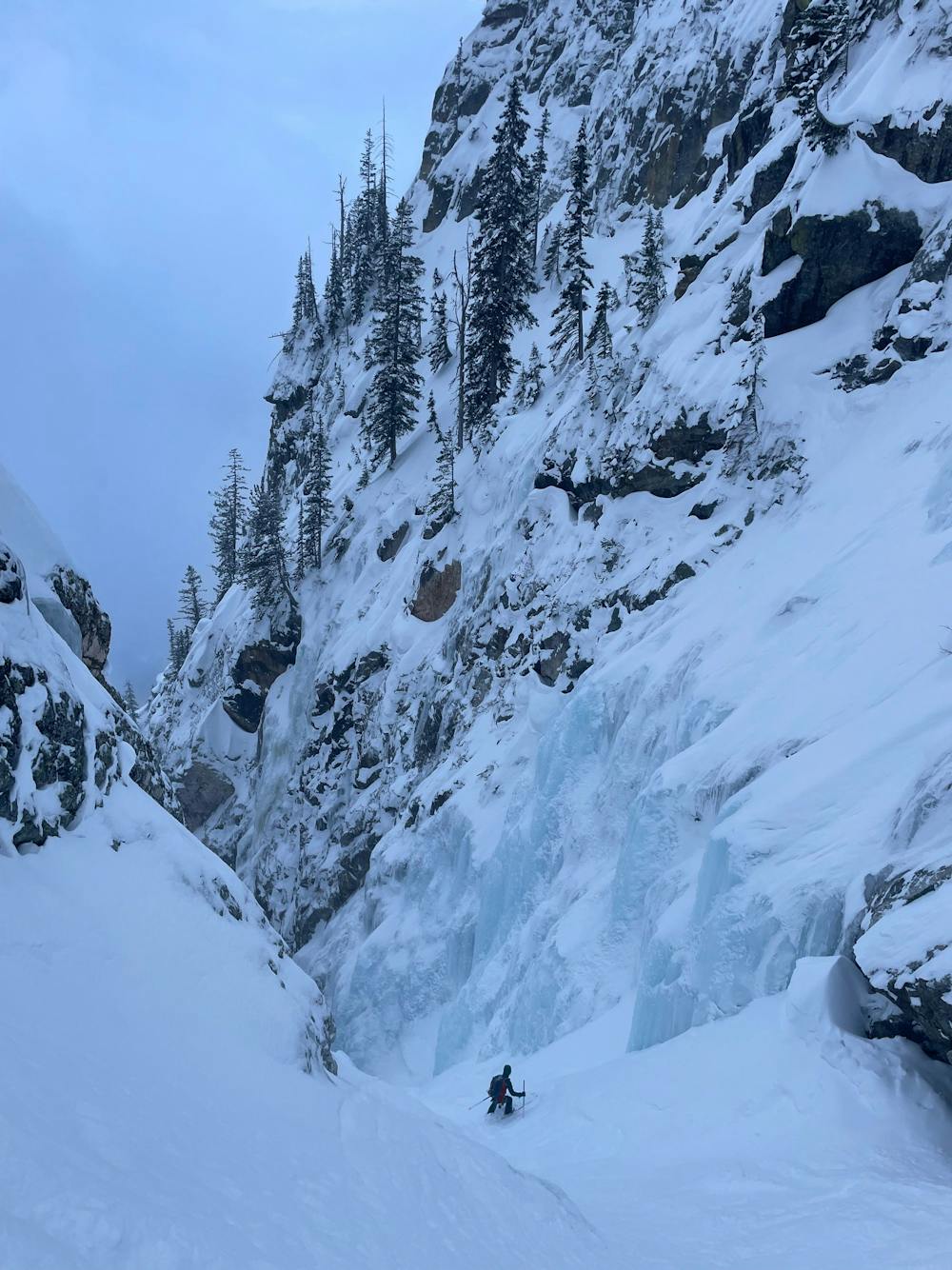
Cross the lake, then pick up a skin track up the east ridge of Prospectors. Drop in for Apocalypse is at ~10,150’. You’ll find a rappel anchor on a tree. Two rappels needed — we used two 60m ropes. Second rappel station is on a rock half-way to the “cave.”
Two chokes on the descent — one before the turn right, then second toward the bottom. Second choke might require a rappel (anchor on skiers right, or build a V-thread in the ice). We were able to side-slip during a good snow year.
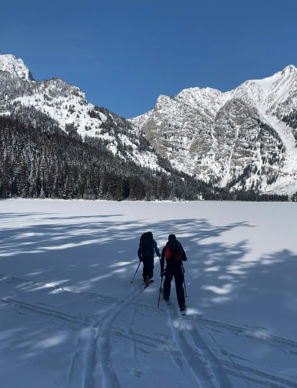
Ski along the Death Valley summer trail, then (1) skin up the ridge on the northwest border of Phelps if you started from Moose, or (2) ski / skate over Phelps Lake if you started in Wilson.
Full trip report: https://www.grizzliesandavalanches.com/apocalypse-couloir-ski-descent/
Severe
Steep skiing at 38-45 degrees. This requires very good technique and the risk of falling has serious consequences.

In case of a fall, death is highly likely.

Away from help but easily accessed.
7.6 km away
A highly technical optional route into A chute.
Severe Ski Touring
7.6 km away

A classic Granite Canyon Chute, steep and narrow.
Severe Ski Touring
7.6 km away

Hazardous and technical route finding, steep couloir skiing.
Severe Ski Touring
7.6 km away

A long, steep and sustained terrain trap
Difficult Ski Touring
10 routes · Ski Touring