23 m away
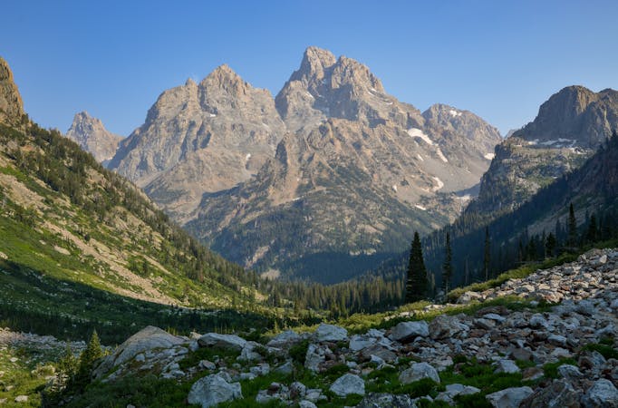
Granite Canyon via Rendezvous Mountain
An epic point-to-point from the top of Rendezvous Mountain, through Granite Canyon, and ending in Teton Village.
Difficult Trail Running
- Distance
- 19 km
- Ascent
- 239 m
- Descent
- 1.5 km
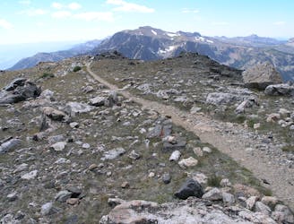
A trail connecting the Wildflower Trail to the summit of Rendezvous Mountain, a missing link if planning longer runs.
Trail Running Difficult

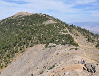
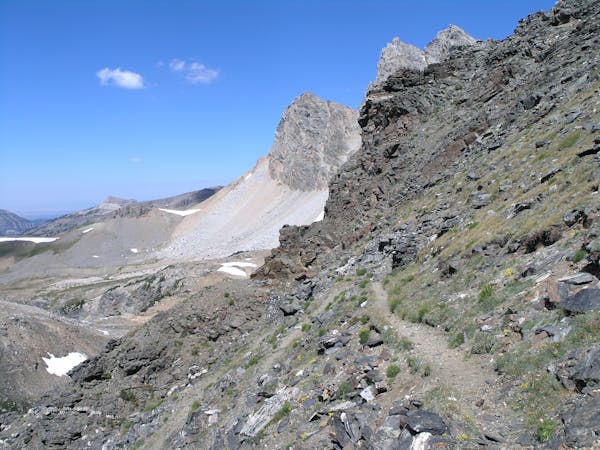
The Cirque Trail is the missing link between the Wildflower Trail and the Granite Canyon Tram Route. The trail connects the top of Bridger Gondola to the top of the Aerial Tram at the summit of Rendezvous Mountain and is runnable by itself, or great as a part of a larger loop.
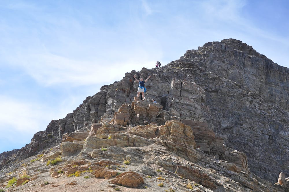
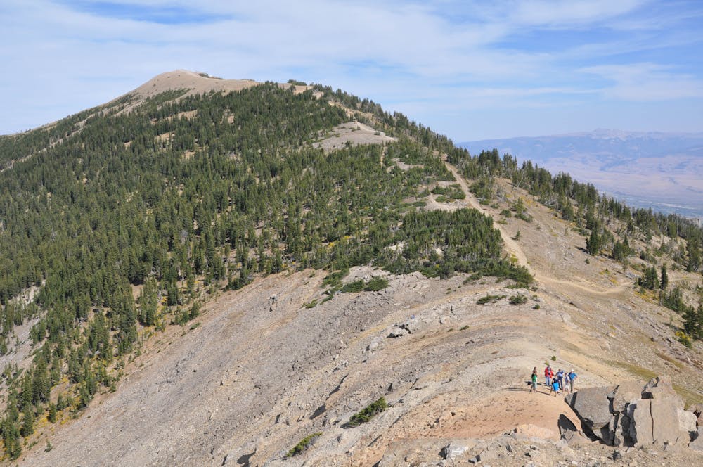
By itself, the trail is most often run from top to bottom, descending nearly 1,400 feet in two miles. Though it isn't particularly remote, it begins at the 10,450-foot summit of Rendezvous Mountain and ends at 9,100 feet—making it a challenging run nonetheless.
Paired with the Wildflower Trail, it provides a complete route from the bottom of Teton Village to Rendezvous Peak, the top and bottom of the Aerial Tram. For an ambitious trail runner, this could be used to complete a full loop with the Granite Canyon Tram Route.
Difficult

Some trail sections have exposed ledges or steep ascents/descents where falling could cause serious injury.

Away from help but easily accessed.
23 m away
An epic point-to-point from the top of Rendezvous Mountain, through Granite Canyon, and ending in Teton Village.
Difficult Trail Running
3.6 km away
A quick and easy trail run beginning at the base of Jackson Hole Mountain Resort.
Moderate Trail Running
3.6 km away

A crowd favorite connecting the base of Jackson Hole Mountain Resort to the top of Bridger Gondola.
Moderate Trail Running
8.5 km away
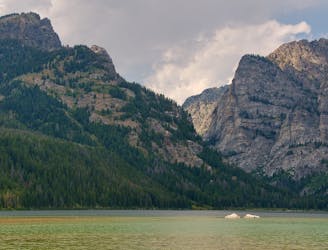
An easy lakeside trail run loaded with mountain views and wildlife.
Easy Trail Running
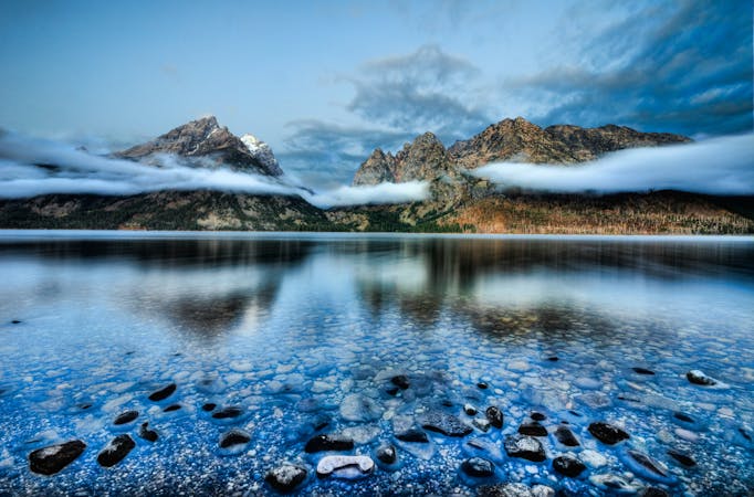
9.7 km away
An epic traverse through the heart of the Tetons, best run as a shuttle.
Difficult Trail Running
9.7 km away

A quick run or hike to a vista overlooking Phelps Lake.
Easy Trail Running
6 routes · Trail Running
4 routes · Trail Running
7 routes · Trail Running
20 routes · Trail Running