6 km away
Taylor Mountain Loop
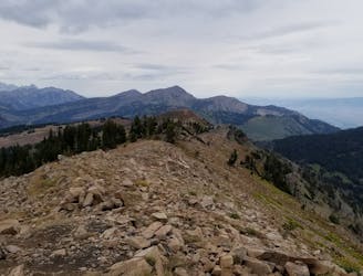
An incredibly steep run from Teton Pass to Taylor Mountain.
Severe Trail Running
- Distance
- 9.3 km
- Ascent
- 962 m
- Descent
- 962 m
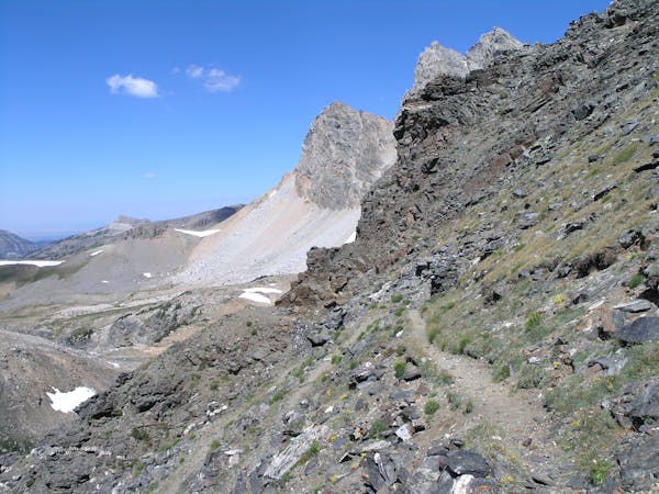
An easy trail run if you're short on time or looking for a change of pace.
Trail Running Moderate

Located along the Wyoming/Idaho border, the Rush Hour Trail is great if you're short on time, new to trail running, or simply looking for a change in pace from the array of backcountry offerings. According to long-time local Celeste Young, locals affectionately refer to the area as "Wydaho," and the Rush Hour Trail is a staple for anyone looking for a quick ride or run from town.
There are two trailheads for this out-and-back run, one along Old Jackson Highway and one at the state line. Most visitors park at the larger trailhead on the state line, home of the iconic "Welcome to Wyoming" sign. There is no defined parking at the other trailhead, but the Mike Harris Campground is located across the highway if you're looking for somewhere to spend the night.
During the summer months, the trail is lined with an array of vibrant wildflowers, with stands of aspen intermingling with lush meadows. In contrast to the backcountry runs in the region, the trail stays quite close to the state highway, and sightings of bear or elk are extremely unlikely.
Source: http://www.cyclingutah.com/women/wydaho-mountain-biking-teton-county/
Moderate

The trail contains some obstacles such as outcroppings and rock which could cause injury.

Close to help in case of emergency.
6 km away
An incredibly steep run from Teton Pass to Taylor Mountain.
Severe Trail Running
7 routes · Trail Running