6.3 km away
Mount Washburn Trail
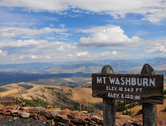
An 11.7km out-and-back trail with spectacular views throughout, fit for intermediate runners.
Moderate Trail Running
- Distance
- 11 km
- Ascent
- 420 m
- Descent
- 420 m
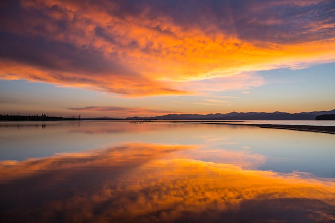
A superb out-and-back that takes you to some of the greatest elements of Yellowstone National Park.
Trail Running Difficult

A superb out-and-back that takes you to some of the greatest elements of Yellowstone National Park. The challenge comes as you plunge an epic 1,400 feet through the Grand Canyon to the banks of the Yellowstone River, and all the way back up again! It’s a 10.2 mile round trip to Seven Mile Hole, with an additional 3-mile side trip to Washburn Hot Springs.
Directions: The trail is very varied- starting along the rim of the Grand Canyon of the Yellowstone River, it then passes through pine forests and picturesque meadows, before steeply descending down through the canyon, past a bubbling geothermal area, all the way to the river’s edge. Find the parking lot for the Seven Mile Hole Trail at the Inspiration Point overlook of the Grand Canyon. Walk a short way back up the access road to Glacier Boulder, a 500-ton granite rock left behind around 15,000 years ago as the Pinedale Glaciation retreated. You’ll spot the trailhead right next to Glacier Boulder. Follow the path through the pine forest, and to the edge of the north rim of the Grand Canyon of Yellowstone for 1.5 miles. Dip off onto a short side trail to a viewpoint of the magnificent 1,000 feet high Silver Cord Cascade. The trail then pulls away from the canyon and into the forest, eventually you’ll come to a fork, left takes you back to the highway via Washburn Spur Trail. Right is the route you need, taking you through the woods for another ½ mile until it begins a plunging descent passed active and inactive hydrothermal features, all the way down to the river at the bottom of the canyon. It is called “Seven" Mile Hole because it lies 7 miles down river from Lower Falls. Now it’s time to turn back- retrace your steps back to Glacial Boulder, which begins with a very strenuous climb out of the canyon. You have the option on the way back to veer off on a small detour to Washburn Hot Springs, by turning right at the junction for Washburn Spur Trail and going along 1.5 miles. The hot springs are a collection of highly acidic mud pots, named after the 1870 Washburn Expedition who in turn named the area "Hell-Broth Springs," because it was such an "infernal looking smelling and sounding place." You can climb the hill behind the two big mud pots to get a good look at the rest of the basin. Take care with your footing, as acidic thermal areas are highly dangerous! Turn back the way you came and rejoin the trail all the way to Glacial Boulder.
Difficult

Away from help but easily accessed.
6.3 km away
An 11.7km out-and-back trail with spectacular views throughout, fit for intermediate runners.
Moderate Trail Running
5 routes · Hiking · Trail Running
5 routes · Hiking · Trail Running