Stubaier Höhenweg Noord (4d)

4 day route on the north site of the Stubaier Höhenweg
Moderate Hiking
- Distance
- 49 km
- Ascent
- 4.4 km
- Descent
- 3.5 km

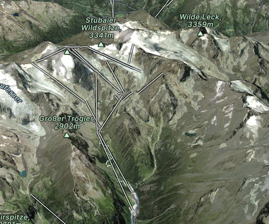
Explore Stubaier Gletscher with curated guides of the best ski routes, and more. With over 29 3D trail maps in FATMAP, you can easily discover and navigate the best trails in Stubaier Gletscher.
No matter what your next adventure has in store, you can find a guide on FATMAP to help you plan your next epic trip.
Get a top trail recommendation in Stubaier Gletscher from one of our 6 guidebooks, or get inspired by the 29 local adventures uploaded by the FATMAP community. Start exploring now!
4 day route on the north site of the Stubaier Höhenweg
Moderate Hiking

Erster Tag der Skiroute "Hoch Stubai"
Moderate Ski Touring

Another true classic. And stage two of a X-Tirol.
Difficult Freeride Skiing

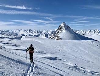
Quick tour up to a 3000m peak
Difficult Ski Touring

Classic and easy Stubaital summit
Moderate Ski Touring

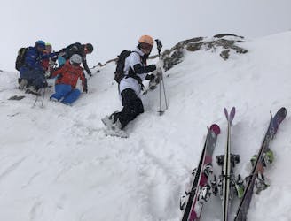
Experts only. Check it out from below, you need stable conditions.
Severe Freeride Skiing

Experts only. Check it out from below, you need stable conditions.
Severe Freeride Skiing

This one is amazing. And serious. Experts only.
Severe Freeride Skiing

This one is amazing. And serious. Experts only.
Severe Freeride Skiing

Adventourus and pretty long for a whole day tour but for sure doable
Difficult Ski Touring
A classic glacier skimo without using any lifts
Severe Ski Touring
Start from a little cliff near lift chair,maybe need climb down 5m,than you get 3KM open valley,enjoy the free ride!Take the right side you will back to piste.
Moderate Freeride Skiing

Zuckerhütl Northface Skitour
Severe Ski Touring