3 routes

Aisén del General Carlos Ibáñez del Campo
Explore Aisén del General Carlos Ibáñez del Campo with curated guides of the best routes. With over 4 3D trail maps in FATMAP, you can easily discover and navigate the best trails in Aisén del General Carlos Ibáñez del Campo.
No matter what your next adventure has in store, you can find a guide on FATMAP to help you plan your next epic trip.
Get a top trail recommendation in Aisén del General Carlos Ibáñez del Campo, or get inspired by the 4 local adventures uploaded by the FATMAP community. Start exploring now!
Destinations in Aisén del General Carlos Ibáñez del Campo
Routes in Aisén del General Carlos Ibáñez del Campo
El Diablo

Easy ski line,goup for the ridge
Easy Freeride Skiing
- Distance
- 3.4 km
- Ascent
- 5 m
- Descent
- 834 m
El Diablo

Easy Line for ski, for go up take the Ridge
Easy Freeride Skiing
- Distance
- 3.4 km
- Ascent
- 5 m
- Descent
- 834 m
Trekking Las Horquetas | 4 dias
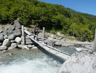
El trekking mas largo y variado del parque nacional cerro castillo.
Moderate Hiking
- Distance
- 51 km
- Ascent
- 2.4 km
- Descent
- 2.9 km
Ski Descent - Normal Rute - Cerro Castillo

Pleasant descent of the couloir of the normal route of Cerro Castillo, maximum inclination 45 degrees.
Difficult Ski Touring
- Distance
- 9.1 km
- Ascent
- 1.4 km
- Descent
- 1.4 km