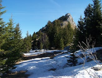
Le Semnoz depuis les Puisots

Une randonnée plaisante à travers la magnifique forêt qui s'étend le long des pentes du Semnoz, une montagne qui surplombe la rive ouest du Lac d'Annecy.
Moderate Hiking
- Distance
- 8.8 km
- Ascent
- 344 m
- Descent
- 344 m

Go hiking in Bauget Alps with curated guides of the best hikes across the region. With over 37 3D trail maps in FATMAP, you can easily discover and navigate the best trails in Bauget Alps.
No matter what your next adventure has in store, you can find a guide on FATMAP to help you plan your next epic trip.
Get a top hiking trail recommendation in Bauget Alps from one of our 5 guidebooks, or get inspired by the 37 local adventures uploaded by the FATMAP community. Start exploring now!
Une randonnée plaisante à travers la magnifique forêt qui s'étend le long des pentes du Semnoz, une montagne qui surplombe la rive ouest du Lac d'Annecy.
Moderate Hiking

Route to go up and make a paraglide fly
Severe Hiking
Une manière originale et alpine de traverser ce sommet.
Severe Hiking
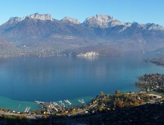
Here you can find the fantastic views, specially view on top La Tournette and behind the massif of Mont Blanc and the chain of the Aravis.
Moderate Hiking