Omalo - Shatili hiking
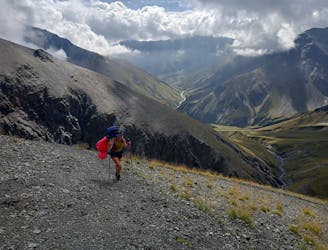
Remote trekking via old villages with medieval defensive towers and among shepherds on horseback
Difficult Hiking
- Distance
- 75 km
- Ascent
- 3.2 km
- Descent
- 3.8 km

Go hiking in Mtskheta-Mtianeti with curated guides of the best hikes across the region. With over 35 3D trail maps in FATMAP, you can easily discover and navigate the best trails in Mtskheta-Mtianeti.
No matter what your next adventure has in store, you can find a guide on FATMAP to help you plan your next epic trip.
Get a top hiking trail recommendation in Mtskheta-Mtianeti from one of our 2 guidebooks, or get inspired by the 35 local adventures uploaded by the FATMAP community. Start exploring now!
Remote trekking via old villages with medieval defensive towers and among shepherds on horseback
Difficult Hiking

Advanced Hike from Gudauri to Sno Valley
Severe Hiking