S-Charl to Padoellhof
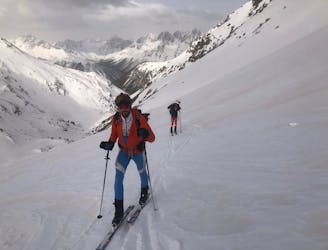
A 2 country day linking through the Reschenpass, one of the lowest cols on the main Alpine chain
Moderate Ski Touring
- Distance
- 34 km
- Ascent
- 2.1 km
- Descent
- 2.2 km
_Winter.png?auto=compress%2Cformat)
Go Ski Touring in Belpiano (Schöneben) with curated guides of the best routes across the region. With over 6 3D trail maps in FATMAP, you can easily discover and navigate the best routes in Belpiano (Schöneben).
No matter what your next adventure has in store, you can find a guide on FATMAP to help you plan your next epic trip.
Get a top Ski Touring recommendation in Belpiano (Schöneben), or get inspired by the 6 local adventures uploaded by the FATMAP community. Start exploring now!
_Winter.png?w=600&h=450&auto=compress%2Cformat)
A 2 country day linking through the Reschenpass, one of the lowest cols on the main Alpine chain
Moderate Ski Touring