Vallerotana and Rusellæ
❇️Water Memory 1 - Emily A. Sprague
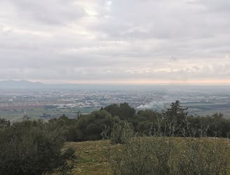
Extreme Hiking
- Distance
- 28 km
- Ascent
- 731 m
- Descent
- 732 m

Go hiking in Grosseto with curated guides of the best hikes across the region. With over 5 3D trail maps in FATMAP, you can easily discover and navigate the best trails in Grosseto.
No matter what your next adventure has in store, you can find a guide on FATMAP to help you plan your next epic trip.
Get a top hiking trail recommendation in Grosseto, or get inspired by the 5 local adventures uploaded by the FATMAP community. Start exploring now!
❇️Water Memory 1 - Emily A. Sprague
Extreme Hiking

Ottimo anche per i principianti
Moderate Hiking

L’Anello dell’Amiata, come dice il nome, è un classico itinerario da trekking nonché ciclabile nella maggior parte del percorso, che descrive un cerchio tutto intorno al Monte Amiata, fra quote comprese tra i 950 mt. e i 1300 mt. di altitudine.
Moderate Hiking