Pozza di Fassa - Panorama Ring on the crests
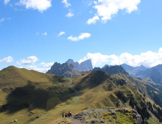
Ring: Pozza di Fassa - Buffaure - Sas D'adam - Su l'Aut - Col Bel - Pozza di Fassa
Difficult Hiking
- Distance
- 23 km
- Ascent
- 1.1 km
- Descent
- 2.2 km

Go hiking in Pozza di Fassa-Aloch-Buffaure with curated guides of the best hikes across the region. With over 4 3D trail maps in FATMAP, you can easily discover and navigate the best trails in Pozza di Fassa-Aloch-Buffaure.
No matter what your next adventure has in store, you can find a guide on FATMAP to help you plan your next epic trip.
Get a top hiking trail recommendation in Pozza di Fassa-Aloch-Buffaure, or get inspired by the 4 local adventures uploaded by the FATMAP community. Start exploring now!
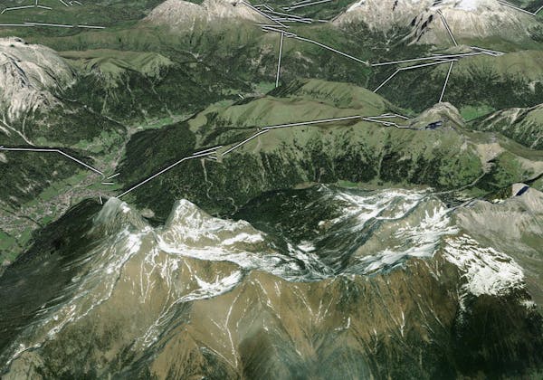
Ring: Pozza di Fassa - Buffaure - Sas D'adam - Su l'Aut - Col Bel - Pozza di Fassa
Difficult Hiking

Trekking in quota di 4 giorni, da rifugio a rifugio.
Difficult Hiking