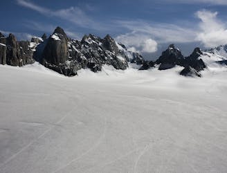
163 routes · Ski Touring · Freeride Skiing · Hiking · Alpine Climbing
Freeride Skiing in Vercelli
Go Freeride in Vercelli with curated guides of the best routes across the region. With over 148 3D trail maps in FATMAP, you can easily discover and navigate the best routes in Vercelli.
No matter what your next adventure has in store, you can find a guide on FATMAP to help you plan your next epic trip.
Get a top Freeride recommendation in Vercelli from one of our 6 guidebooks, or get inspired by the 148 local adventures uploaded by the FATMAP community. Start exploring now!
Freeride Skiing Destinations in Vercelli
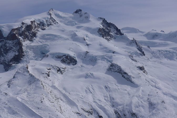
108 routes · Ski Touring · Freeride Skiing · Alpine Climbing
Gressoney La Trinité
33 routes · Freeride Skiing · Hiking · Ski Touring
Alagna
Freeride Skiing Routes in Vercelli
Couloir Endre Sup.
![Couloir Endre Sup.](https://fatmap-adventure-screenshots.imgix.net/routes/22918-blank.png?w=328&h=250&auto=compress%2Cformat)
The steepest of the three Endre couloirs.
Extreme Freeride Skiing
- Distance
- 602 m
- Ascent
- 0 m
- Descent
- 325 m
Olen to Gressoney
![Olen to Gressoney](https://fatmap-adventure-screenshots.imgix.net/routes/22299-blank.png?w=328&h=250&auto=compress%2Cformat)
A nice slope and never too steep often in good powder!
Moderate Freeride Skiing
- Distance
- 773 m
- Ascent
- 24 m
- Descent
- 181 m
Stolemberg to Gressoney
![Stolemberg to Gressoney](https://fatmap-adventure-screenshots.imgix.net/routes/22192-blank.png?w=328&h=250&auto=compress%2Cformat)
A well known classic
Severe Freeride Skiing
- Distance
- 359 m
- Ascent
- 21 m
- Descent
- 220 m
Spallone
![Spallone](https://fatmap-adventure-screenshots.imgix.net/routes/22170-blank.png?w=328&h=250&auto=compress%2Cformat)
Never too crowded, this is a nice line to be on your own
Difficult Freeride Skiing
- Distance
- 1.2 km
- Ascent
- 3 m
- Descent
- 402 m
Pisse Couloir
![Pisse Couloir](https://fatmap-adventure-screenshots.imgix.net/routes/21119-blank.png?w=328&h=250&auto=compress%2Cformat)
Rarely skied
Severe Freeride Skiing
- Distance
- 746 m
- Ascent
- 0 m
- Descent
- 346 m
Diretta Indren
![Diretta Indren](https://fatmap-adventure-screenshots.imgix.net/routes/20767-blank.png?w=328&h=250&auto=compress%2Cformat)
A short icy gully gives way to wide friendly slopes.
Difficult Freeride Skiing
- Distance
- 2.9 km
- Ascent
- 13 m
- Descent
- 729 m
Couloir Rettilineo
![Couloir Rettilineo](https://fatmap-adventure-screenshots.imgix.net/routes/20756-blank.png?w=328&h=250&auto=compress%2Cformat)
This couloir is the easiest access to the Balma valley but still requires steep skiing.
Severe Freeride Skiing
- Distance
- 382 m
- Ascent
- 0 m
- Descent
- 196 m
La Malfatta
![La Malfatta](https://fatmap-adventure-screenshots.imgix.net/routes/20360-blank.png?w=328&h=250&auto=compress%2Cformat)
The Malfatta is the most beautiful itinerary of the Monte Rosa area. Technical access with a rope and serious ambience make this tour very popular amongst freeriders.
Severe Freeride Skiing
- Distance
- 4.3 km
- Ascent
- 8 m
- Descent
- 1.4 km
Freeride Skiing Guidebooks in Vercelli
12 routes · Freeride Skiing