671 m away
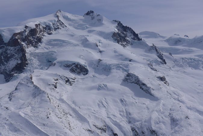
Vallone d'Olen

The Olen valley is not so far from the piste and is perfect terrain for novice freerider
Moderate Freeride Skiing
- Distance
- 3.1 km
- Ascent
- 2 m
- Descent
- 842 m
A nice slope and never too steep often in good powder!
Freeride Skiing Moderate

This is a popular freeride skiing route which is generally considered to be moderate. It's remote, it features low exposure (e1) and is typically done between December and March. From a low point of 2.7 km to the maximum altitude of 2.9 km, the route covers 773 m, 24 vertical metres of ascent and 181 vertical metres of descent. It's graded 1.2 and Labande grade 2. You'll need skins to complete it safely.
This run starts at the old Guglielmina refuge, now destroyed. You have to walk up towards a big col for about 15 minutes. You fatigue will be well rewarded since you will shred nice powder in a big bowl. Multiple lines are possible since the slope is very wide here.
Moderate
Slopes become slightly steeper at around 25-30 degrees.

Exposure is limited to that of the slope itself. Getting hurt is still likely if the slope is steep and/or the snow is hard.

Away from help but easily accessed.
671 m away
The Olen valley is not so far from the piste and is perfect terrain for novice freerider
Moderate Freeride Skiing
739 m away

Easy off-piste near the slopes, very popular.
Moderate Freeride Skiing
744 m away

Steep narrow couloir followed by wide open slope.
Extreme Freeride Skiing
744 m away

The lowest of the three Endre couloirs: steep and exposed.
Extreme Freeride Skiing
775 m away

The widest couloir of the Balma valley and one of the most beautiful.
Difficult Freeride Skiing
845 m away

Steep skiing in a wild mountain environment with a narrow couloir for expert skiers only.
Extreme Freeride Skiing
846 m away

This couloir is the easiest access to the Balma valley but still requires steep skiing.
Severe Freeride Skiing
846 m away

A steep couloir from Salati
Severe Freeride Skiing
854 m away

The steepest of the three Endre couloirs.
Extreme Freeride Skiing
1 km away

A well known classic
Severe Freeride Skiing
12 routes · Freeride Skiing