0 m away
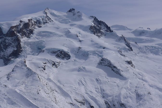
Couloir Endre Central

Steep narrow couloir followed by wide open slope.
Extreme Freeride Skiing
- Distance
- 787 m
- Ascent
- 0 m
- Descent
- 289 m
The lowest of the three Endre couloirs: steep and exposed.
Freeride Skiing Extreme

Of the three Endre couloirs, this one has the most difficult entrance to find. Before you enter the central couloir, descend along the cliff until you reach another rocky head, looking downhill, turn around it from left to right, descending for another 50m. The traverse to enter in the couloir is really exposed. Once inside the couloir there is a steep section and then you are almost immediately on the big slope of the Stolemberg. From here ski down along the Diretta Indren itinerary to the middle station, Gabiet.
Extreme
Extreme skiing terrain above 45 degrees. These routes are reserved for experienced experts.

In case of a fall, death is highly likely.
Little chance of being seen or helped in case of an accident.
0 m away
Steep narrow couloir followed by wide open slope.
Extreme Freeride Skiing
7 m away

Easy off-piste near the slopes, very popular.
Moderate Freeride Skiing
116 m away

The steepest of the three Endre couloirs.
Extreme Freeride Skiing
202 m away

The Olen valley is not so far from the piste and is perfect terrain for novice freerider
Moderate Freeride Skiing
220 m away

The widest couloir of the Balma valley and one of the most beautiful.
Difficult Freeride Skiing
361 m away

A well known classic
Severe Freeride Skiing
375 m away

This couloir is the easiest access to the Balma valley but still requires steep skiing.
Severe Freeride Skiing
375 m away

A steep couloir from Salati
Severe Freeride Skiing
486 m away

Steep skiing in a wild mountain environment with a narrow couloir for expert skiers only.
Extreme Freeride Skiing
744 m away

A nice slope and never too steep often in good powder!
Moderate Freeride Skiing
12 routes · Freeride Skiing