7.1 km away
Niederer Rumpler
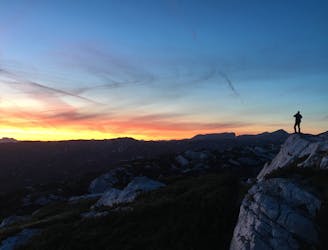
Hike to an exposed point above the Gjald Alm Hut.
Severe Hiking
- Distance
- 4.3 km
- Ascent
- 283 m
- Descent
- 283 m
Guided route: Adamekhütte - Snow hole - Hoßwandscharte - High trough - Simonyhütteh
Hiking Extreme

The hiking trail has a highly apline transition through an impressive karst landscape on a narrow rocky climb. Good physical condition, sure-footedness and stable fair weather are important prerequisites for this tour. In early summer there are still some extensive hard frozen snow fields here, which have to be crossed. from the Adamekhütte to the SimonyhütteFrom the Adamekhütte it goes downhill on the hut ascent in the direction of Gosausee to the signpost at Hohe Riedel, 2035 m. Here it goes right on trail number 650 under the walls of the Schreiberwandeck towards the north until you come to another signpost. On the left the path leads towards Bärwurzkogel and Radltal. But our path leads through the huge karst of the snow hole, crossed by boulders, to the Hoßwandscharte, where on the right you can see the remains of the once still impressive snow hole glacier. 2187 m from the Hoßwandscharte, a short rocky descent to the north follows, then the northern flank of the Hoßkogel has to be crossed with difficulty. Afterwards the route climbs up again via rock steps (wire ropes) into the wide saddle at the Hohe Trog (fork in the path to the Niederen Kreuz). From the saddle the route descends over cart fields and often also over snow fields (special care with hard snow) into the wide Wildkar. Finally you reach the long visible Simonyhütte. https://www.dachstein-panorama.at/?s=pano68545&utmsource=tourdata&utmmedium=textlink&utmcampaign=tourdata360tour" https://www.dachstein-panorama.at/?s=pano68545&utmsource=tourdata&utmmedium=textlink&utmcampaign=tourdata360tour "To the 360° Panorama Tour through the Gosau Valley ...

Extreme
Scrambling up mountains and along technical trails with moderate fall exposure. Handholds are necessary to navigate the trail in its entirety, although they are not necessary at all times. Some obstacles can be very large and difficult to navigate, and the grades can often be near-vertical. The challenge of the trail and the steepness of the grade results in very strenuous hiking. Hikes of this difficulty blur the lines between "hiking" and "climbing".
7.1 km away
Hike to an exposed point above the Gjald Alm Hut.
Severe Hiking