2 m away
Niederer Rumpler

Hike to an exposed point above the Gjald Alm Hut.
Severe Hiking
- Distance
- 4.3 km
- Ascent
- 283 m
- Descent
- 283 m
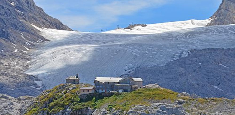
A more demanding hike to Wiesberghaus via Simonyhütte
Hiking Moderate

The shortest hiking route to the Simonyhütte is the Trägerweg. From the cable car valley station Gjaid (section III) walk in the direction of Gjaidalm, turn left to Kaserne Oberfeld, from Kaserne Oberfeld on trail no. 615, turn left at the signpost on trail no. 657 and continue to Simonyhütte (walking time approx. 3 hours).
Moderate
Hiking along trails with some uneven terrain and small hills. Small rocks and roots may be present.
2 m away
Hike to an exposed point above the Gjald Alm Hut.
Severe Hiking