1.8 km away
Niederer Rumpler
Hike to an exposed point above the Gjald Alm Hut.
Severe Hiking
- Distance
- 4.3 km
- Ascent
- 283 m
- Descent
- 283 m
*The broad karst trail leads through a true moon landscape.
Hiking Moderate

The paths over the Margschierf Ridge and to the Hirzkar lakes are narrow and lead over jagged rocks - in any case only in safe weather!
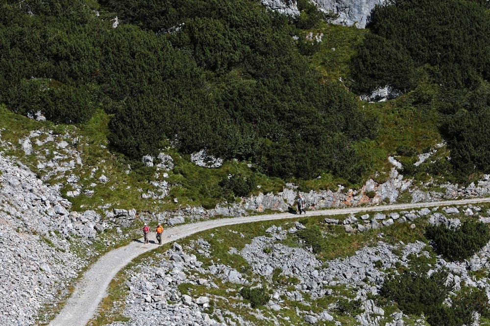
In the east of the Hohe Dachstein the 280 km² large, jagged and impassable karst plateau "Auf dem Stein" spreads out. In the middle is a lonely cross commemorating the catastrophe of 1954: ten pupils and three teachers from Heilbronn in Württemberg were killed in a snowstorm. Today a broadly extended nature trail on the subject of "karst" leads from the Krippenstein - between rock bosses with strange fossils, razor-sharp carts and mysterious "karst tables", where the dissolution of limestone by rainwater can be seen particularly clearly.
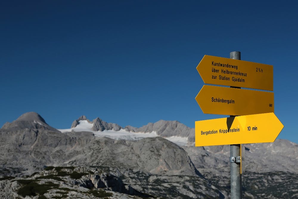
From the mountain station we first visit the Pionierkreuz under the Krippenstein summit - the view to the Hallstätter See is breathtaking 1500 m deep! Back again, then we hike to the Krippenstein Lodge and over the ski slope down into the valley with the lift station. From there, the Karst nature trail leads to the Krippenstein ice cellar (cave) and to the point where it turns left, while two paths branch off on the right. We choose the straight path no. 661, which climbs over the rocky Margschierf ridge (view to the Dachstein). Descent to the Heilbronner Kreuz, visible from afar. Shortly before we reach the wide karst nature trail again, which we now follow to the right. It leads past a hut and then steeply down into a hollow. Past the junction of path no. 666 at Loskoppen. We continue downhill between mountain pines and rocks. After the turn-off of the path to the three tiny Hirzkarseelein (worthwhile detour), a short ascent follows, then we hike in serpentines down to the dilapidated Hirzkaralm. Under the walls of the Niederen Gjaidstein to the cable car station at the Krippeneck (a short detour to the Schilcherhaus on the Gjaidalm is worthwhile).
Shorter alternative: From Margschierf back into the valley at Krippenstein-Eiskeller, there left on trail no. 662 to Hirzkarseelein and down to the Karst nature trail.
Rest stops: Krippenstein Lodge, Gjaid Alm.
Order hiking maps to the Dachstein Salzkammergut region ...
( http://dachstein.salzkammergut.at/kartenbestellung.html ) To the 360° Panorama Tour through Obertraun ... ( https://www.dachstein-panorama.at/?s=pano68570&utmsource=tourdata&utmmedium=textlink&utmcampaign=tourdata360tour )
Mountain rescue: 140
equipment
Moderate
Hiking along trails with some uneven terrain and small hills. Small rocks and roots may be present.
1.8 km away
Hike to an exposed point above the Gjald Alm Hut.
Severe Hiking