441 m away
Niederer Rumpler
Hike to an exposed point above the Gjald Alm Hut.
Severe Hiking
- Distance
- 4.3 km
- Ascent
- 283 m
- Descent
- 283 m
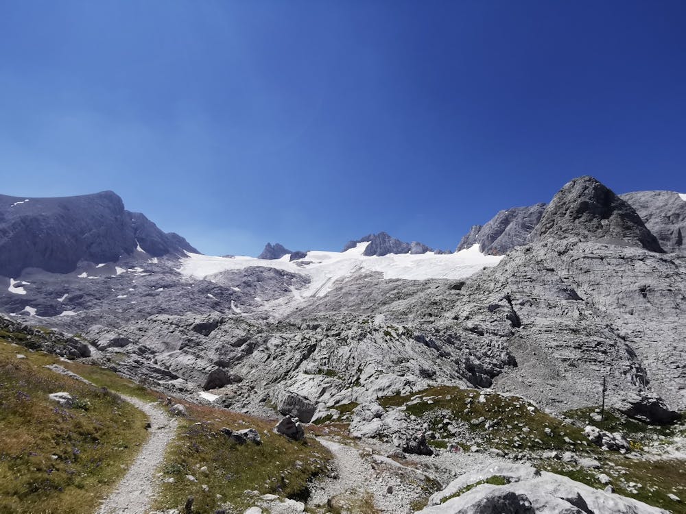
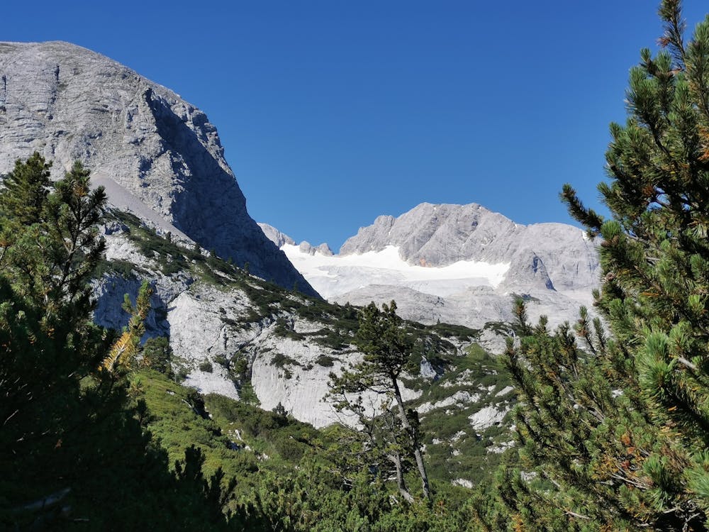
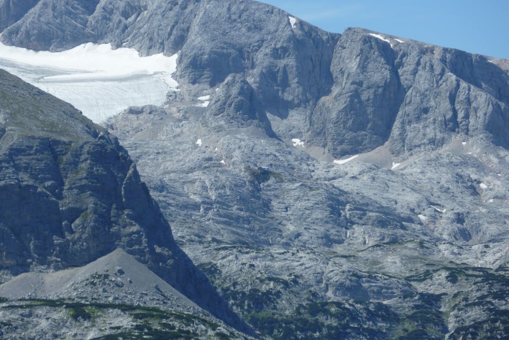
High alpine and scenically unique hike into the glacier forefield under the Hohe Dachstein.
Hiking Difficult

The steep and stony paths are sometimes steep, but in dry conditions there are no problems. Do not walk in fog or snow!
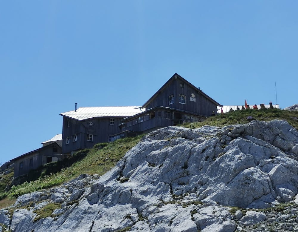
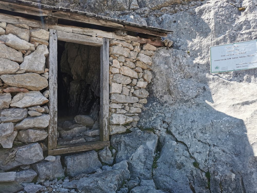
This high-alpine hut destination is reminiscent of a very special explorer of the Dachstein mountains: the geographer Dr. Friedrich Simony (1813-96), an "adventurer in a scholar's skirt", explored, described, painted and photographed the entire massif to the last corner. He was the first person to spend a night on the High Dachstein and visited the glacier, the Karls-Eisfeld, named after an archduke, even in winter. Today, at an altitude of 2200 m above sea level, a cosy place to stay and the Dachstein Chapel await you - directly in front of the Hohe Dachstein and the Hallstätter Glacier. From the Gjaidalm cable car station near the Gjaidalm we hike up the road to the Oberfeld barracks. From there we follow path no. 615 in the direction of Taubenkogel. At about 1960 m above sea level, a path branches off to the right, on which we ascend after the signpost "Simonyhütte" to a hilltop with two unmissable iron bars under the Taubenkogel. Behind it through the debris at the foot of the walls downhill, between huge boulders of stone around the mountain and through the large debris field under its west crashes to the Karschwelle in the north of the Lower Ice Lake (old glacier mark on a stone). Now turn right and ascend through the stepped eastern flank of the Taubenriedel into the wide basin of the Upper Ice Lakes. A little further towards the tongue of the Hallstätter glacier, then to the right and over the scree slope up to the Simonyhütte. Marked climbing tracks lead left (east) below the striking rocky Schöberl to the western ice edge of the Hallstätter glacier and to the "Dachsteinmadonna". The way back takes place on the wide and initially serpentine "Reitweg" (No. 601) - past the "Hotel Simony", a primitive half-timbered cave - and through the outlet of the Wildkars. From the turn-off before Ochsenwieshöhe, the shortest path on the right (no. 650) leads back to Gjaidalm, down a steep, rocky slope to Taubenkar, then up and down between mountain pine hills and individual stone pines to a division above the chalk pit and from there on the right through hilly terrain to another turn-off. To the left you come to the nearby Gjaidalm and on a road up to the cable car station. However, it is more rewarding to walk straight on the "Reitweg" and through a hollow down to the Wiesberghaus. From there a very nice path also leads to the Gjaidalm (No. 654). First it leads down into Bärengasse. From this high valley overgrown with Swiss stone pines we climb up to a hill, where the path no. 650 described above joins. You can also descend from the Wiesberghaus on the "classic" Dachsteinweg to Hallstatt. You hike through beautiful larch and stone pine forests down to the bottom of the Wiesalm and through Herrengasse to the closed Tiergarten hut. We descend steeply under the Martins- and the Tropfwand until a forest road welcomes us at the "Alter Herd". The marked path shortens your hairpin bends to the Waldbach (on the left a short detour to the karst spring of the Waldbach origin), then we march on the road to the turnoff at the bridge over the Waldbachstrub (deep view to the waterfall). Right on the mostly asphalted roadway down into the Echerntal valley and out to Hallstatt-Lahn.
Order hiking maps to the Dachstein Salzkammergut region ... ( http://dachstein.salzkammergut.at/kartenbestellung.html ) To the 360° Panorama Tour Krippenstein / Dachstein Salzkammergut ... ( https://www.dachstein-panorama.at/?s=pano68571&utmsource=tourdata&utmmedium=textlink&utmcampaign=tourdata360tour )
Mountain rescue: 140
equipment
Difficult
Hiking trails where obstacles such as rocks or roots are prevalent. Some obstacles can require care to step over or around. At times, the trail can be worn and eroded. The grade of the trail is generally quite steep, and can often lead to strenuous hiking.
441 m away
Hike to an exposed point above the Gjald Alm Hut.
Severe Hiking