Hoisnrad
Dachstein Salzkammergut
*The Hoisnradalm mountain bike tour starts in Bad Goisern. Via Lauffen to the Reinfalzalm and the Hoisnradalm. The way back to Bad Goisern leads the bikers via the Predigstuhl area to the Hütteneckalm and down via the panorama road to Bad Goisern.*
Mountain Biking Moderate
- Distance
- 33 km
- Ascent
- 1.1 km
- Descent
- 1.1 km
- Duration
- 3-4 hrs
- Low Point
- 478 m
- High Point
- 1.2 km
- Gradient
- 8˚

The highlight of the Hoisnradalm tour.
- •
- •
- •
- •
Description
-----------------------------------------------------------------------------------
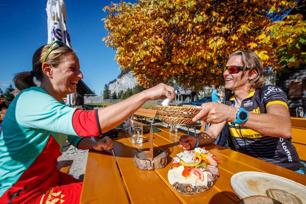
A typical Salzkammergut mountain bike snack in the Hoisnradalm & Hütteneckalm
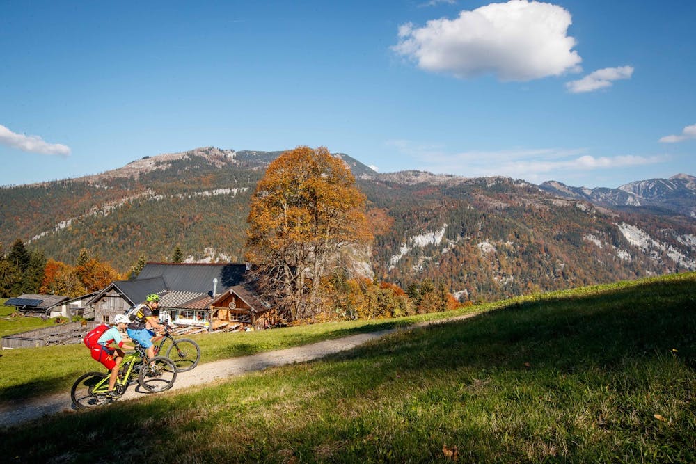
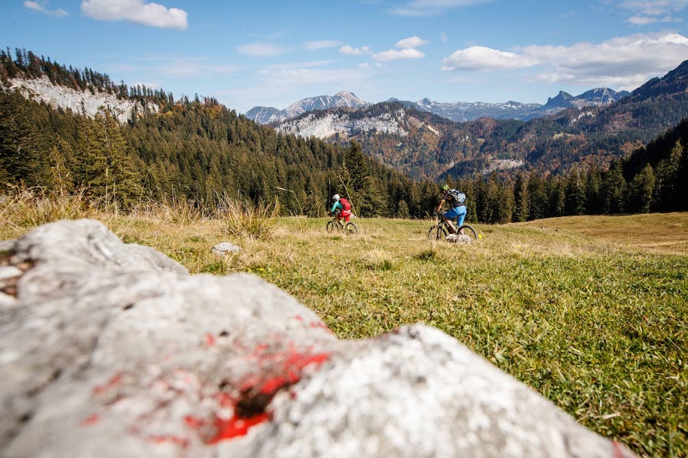
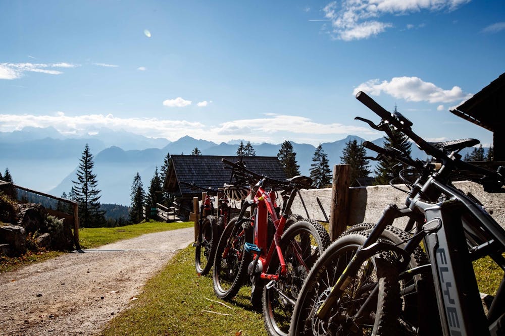
The Hoisenradalm tour is a medium-difficulty mountain bike tour with beautiful views and delicious Salzkammergut delicacies. The two huts are real hotspots in the region. In both the Hoisnradalm and the Hütteneckalm we local mountain bikers meet regularly on Kaiserschmarren and Co. The mountain bike tour also offers seclusion on the trails Anzenberg and Reinpfalzalm. Especially in summer, the shady forests are a dream before going up to enjoy the view of the Dachstein glacier glittering in the summer heat!
Start: Tourist Information in Bad Goisern - over the Goisererbrücke bridge - towards Hanusch-Hof - along the Traun over a wild path to Weißenbach - left at the Traunbrücke bridge - right at Gasthof Weißenbachwirt - right at Schlosserei Deubler - along the road on the left bank of the Traun - Lauffen - left before the curling rink through the railway underpass - right into the small pilgrimage town of Lauffen - left at Gasthaus Anzenaumühle the Anzenberg forest path leads up in several bends. At 12.5 km we turn right towards Reinfalzalm. After this alpine pasture, the road continues straight ahead to the Leckenmoos crossroads. The forest road leads half left past alpine huts to the Hoisenradalm - a beautiful vantage point. We return to the Leckenmoos junction, where we take a half-left turn and continue uphill. At 21.2 km turn left onto the trail to the Hütteneckalm. A great panorama awaits us! We continue steeply downhill and at 25 km we turn sharp right and soon arrive at the mountain inn Predigstuhl. ( start of asphalt ) There we continue downhill to Lasern, straight ahead along Josef Putz Straße until we reach the underpass, then left into Kirchengasse, where we arrive at the tourist office again. Alternatively, for trail hungry people, we go behind the mountain hotel Predigstuhl along the old toboggan run to the Ewigen Wand and then down the forest paths to Anzenau - from Abzenau via Weißenbach along the Traun back to the centre of Bad Goisern. (Easy Trail)
Order mountain bike map for all routes in Salzkammergut ... ( http://dachstein.salzkammergut.at/kartenbestellung.html )
Mountain rescue: 140
To the 360° panorama tour through Bad Goisern ... ( https://www.dachstein-panorama.at/?s=pano57984&utmsource=tourdata&utmmedium=textlink&utmcampaign=tourdata360tour )
Difficulty
Moderate
Mostly stable trail tread with some variability, with unavoidable obstacles 8in/20cm tall or less. Other obstacles such as rock gullies and steep sections may exist. Ideal for lower intermediate riders.