Salzkammergut Trophy A Strecke
Dachstein Salzkammergut
Salzkammergut Trophy A Strecke
Mountain Biking Extreme
- Distance
- 207 km
- Ascent
- 6.4 km
- Descent
- 6.4 km
- Duration
- 1 day +
- Low Point
- 477 m
- High Point
- 1.5 km
- Gradient
- 10˚
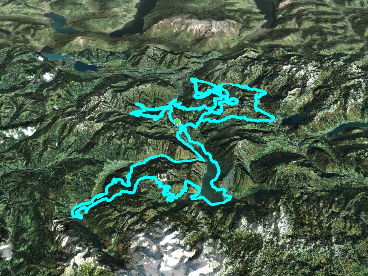
This is a popular mountain biking route which is generally considered to be extreme. It's extremely remote, it features extreme exposure and is typically done in May, July, September and November. From a low point of 477 m to the maximum altitude of 1.5 km, the route covers 207 km, 6359 vertical metres of ascent and 6360 vertical metres of descent.
Description
Salzkammergut Trophy A Strecke
Difficulty
Extreme
Very steep, difficult, narrow singletrack with widely variable and unpredictable trail conditions. Unavoidable obstacles could be 15in/38cm tall or greater, and unavoidable obstacles with serious consequences are likely to be present. Obstacles could include big rocks, difficult root sections, drops, jumps, sharp switchbacks, and more. Ideal for expert-level riders.
Extreme Exposure

Some trail sections are extremely exposed where falling will almost certainly result in serious injury or death.
Remoteness
In the high mountains or remote conditions, all individuals must be completely autonomous in every situation.
Best time to visit
Features
- Technical
- Singletrack