5.4 km away
Neue Bamberger Hut
A fabulous, long trip into a wild mountain range.
Difficult Hiking
- Distance
- 21 km
- Ascent
- 970 m
- Descent
- 969 m
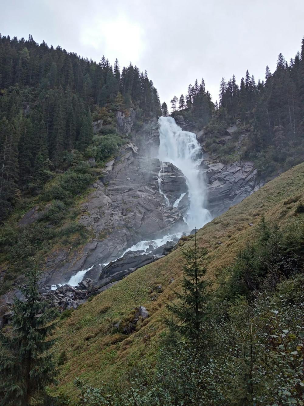
Austria's highest waterfalls have to be seen to be believed!
Hiking Moderate

This hike is a rare example of a trip which is perhaps even better in rain than under a hot sun - a bit of precipitation will make the waterfalls even bigger, and a heavy, grey sky only adds to the ambience of being next to such giant volumes of moving water.
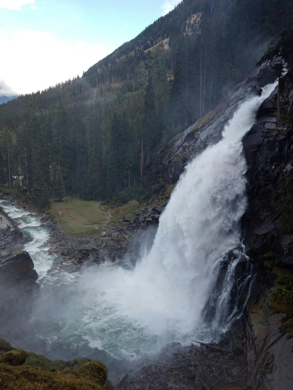
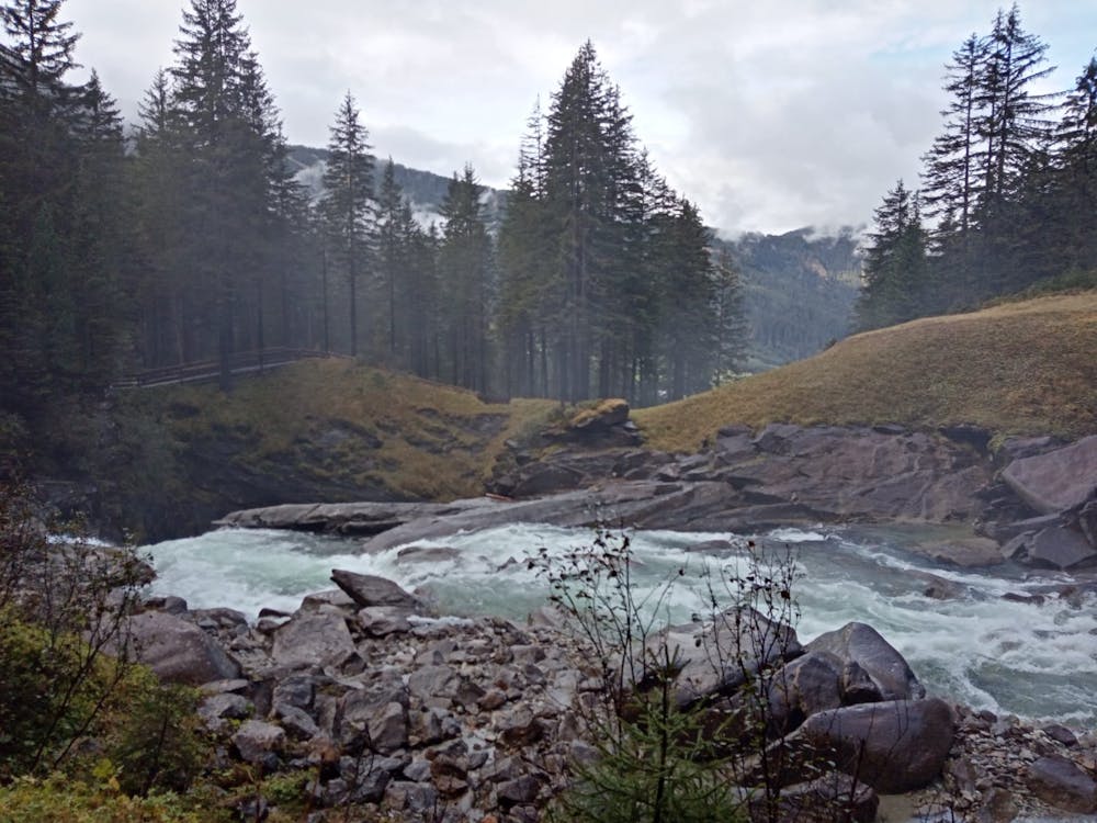
There is extensive parking at the entrance to the falls, and a visitor centre too. To access the falls, walk south from the visitor centre down a wide track to reach the small hut where you need to pay a €4.00 fee per person. With the fee paid up, stroll south for a few hundred metres on the track to reach Hanke's Cafe, and the first good viewpoint of the lower falls. Accessing the viewpoint requires a bit of a detour but it's an effort well worth making in order to get close to the Unterer (lower) waterfall.
Get back onto the main path and begin the steep climb up alongside the waterfall. The path is abundantly clear and extremely well maintained but it is steep in places, so whilst there are no technical difficulties, there are some physical ones! The whole route is peppered with viewpoints and specially built platforms overlooking the various sections of the waterfalls.
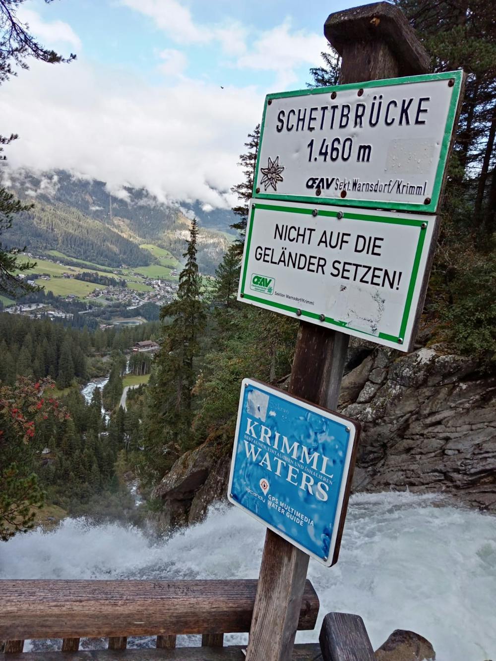
The final viewpoint is called the Schettbrücke and is amazing - you can see all the way down to your start point and are right on the edge of the huge upper falls. What's more, you're right on the edge of the utterly wild Hohe Tauern National Park, and there's an interesting information board (in German) with details of some of the Park's high mountain huts.
When you're done reading and admiring the view, descend via the same route, perhaps stopping for a drink at the well positioned Gasthof Schönangerl on the way down.
Moderate
Hiking along trails with some uneven terrain and small hills. Small rocks and roots may be present.

The trail contains some obstacles such as outcroppings and rock which could cause injury.
Away from help but easily accessed.
5.4 km away
A fabulous, long trip into a wild mountain range.
Difficult Hiking
8 km away
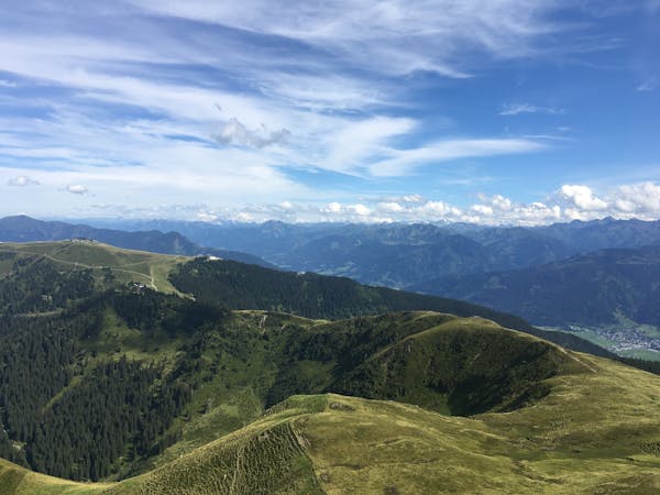
A wonderful loop along a stunning ridge.
Moderate Hiking
5 routes · Hiking
5 routes · Mountain Biking · Hiking

25 routes · Hiking
8 routes · Hiking