3.4 km away
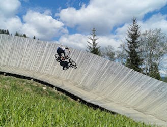
Panorama Trail + Monti Trail
A route top to bottom, connecting two amazing flow trails!
Moderate Mountain Biking
- Distance
- 6.9 km
- Ascent
- 0 m
- Descent
- 766 m
Where hikers and bikers meet. The trail that connects both valleys (Glemm Valley with Leogang)
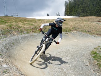
Mountain Biking Difficult

This is a popular mountain biking route which is generally considered to be difficult. It's an unknown remoteness, it features unknown exposure and is typically done in an unknown time of year. From a low point of 1.7 km to the maximum altitude of 1.8 km, the route covers 1.8 km, 56 vertical metres of ascent and 98 vertical metres of descent.
This trail has two spectacular steep serpentines and boasts a natural flow. That, combined with stunning views makes this a must hit trail. This trail gets used by a lot of hikers, so take your time and keep an eye out!
Difficult
Mostly stable trail tread with some variability featuring larger and more unavoidable obstacles that may include, but not be limited to: bigger stones, roots, steps, and narrow curves. Compared to lower intermediate, technical difficulty is more advanced and grades of slopes are steeper. Ideal for upper intermediate riders.
3.4 km away
A route top to bottom, connecting two amazing flow trails!
Moderate Mountain Biking
8.3 km away
An easy trail to start with in Hinterglamm area!
Difficult Mountain Biking