3.7 km away
Blue Line

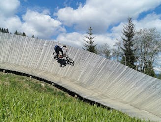
An easy trail to start with in Hinterglamm area!
Difficult Mountain Biking
- Distance
- 2.8 km
- Ascent
- 0 m
- Descent
- 428 m

A challenging trail for true riders
Mountain Biking Difficult

This is a high mountain trail of the finest quality. This very technical trail is dotted with peaks, ancillary curves as well as some crunchy stone and wildly roots passages (as well as a few minor hike-a-bike sections). It is a real treat for experienced bikers who like a challenge. The landscape it truly unique, the panoramic views combined with a delightful blend of varying terrain makes this trail experience hard to beat.
Smiles all around are guaranteed upon completion! You exit directly by the Bergstadl hut, where a well-deserved break awaits you.
Difficult
Mostly stable trail tread with some variability featuring larger and more unavoidable obstacles that may include, but not be limited to: bigger stones, roots, steps, and narrow curves. Compared to lower intermediate, technical difficulty is more advanced and grades of slopes are steeper. Ideal for upper intermediate riders.
3.7 km away

An easy trail to start with in Hinterglamm area!
Difficult Mountain Biking
5.9 km away

A route top to bottom, connecting two amazing flow trails!
Moderate Mountain Biking