2.8 km away
Blue Line
An easy trail to start with in Hinterglamm area!
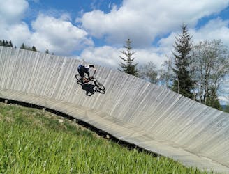
Difficult Mountain Biking
- Distance
- 2.8 km
- Ascent
- 0 m
- Descent
- 428 m
A stunning trail in a beautiful mountain scenery, suitable for freeriders as well as CC riders.
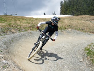
Mountain Biking Moderate

This is a popular mountain biking route which is generally considered to be moderate. It's an unknown remoteness, it features unknown exposure and is typically done in an unknown time of year. From a low point of 1.3 km to the maximum altitude of 1.5 km, the route covers 1.7 km, 0 vertical metres of ascent and 226 vertical metres of descent.
This trail offers smooth riding through idyllic alpine meadows, it dreamily uses the natural topography of the slopes in a playful way, creating many small tables, turns and waves! It is considered as part of the Hacklberg Trail experience, as it is accessed after it.
Moderate
Mostly stable trail tread with some variability, with unavoidable obstacles 8in/20cm tall or less. Other obstacles such as rock gullies and steep sections may exist. Ideal for lower intermediate riders.
2.8 km away
An easy trail to start with in Hinterglamm area!
Difficult Mountain Biking
6.2 km away
A route top to bottom, connecting two amazing flow trails!
Moderate Mountain Biking