3.7 km away
Blue Line
An easy trail to start with in Hinterglamm area!
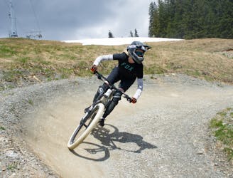
Difficult Mountain Biking
- Distance
- 2.8 km
- Ascent
- 0 m
- Descent
- 428 m
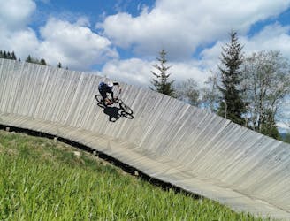
Flow master with airtime guarantee, an absolute must when in Saalbach!
Mountain Biking Difficult

A natural, unspoilt track with a breathtaking mountain scenery that you can take with a lot of speed. The gravel road up to the start of the trail at the western summit is steep but well worth it. The Hacklberg Trail from the Schattberg in Saalbach over to the western summit to Hinterglemm is one of the most beautiful trails in the valley. Before the pleasure, however, comes the work: here in the form of a demanding climb, which must be conquered in order to enjoy the pure bliss that is the Hacklberg Trail.
Difficult
Mostly stable trail tread with some variability featuring larger and more unavoidable obstacles that may include, but not be limited to: bigger stones, roots, steps, and narrow curves. Compared to lower intermediate, technical difficulty is more advanced and grades of slopes are steeper. Ideal for upper intermediate riders.
3.7 km away
An easy trail to start with in Hinterglamm area!
Difficult Mountain Biking
5.6 km away
A route top to bottom, connecting two amazing flow trails!
Moderate Mountain Biking