1.1 km away
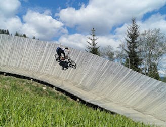
Panorama Trail + Monti Trail
A route top to bottom, connecting two amazing flow trails!
Moderate Mountain Biking
- Distance
- 6.9 km
- Ascent
- 0 m
- Descent
- 766 m
A great flowy trail for everyone!
Mountain Biking Moderate

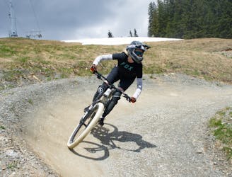
This trail is perfect for kids or beginners. The Milka Line is a delightful trail, it boasts endless flowy sections, with generous, wide curves, small wooden features and a steady gradient. You will also earn magnificent views of Saalbach Hinterglemm. It is a perfect, fun intro into freeriding. The 2.9 km route leads from the Kohlmais Middle Station over extensive alpine meadows, past small forests and ends again directly at the Kohlmais Valley Station, where a snapshot station is located. The relatively easy route promises maximum riding pleasure with minimal difficulty. You will certainly not feel short changed!
Moderate
Mostly stable trail tread with some variability, with unavoidable obstacles 8in/20cm tall or less. Other obstacles such as rock gullies and steep sections may exist. Ideal for lower intermediate riders.
1.1 km away
A route top to bottom, connecting two amazing flow trails!
Moderate Mountain Biking
4.6 km away
An easy trail to start with in Hinterglamm area!
Difficult Mountain Biking