5 m away
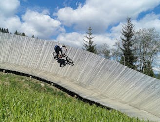
Panorama Trail + Monti Trail
A route top to bottom, connecting two amazing flow trails!
Moderate Mountain Biking
- Distance
- 6.9 km
- Ascent
- 0 m
- Descent
- 766 m
Flowy trail with many berms and a few jumps
Mountain Biking Severe

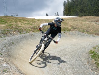
The Panorama trail is a short trail that leads to the Milka Line. Although shorter than the Milka Line it is slightly more technical. It is a great trail to learn to hold pace, hit berms and to gain experience in the air. Combine that with great views of the valley and its a winner!
Severe
Widely variable, narrow trail tread with steeper grades and unavoidable obstacles of 15in/38cm tall or less. Obstacles may include unavoidable bridges 24in/61cm wide or less, large rocks, gravel, difficult root sections, and more. Ideal for advanced-level riders.
5 m away
A route top to bottom, connecting two amazing flow trails!
Moderate Mountain Biking
5.4 km away
An easy trail to start with in Hinterglamm area!
Difficult Mountain Biking