4.3 km away
Blue Line
An easy trail to start with in Hinterglamm area!
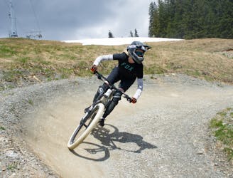
Difficult Mountain Biking
- Distance
- 2.8 km
- Ascent
- 0 m
- Descent
- 428 m
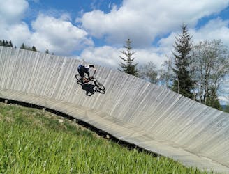
The X-Line at the Schattberg is the Grandmaster of the freeride lines in Saalbach Hinterglemm. No other freeriding track is as diverse, playful, challenging and long as the X-Line.
Mountain Biking Extreme

From the Schattberg summit to the valley station of the Schattberg-Express, the X-Line crosses over 1,000 hm over a length of over 6 kilometres. However, it is not the length or height difference, which makes the X-Line unique. It is a combination of the richness of the trail, the difficulty and the breathtaking panoramas that accompany you along the deep-rooted X-Line. At the top you are greeted with flowy, yet rough terrain turns, followed by a gnarly forest section and finishing off with more roots and particularly huge jumps and drops, including the infamous road gap at the bottom.
Extreme
Very steep, difficult, narrow singletrack with widely variable and unpredictable trail conditions. Unavoidable obstacles could be 15in/38cm tall or greater, and unavoidable obstacles with serious consequences are likely to be present. Obstacles could include big rocks, difficult root sections, drops, jumps, sharp switchbacks, and more. Ideal for expert-level riders.
4.3 km away
An easy trail to start with in Hinterglamm area!
Difficult Mountain Biking
4.9 km away
A route top to bottom, connecting two amazing flow trails!
Moderate Mountain Biking